
Directions
Northfield Lake is located in Thomaston, Connecticut, easily accessible from Route 8. From points south, take Route 8 north to exit 38. Take a left onto South Main Street. At the third traffic light, take a left onto Route 254 and proceed two miles north to the park. From points north, take Route 8 south to exit 38. Take a right onto South Main Street. At the next traffic light, take a right onto Route 254 and proceed two miles north to the park.
Phone
860-283-5540
Activities
BIKING, HISTORIC & CULTURAL SITE, INTERPRETIVE PROGRAMS, FISHING, HIKING, PICNICKING, WILDLIFE VIEWING, DAY USE AREA, KAYAKING, CANOEING, BIRDING
Keywords
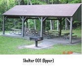
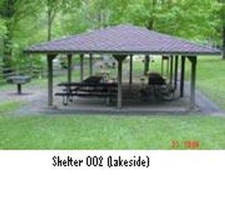
NRBL,Shelter #1,Shelter #2,Pavilion #1,Pond Side Shelter,Pavilion #2,NORTHFIELD BROOK LAKE GROUP SHELTERS
Related Link(s)
Connecticut State Road Conditions
Overview
Northfield Brook Lake Group Shelters are located along a small scenic lake in the Naugatuck Valley of west-central Connecticut.
Naugatuck Valley boasts picturesque small towns, rolling hills and industry and where public recreation is valued. On warm summer evenings, people gather at the park to enjoy hiking, picnicking and other outdoor activities.
Recreation
The recreation area provides two picnic shelters that can be reserved for group events in spring, summer and early fall, though guests are invited to walk the park during daylight hours any time of year. The park gives visitors an easy time of relaxing and having fun in nature. A 1.7-mile long hiking trail follows the brook upstream and up the forested hillside. Anglers seek out stocked trout, as well as warm water fish naturally found in the lake, such as bass. Children and families can learn about natural resources and water safety by attending educational programs given by park rangers on weekends.
Facilities
The facility provides the setting and amenities for large groups gatherings. Each of two picnic shelters can each be reserved for up to 100 people. The park also has picnic tables, grills and horseshoe pits.
Natural Features
The 208 acres of undeveloped public land at Northfield Brook Lake are managed for recreation, forest and wildlife. The mixed pine and hardwood forest presents a brilliant backdrop of colors during fall foliage season. Wildlife is abundant in the reservoir area. White-tailed deer, beaver, red fox, raccoon, gray squirrel and cottontail rabbits either live in or visit project lands. Birds spotted at the lake include Canada geese, wood ducks, great blue heron, osprey and American kestrel.
Nearby Attractions
The small town of Thomaston has grocery stores, restaurants and gas stations. Visitors might also enjoy going for a short drive through the scenic Northwest Hills of Connecticut and the quaint New England towns of Litchfield and Goshen.