
Directions
From Lakeview, drive 6 miles north on Highway 395 and turn right (east) on Highway 140. Drive for 8 miles on Highway 140 and turn left on Forest Road 3615. Drive 7.5 miles on Forest Road 3615 to arrive at the cabin. The entire route to the cabin is paved and easily accessible. Guests should contact the Lakeview Ranger District Office prior to reserving the cabin for dates before July 1st to ensure that the road is open and clear of snow.
Phone
541-947-6300
Activities
BIKING, CAMPING, FISHING, HIKING, HORSEBACK RIDING, CROSS COUNTRY SKIING, SNOWMOBILE TRAILS, BIRD WATCHING
Keywords
ASPB,FREMONT WINEMA NF – FS
Related Link(s)
Overview
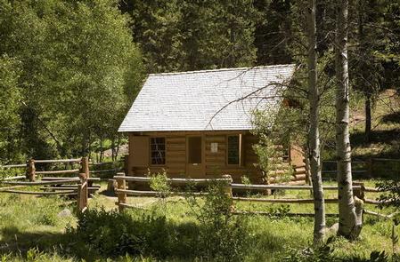
Historic Aspen Cabin is nestled in a forest of fir, pine, and aspen, and provides an ideal setting for guests seeking relaxation and recreation in the Fremont-Winema National Forest. It was built in 1930 and originally used as an administrative cabin and fire guard station by U.S. Forest Service employees.
It also served as a warming shelter for snowmobilers and cross-country skiers during the 1990s. Today, the cabin offers guests a secluded getaway in a landscape abundant with wildlife and nature.
Although the cabin provides some amenities to those seeking a comfortable lodging experience, guests must bring several of their own amenities.
Recreation
Aspen Cabin is a wonderful location for hiking, fishing, horseback riding and biking in summer and early fall. In the winter months, guests can take advantage of skiing, snowshoeing and snowmobiling.
Hikers will find scenic trails near the cabin, including Crane Mountain National Recreation Trail, located 3 miles to the southwest and at the Walker Trailhead. The Drake McDowell Semi-Primitive Non-Motorized Area is just 2 miles to the east.
Facilities
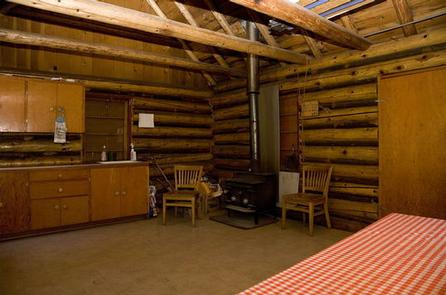
The one-room cabin is designed to accommodate up to four people and is furnished with four cots, a dining table and chairs, countertop space for food preparation and a wood stove for heating. Also a broom, dustpan, dust mop, basic cleaning supplies and an axe. A picnic table and campfire ring are located outdoors, as well as a pit toilet. There is no water on-site, so guests must bring a sufficient supply for drinking, cooking and washing. Guests may fill water jugs at Mud Creek Campground approximately 1.5 miles away. Guests must also provide their own sleeping bags, sleeping pads, towels, dish soap, matches, cooking gear and a first aid kit. The Forest Service does not provide firewood but there is ample down and dead wood in the surrounding area. Cutting down standing trees for firewood is prohibited.
Natural Features
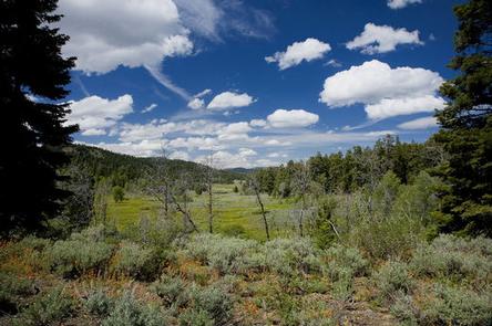
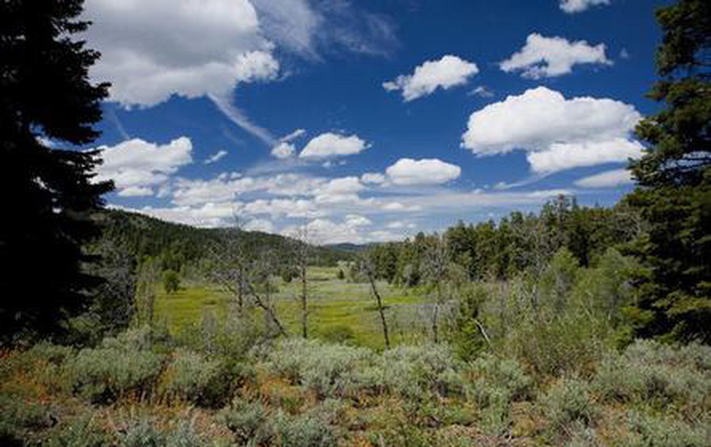
Fremont National Forest is known for its towering snow-capped peaks, volcanic landscapes, wide-open sage basins, scenic vistas and wild places, where guests can still find solitude.
The area around the cabin is home to abundant wildlife, including deer, elk and squirrels. For birders to the area, sparrows, jays, sandhill cranes and woodpeckers find habitat in nearby ecosystems.
Indian paintbrush, camas, wild lilies and other wildflowers add splashes of color to the forested landscape.
Nearby Attractions
Warner Canyon Ski area is typically open when conditions allow. Fremont National Recreation Trail is over 100 miles long and offers non-motorized opportunities (biking, stock, hiking).