
Directions
From North Bend Oregon, travel north on Highway 101 for 1 1/2 miles to Trans Pacific Parkway. Turn west (left) on Trans Pacific Pkwy, proceed 1 mile and turn right onto Horsfall Beach Road. For access via Horsfall Campground drive ½ mile on Horsfall Beach Road, the campground will be on the right. Sand Access is signed. For access via Old Bark Staging Area drive ¾ mile on Horsfall Beach Road, the parking is on the right. For access via Bull Run Staging Area drive 2 miles on Horsfall Beach Road. Sand access is signed on the right.
Phone
541-271-6000
Activities
CAMPING, FISHING, HIKING, WILDLIFE VIEWING
Keywords
HROD,TENT CITY,COOS BAY,BARK ROAD,BULL RUN,ODNRA,OREGON DUNES,Sand Dunes,Sand Camps,Horsfall ODNRA,SIUSLAW NF – FS
Related Link(s)
Overview
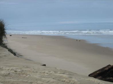
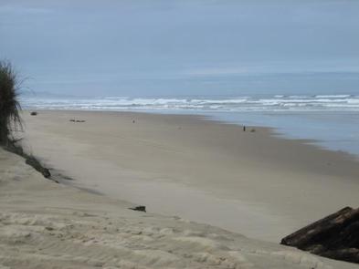
Horsfall Sand Camping is home to the largest riding area in the Oregon Dunes National Recreation Area. Adventure seekers can experience the thrill of riding through vast open dunes or meandering through designated sand routes surrounded by shore pine, wax myrtle, huckleberry, and salal. The tops of dunes provide prime views of the Pacific Coast to the west and the foothills of the Oregon Coast Range to the east.
Recreation
Horsfall ultimately attracts off-road vehicle enthusiasts. Thrillseekers have a choice of riding on designated routes like the Bark Sand Route and Bull Run Sand Route, or cruising in the open riding sections.
Anglers can fish in Jordan Cove, the portion of Coos Bay that is nearest the campsites. Hikers can access the nearby Bluebill Trailhead for a journey by foot to the Pacific beach.
Facilities
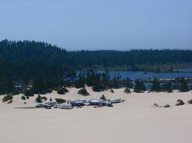
Access to campsites is by 4×4 vehicles only via soft sand routes. Campsites are primitive and it’s recommended that all campers bring portable toilets and fire pans. Individual sites are identified by numbered posts. Each site accommodates up to 5 vehicles and 20 campers for tent camping. Three group sites accommodate 40 people and 10 vehicles.
Natural Features
The dispersed camping area is on the sand in the southern edge of the Oregon Dunes National Recreation Area, known for its wind-sculpted sand dunes towering to 500 feet above sea level. This area sits near several watering holes, including Horsfall Lake, Bluebill Lake and Jordan Cove, which is a section of Coos Bay. Coyote, black bear, elk, mink, porcupine and otter are just a few of the species that have been tracked on the Oregon Dunes.
Nearby Attractions
Coos Bay, a picturesque inlet where the Coos River flows into the Pacific Ocean, is nearby. The waterway is about 3 miles wide and 10 miles long, creating a flourishing habitat for sea birds.