BLACK CANYON CAMPGROUND, OR Campground Reservation, Info, Images, Map, Directions

BLACK CANYON CAMPGROUND, Oregon Campground Images, Info & Reservations

Directions

From Oakridge, Oregon, follow Highway 58 west about 8 miles to Black Canyon Campground, located 1 mile east of Lookout Point Reservoir.

Phone

801-226-3564

Activities

BIKING, BOATING, FISHING, KAYAKING

Keywords

BCAN,WILLAMETTE NF -FS

Related Link(s)

Rec Area Info & Images

Oregon State Road Conditions

Oregon State Tourism

Forest Service Concessionaire

Overview

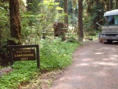
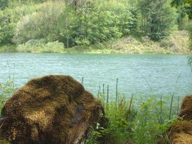
Black Canyon Campground in Oregon rests next to the Middle Fork of the Willamette River. This scenic campground is heavily shaded by towering hemlock, cedar and Douglas fir. Fishing and kayaking are a popular pastimes.

Recreation

A 1-mile interpretive nature trail winds through the campground, and Lookout Point Lake is less than a mile away, with opportunities for boating and fishing. A boat ramp is located on the lake.

The Willamette National Forest has about 1,700 miles of trails. While many are located in wilderness areas, a number of trails are situated at lower elevations and provide easy, year-round hiking.

Black Canyon is within the Winberry Trail Area, with excellent terrain like the Tire Mountain Trail for mountain biking and horseback riding, and the Clover Patch Trail for hiking.

Facilities

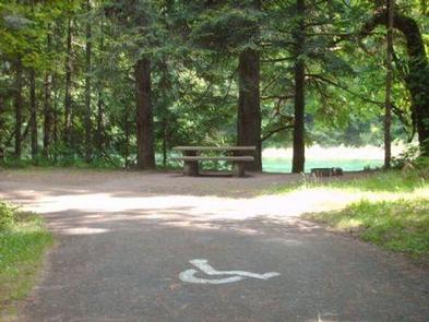
The campground offers some riverside sites with pleasant shade, fresh air with cool breezes. There are 75 sites, 19 are reservable. Each site contains a picnic table and campfire ring with grill. Accessible vault toilets and drinking water are provided.

Natural Features

The Willamette National Forest stretches 110 miles along the western slope of the Cascade Range in western Oregon. Elevations on the forest range from about 1,500 feet above sea level to 10,495 feet at the snowcapped summit of Mt. Jefferson, Oregon’s second highest peak. Wildlife in the region includes black tail deer, Roosevelt elk, bobcats and bald eagles.

Nearby Attractions

Visitors enjoy sightseeing along the West Cascades Scenic Byway. The drive begins at Westfir and stretches 220 miles past waterfalls, ancient forests and numerous rivers, creeks and lakes.

Reservation

More from CampingHiking.net:

MORGANTON POINT, Georgia Campground Images, Info & Reservations

Directions Take U.S. Highway 515 north from Blue Ridge for 4 miles to Georgia Highway 60. Turn right (southwest) and continue 3 miles to the town of Morganton. In Morganton, turn right on County Road 616 (Lake Drive) and proceed for 1 mile. To enter the campground, take the first

OLD HWY 41 NO 3, Georgia Campground Images, Info & Reservations

Directions From I-75 take exit 278 and turn south onto Glade Road. Turn right onto Highway 92/Lake Acworth Drive, then after a mile exit to the right which will loop around to Hwy 293/Main Street. At stop sign turn left onto Highway 293/Main Street and follow signs to the campground.

OAK HILL – LAKE VESUVIUS, Ohio Campground Images, Info & Reservations

Directions From U.S. Highway 52 at Ironton, take State Route 93 north for 9 miles to the Lake Vesuvius Road (County Road 29). Turn east toward Lake Vesuvius and travel 1 mile to the recreation area. Phone 740-534-6500 Activities BOATING, CAMPING, FISHING, HIKING, WILDLIFE VIEWING, SWIMMING SITE Keywords OAHI,VESUVIUS,LAKE VESUVIUS,LAKE

BROYLES, Georgia Campground Images, Info & Reservations

Directions From Interstate 85, take exit 11 to Highway 24 headed towards Anderson, SC. Turn right onto Hattens Ford Road and follow signs to the facility. 900 SMYZER ROAD, TOWNVILLE, SC 29689 Phone 888-893-0678 HARTWELL PROJECT OFFICE Activities BOATING, FISHING, PICNICKING, DAY USE AREA, SWIMMING SITE, SWIMMING, WATER ACCESS Keywords

BUCKHORN CAMPGROUND, Kentucky Campground Images, Info & Reservations

Directions Traveling north from Lexington, take I-64 to the Mountain Parkway. Exit at Slade, take KY 11 South through Beattyville. Continue on Highway 11 to Booneville, continuing past the courthouse to KY 28 West. Follow KY 28 about 23 miles to Buckhorn. Traveling east From Hazard, take KY 15 North

WAXMYRTLE CAMPGROUND, Oregon Campground Images, Info & Reservations

Directions From Florence, OR, travel seven miles south on Highway 101 to the Siltcoos Beach Access Road. Turn right on Siltcoos Beach Access Road and proceed one mile west to Waxmrytle Campground. Turn south (left); the campground entrance is the bridge on the south side on the Siltcoos Beach Road.