
Directions
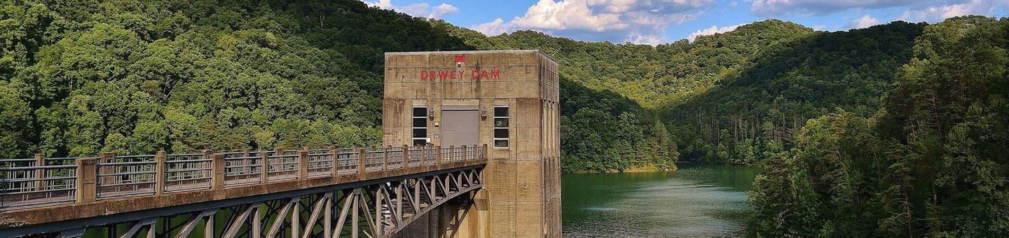
From US 23 turn at the red light toward Highlands Hospital (Route 302) for about one mile, turn right onto Route 3 for about 1.5 miles; after 1st over pass turn right onto 302 Lake Road, take left at bottom of ramp and Dewey Recreation Area Entrance is one mile on right, Project Office is 1.25 miles on right.
Phone
(606) 886-6709 LAKE OFFICE
Activities
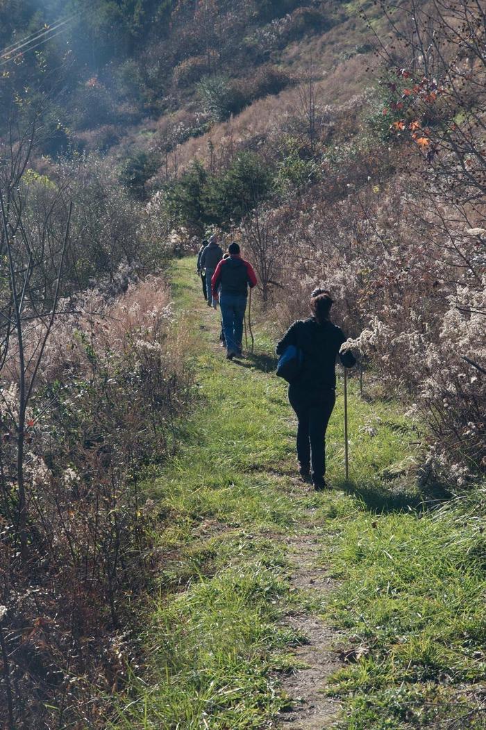
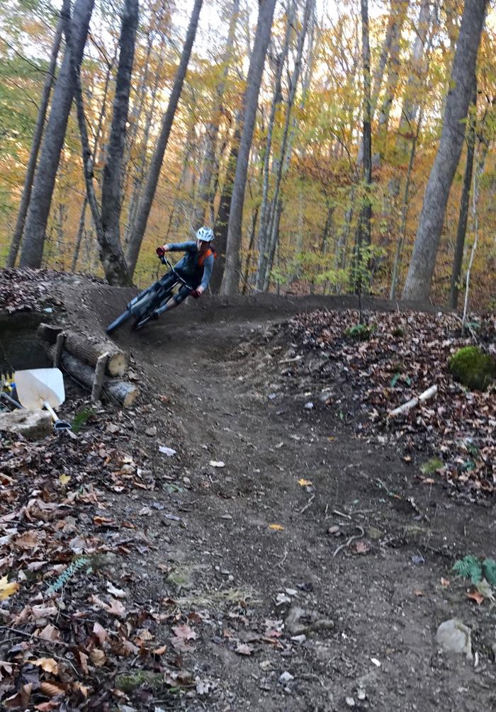
BOATING, CAMPING, FISHING, HIKING, HORSEBACK RIDING, HUNTING, VISITOR CENTER, WILDLIFE VIEWING, DAY USE AREA, MOUNTAIN BIKING, KAYAKING, CANOEING
Keywords
DEWE,PICNIC HOLLOW,DEWEY LAKE
Related Link(s)
Kentucky State Road Conditions
Overview
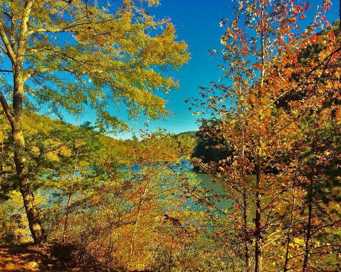
Dewey Lake Shelters offer a day-use area on the shores of Dewey Lake in eastern Kentucky. Located just west of the Appalachian Mountains, the lake shore offers a peaceful, forested setting with plenty of outdoor recreation opportunities for groups of up to 150 guests.
Recreation
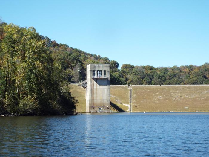
The picnic shelters are situated on an open, grassy area with plenty of space for children to play. A hiking trail is located near picnic shelter 4. Fishing is a popular activity from boats and the shoreline, and anglers will find bass, crappie, brim, bluegill, catfish and muskie. Hunting is also allowed in various wildlife management ares throughout the land surrounding the lake. For area hunting maps please visit our Project Office. Dewey Lake Primitive Campground is only accessible by boat or by a short hike (approximately 0.25 mi.) and contains 10 camping sites. Each of these sites are furnished with a picnic table, fire ring, and lantern post Parking is available at the parking lot on top of the dam, or the parking lot at Picnic Hollow. A water spigot is available and portable restroom facilities. Electric hookups are not available. Fees are $10 per night and paid through an honor vault system found by the information board on the campground. This primitive campground is lake front and will be open for use May 11, 2019 – October 5, 2019. Jenny Wiley State Resort Park, which lines much of the western shore of the lake, has many additional amenities and activities, such as off-road bicycling and hiking trails and a marina with boat rentals and docking facilities. Here you may also experience the secluded beauty of the 49-room May Lodge, which overlooks Dewey Lake, surrounded by towering pines and peaceful mountains.
Facilities
Dewey Lake offers four covered picnic shelters, ideal for family reunions and other large group events. All shelters have electric hookups and are near a playground. Shelter 2 is also adjacent to a baseball field, and shelters 1 and 3 are closest to Dewey Dam Outflow Area. Shelter 4 is located at Picnic Hollow at Dewey Dam. This location is adjacent to hiking trails, a small playground, and restrrom facilities.
Natural Features
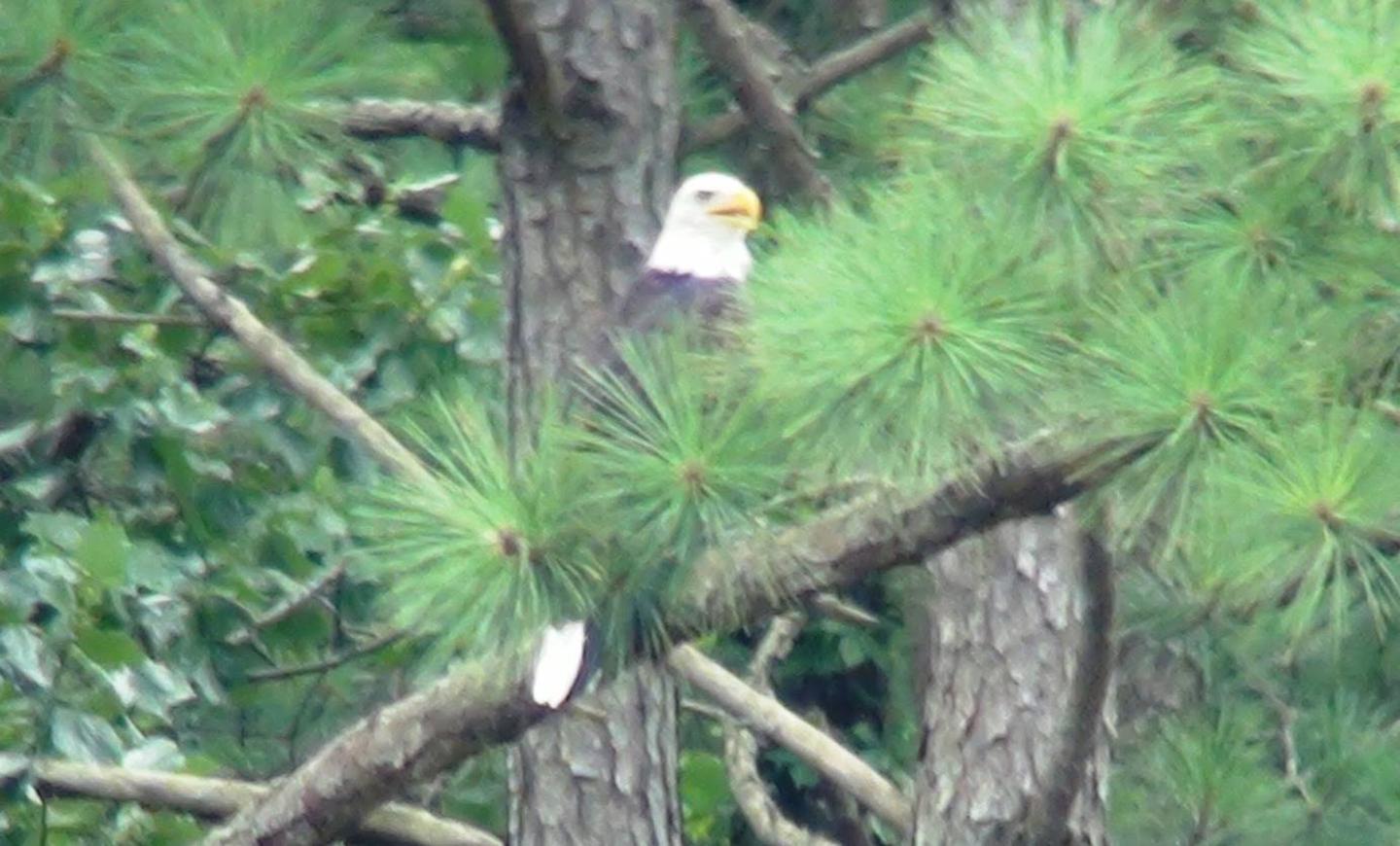
The lake is surrounded by rolling, forested hills that rise hundreds of feet above the water. The thick forests and calm water provide habitat for a variety of animals, including bald eagles, black bear, elk, deer, osprey and otters. Fall foliage displays brighten the lush green forests each fall.
Nearby Attractions
Jenny Wiley State Park is located within the Dewey Lake area. The state park offers a full range of features for visiotrs to utilize during their stay at Dewey Lake. Amenities include a 49 room lodge, gift shop, swimming pool, 18 cottages, 3 boat ramps, a marins, canoe/pomtoon rentals, picnic sites, a campground, hiking/biking trails and the Jenny Wiley Ampitheater. For additional information about Jenny Wiley State Park contact (606)-889-1790. German Bridge is located at the head waters of Dewey Lake. This campground off of KY Rt. 194 offers visitors primitive and full hook up campsites, horse stalls upon availablitiy, a boat ramp, easy access to miles of hiking & equestrian trails, and a playground. For additional information about German Bridge contact (606)-874-1150. Sugarcamp Mountain Trails are nestled deep within the mountains of Eastern Kentucky. These multi-use trails (mountain biking, hiking, & horse) provides spectacular views of Dewey Lake and the surrounding area. For a detailed description and interactive map of every trail on the system, visit the trail page at MTBProject.com.