
Directions
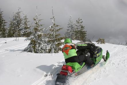
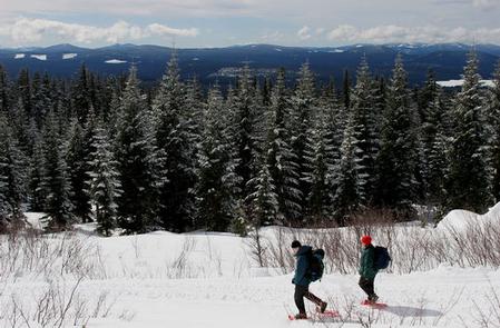
Access begins at the junction of Highway 26 and Forest Service Road 42, 12 miles south of Government Camp, Oregon, at the Skyline Sno-Park. Guests must park and the Sno-Park and ski, snowshoe or snowmobile to the facility. From the parking area, proceed on Forest Service Road 42 to the 240 spur road and continue to the lookout, approximately 3.2 miles with an elevation climb of 900 feet. It is a good path for moderate skiers and will take three-and-a-half to four hours to complete. Maps are available online or for purchase by calling the Barlow Ranger District.
Guests will need to purchase a Sno-Park permit to park at Skyline Sno-Park. Permits can be purchased at several locations in the Portland area, or at CJ’s on Highway 26, west of the intersection of Highway 26 and Forest Service Road 42.
Phone
541-467-2291
Activities
CAMPING, FISHING, HIKING, HUNTING, WILDLIFE VIEWING, BIRDING, CROSS COUNTRY SKIING, SNOWMOBILING
Keywords
CLLO,CLEAR LAKE CABIN,CLEAR LAKE,CLEAR LAKE LOOKOUT,MT. HOOD NF – FS
Related Link(s)
Overview
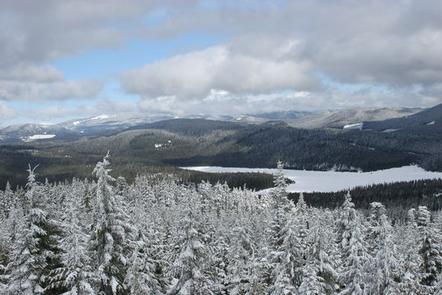
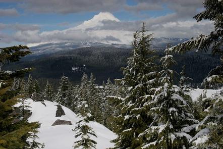
Clear Lake Cabin Lookout is situated on the southern slope of Mt. Hood, providing spectacular panorama views of snow-covered treetops, alpine lakes and rugged Cascade peaks. It also provides access to a variety of recreational opportunities, including fishing, hiking and wildlife viewing, as well as winter sports. The lookout can only be accessed by skiing, snowmobiling or snowshoeing up to 4 miles from a parking area at the Skyline Sno-Park. A Sno-Park permit is required to park there and the trek takes about three to four hours. Guests are responsible for their own travel arrangements and safety, and must bring several of their own amenities.
Recreation
The surrounding area is popular among winter sports enthusiasts, as it offers access to miles of great cross country skiing, snowshoeing and snowmobiling. A ski tour is available around the spring-fed Little Crater Lake. Fishing is available in the various mountain lakes and streams, however, many may be frozen.
Facilities
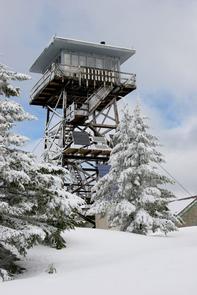
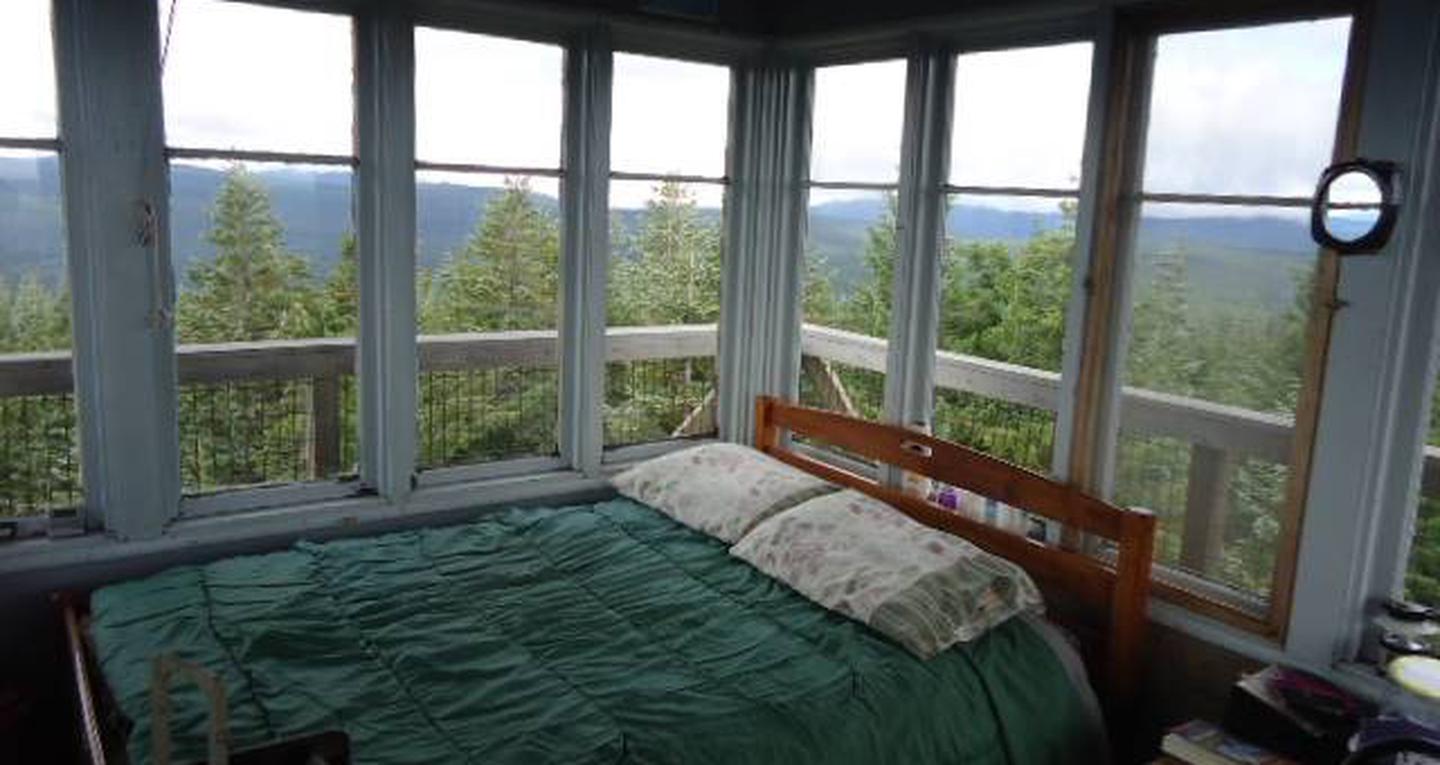
The cabin is atop a 40-foot tower and is surrounded by a wooden catwalk. The 14-by-14 room is furnished with a small bed, a wood stove for heating and a table and chairs. It has a propane cook stove and solar-powered lights. There is no water on-site.
An outhouse with vault toilets is located on the ground, as well as a shed stocked with firewood. A rope and pulley system is available to transport gear, as well as firewood, up and down the tower with ease.
Guests will need to bring their own water for drinking, cooking and cleaning purposes, as well as their own bedding, food and clothing, towels, toilet paper, among other necessities. Garbage bags are also not supplied and guests will need to carry out all trash and clean the facility prior to leaving.
Natural Features
The tower sits on Clear Lake Butte, a 4,454-foot gently sloped hillside covered with fir trees, on the south side of Mt. Hood. Of the nine peaks in Oregon’s Cascade Mountain Range, Mt. Hood stands the tallest, at 11,239 feet. It is thickly forested and capped with glaciers and snow.
The lookout tower is perched on the mountainside, near the northwest corner of the Warm Springs Indian Reservation. It is one of three Forest Service watchtowers on Mt. Hood and it is still used to spot fires during summertime each year.
Originally 100 feet tall when it was built in 1932, the tower was replaced with the current 40-foot building in 1962. It overlooks Clear Lake and Timothy Lake in the distance. A variety of wildlife make its home in the area.