
Directions
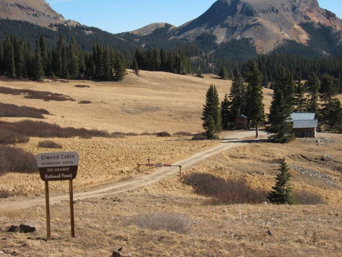
From Del Norte, take U.S. Highway 160 west to South Fork. Continue west on U.S. Highway 160 for 8 miles to Park Creek Road. Travel 15 miles on Park Creek Road to Summitville Road. Turn right on FSR 380, the cabin is about 2 miles on the left.
From the junction of FSR 250 in the Alamosa Canyon and FSR 380, follow FSR 380 about 8 miles, the cabin is on the right.
Access to the cabin in the summertime can be accomplished with just about any vehicle; however, when the dirt roads are wet they tend to get slick.
In winter, the trail access to the Elwood Cabin is on the unplowed portion of Forest Road 380, which starts southeast from the junction, but makes a bend and continues south-southwest to the cabin. The 2 mile ski to the cabin is generally easy with a 400 foot elevation gain. The Elwood Cabin is visible below the road on a knoll projecting into a large open park. Allow from 1.5 – 2 hours or longer, depending on snow conditions, for the trip.
Phone
719-274-8971
Activities
CAMPING, FISHING, HIKING, HUNTING, WINTER SPORTS, WILDLIFE VIEWING
Keywords
ELWC,RIO GRANDE NF- FS
Related Link(s)
Colorado State Road Conditions
Overview
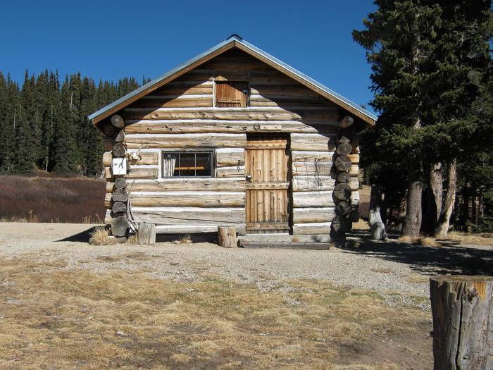
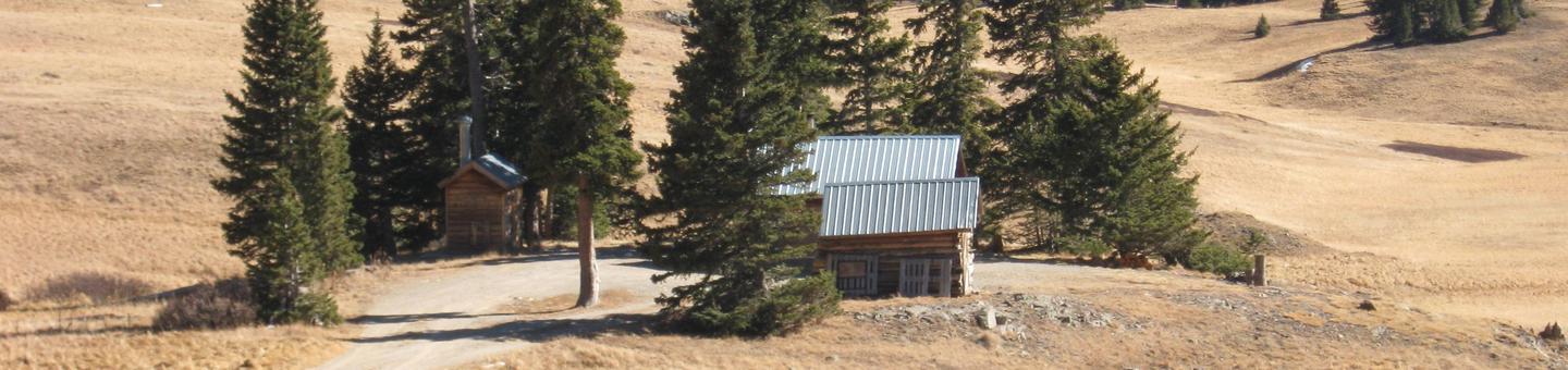
Elwood Cabin sits in a saddle along the San Juan Mountains overlooking an open meadow, offering guests a unique lodging opportunity.
The cabin was built in 1911 by the Mountain States Telephone Company as a "line shack" to support crews maintaining the transcontinental telephone line. Remnants of this old telephone line are still found along Iron Creek to the southeast. The cabin was also used as a Forest Service Station from 1950 until 1962, serving as living quarters for Forest Service employees who worked on numerous projects in the area.
Although the phone line has been abandoned, today the cabin is a high-altitude getaway for guests seeking relaxation and recreation in south-central Colorado.
During summer months the cabin can be accessed by motorized travel. During winter months access to the cabin is by snowmobiles, cross country skiing or snow shoeing.
Recreation
The area around Elwood cabin offers a variety of recreational opportunities year-round. Summertime brings excellent scenic tour opportunities in and around the Summitville area as well as exploration of several historical mining sites.
Anglers have a spectacular backdrop to fishing streams such as Iron Creek or Treasure Creek. Nearby Platoro Reservoir, which feeds the Conejos River, provides excellent fishing for trout and salmon.
Great hiking can be found around the area, as it spans both the Rio Grande and San Juan National Forests, as well as the South San Juan Wilderness.
In winter, the Elwood cabin area can be blanketed with as much as ten feet of snow, requiring preparation and knowledge of winter travel. Snowmobiling, skiing and snowshoeing are popular activities in the area.
Facilities
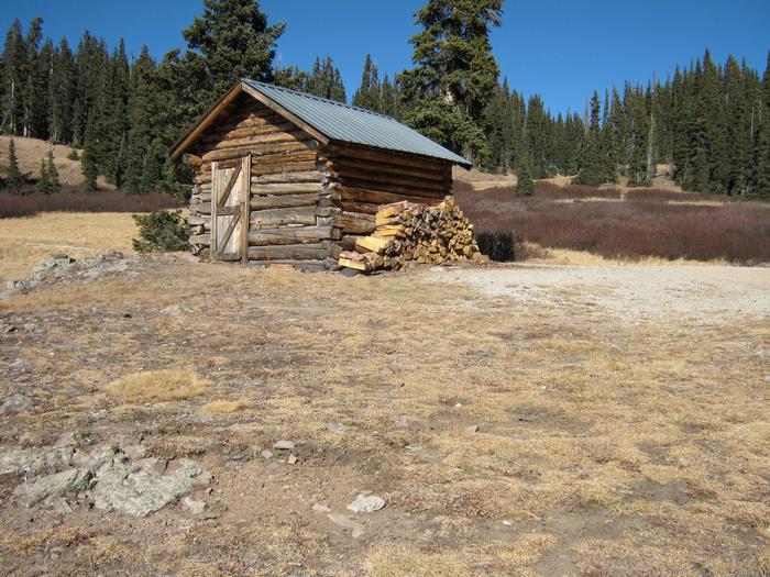
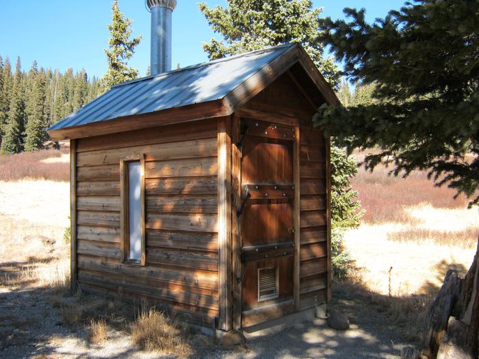
The one room log cabin is furnished with two bunk beds with single beds on the top and foldout double beds on the bottom, accommodating up to six people. The cabin has a wood stove for heat, propane lighting and a propane stove. The kitchen is equipped with a table and chairs, cooking utensils, pots and pans and a fire extinguisher. Firewood is available in the adjoining shed. An outdoor vault toilet is also on-site.
Guests must provide a sufficient supply of water for cooking, cleaning and washing. Guests are also encouraged to bring an additional light source in case of emergencies.
Although the cabin has some amenities, guests do need to provide their own food, sleeping bags, linens, towels, dish soap, matches, first aid kit, avalanche equipment, toilet paper and garbage bags.
Natural Features
High in the San Juan Mountains at an elevation of 11,000 feet, this cabin provides guests with views of nearby peaks, meadows filled with wildflowers and alpine forests.
While staying at such a high elevation guests will notice how light plays differently on the landscape and stars blanket the sky on clear cold evenings. Elk, deer, and other wildlife are often seen in meadows adjacent to the cabin. Bear, marmot and chipmunks also call the area home.
Nearby Attractions
Summitville is a nearby ghost town where gold was first discovered in 1870, then mined until the early 1990s. When contaminants leaked off-site and flowed into the local watershed the government forced it to shut down. Now a water treatment plant is on the site as part of a federal clean up program.