

Directions
From I-81, take exit 80 (Fort Chiswell) and go east on US 52 for about 1 mile. Turn right and drive south on VA 94 for about 12 miles to the intersection of the Virginia Highlands Horse Trail. Turn right onto a gravel road marked with orange diamonds (this is also the Virginia Highlands Horse Trail). This road is called Cha Cha Ridge Road. About 0.3 miles down Cha Cha Ridge Road, bear right onto the Virginia Highlands Horse Trail. A short distance later, turn left at the Sunrise Cabin sign.
Phone
800-628-7202
Activities
BIKING, CAMPING, HIKING, HORSEBACK RIDING, HUNTING, WILDLIFE VIEWING
Keywords
SUNC,Sunrise Cabin,GEORGE WASHINGTON/JEFFERSON NF-FS
Related Link(s)
Virginia State Road Conditions
Overview
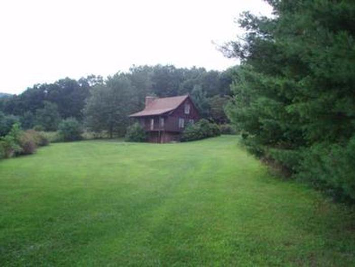
Visitors at Sunrise Cabin enjoy outstanding views from the front porch and warm, cozy evenings beside the stone fireplace. Sunrise cabin provides visitors with unique opportunity to enjoy the natural features of the George Washington & Jefferson National Forests while still having many of the conveniences of home.
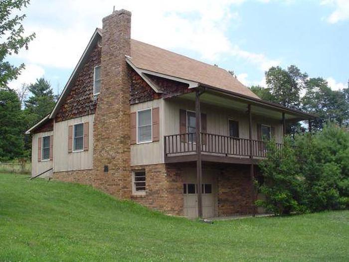
The cabin was constructed in 1980 and offers many modern amenities such as electricity, kitchen appliances and showers. The property was acquired in an effort to help preserve the land around the beloved Virginia Highlands Horse Trail in southwest Virginia.
Recreation
Recreation opportunities abound, with easy access to hiking, fishing, biking and canoeing. The cabin is right across from the Virginia Highlands Horse Trail, a 68-mile trail through mountains and valleys of the Appalachians.
The New River Trail State Park has been designated an official National Recreation Trail by the U. S. Department of the Interior. It is located less than 5 miles from the cabin and parallels 39 miles of the New River, which is one of the world’s oldest rivers and among a handful of rivers flowing north.
In addition to hiking, biking and horseback riding, the park offers opportunities for anglers to fish for just about every major freshwater game fish in the state. While there are no designated swimming locations, tubing, canoeing and kayaking are all popular ways for visitors to get in and enjoy the river.
Facilities
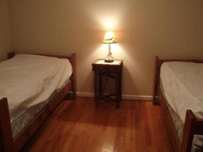
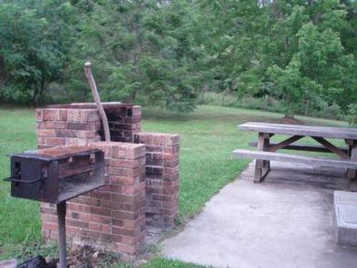
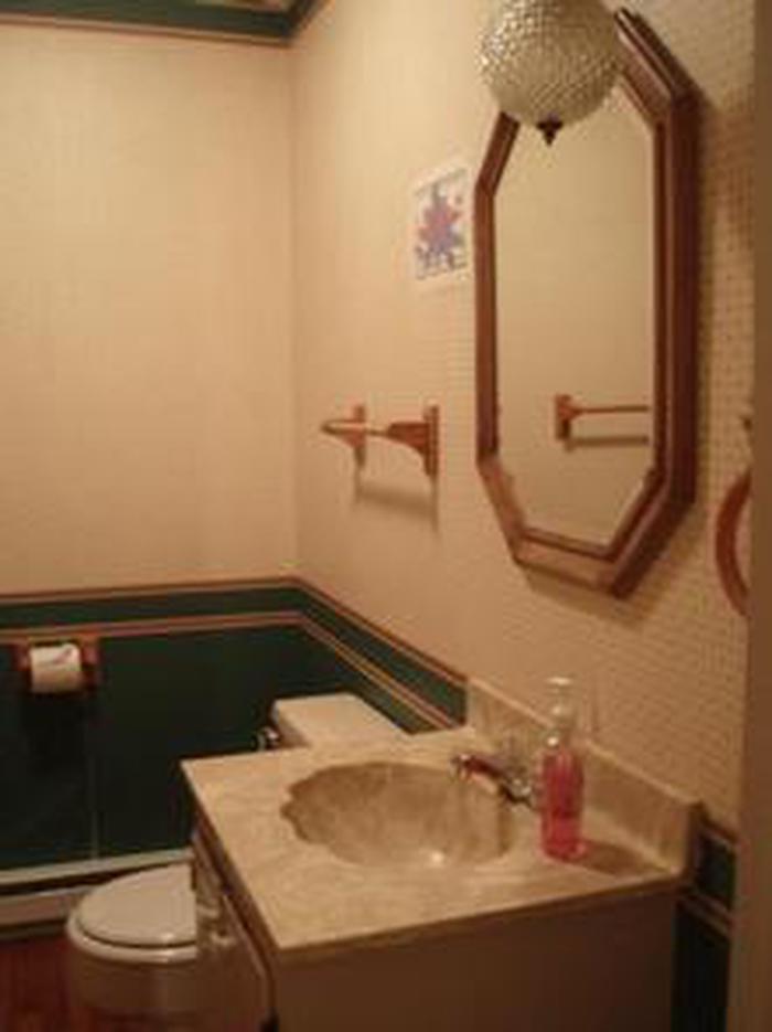
The modern, two-story house can accommodate up to eight people. It has four furnished bedrooms including one full bed and six twin beds, two bathrooms with bathtubs, a living room, dining room, and a fully equipped kitchen. There is a front porch and back patio with a built-in fireplace and picnic table. Limited dishes, pots and pans are included.
Electricity and hot water are provided, but the unit does not have air conditioning, a phone or television. Campers are expected to bring their own bed linens, pillows, towels, flashlight, food, dish detergent, laundry detergent, a first aid kit and trash bags. For outside enjoyment, visitors can bring lawn furniture, firewood for the fireplace and charcoal for the grill.
This cabin is not professionally cleaned between each renter. Renters are asked to bring basic cleaning and paper products (broom, mop, dust pan provided) and leave the cabin in good order for the next renter.
Natural Features
The cabin features a large grassy lawn that meets a dense stand of pine and hardwoods. At an elevation of 2,500 feet, the front deck provides scenic mountain views of the Blue Ridge Highlands Region.
The cabin is located in the Mount Rogers National Recreation Area, a 200,000-acre stretch of land with two lakes, 50 miles of streams and multiple historic sites.
Nearby Attractions
New River Trail State Park, Virginia Highlands Horse Trail