Directions
STAR MEADOW GUARD STATION
5250 Star Meadows Road
Whitefish, Montana 59937
Travel from Whitefish west on Highway 93 approximately 12 miles to mile marker 139, turn left onto Farm to Market Road. Continue 1.7 miles; turn right at the "Tally Lake Campground" sign onto the "Star Meadows Road". Continue to mile marker 15 located almost across from the cabin driveway.
Phone
406-758-5204
Activities
BIKING, CAMPING, FISHING, HIKING, HORSEBACK RIDING, HUNTING, WINTER SPORTS, WILDLIFE VIEWING
Keywords
STAC,STAR MEADOWS CABIN,GUARD STATION,HISTORIC CABIN,FLATHEAD NF – FS
Related Link(s)
Overview
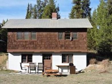
This two-room historic Forest Service Guard Station is located 23 miles from Whitefish, Montana, and is accessed by a paved road. Star Meadows was built to serve as a work station and a place to pasture stock. The buildings on this site were built in 1941 and were in service as a work center until 1971. In June 2001, a Passport In Time project completed the restoration of the cabin and the site was put on the National Historic Registry. The tool shed was renovated to create an additional bunkhouse in 2010 with American Recovery and Reinvestment funds. With two bunk beds, it sleeps four comfortably and is great for kids.
Recreation
There is plenty of opportunity for hiking, horseback riding and mountain biking in the area surrounding the cabin. Trail #171A starts in the back yard and goes all the way to Sylvia Lake approximately 10 miles away. In the winter, visitors enjoy cross country skiing and snowshoeing. Snowmobiling can be enjoyed on designated trails, but is not permitted on the cabin grounds.
Big game hunting in the national forest lands is a popular activity enjoyed by visitors, as well as fishing in Sheppard Creek behind the cabin, other nearby mountain streams and Tally Lake, which is about 11 miles east of the cabin. Guests at the cabin also enjoy ample open space for yard games and other outdoor group activities.
Facilities
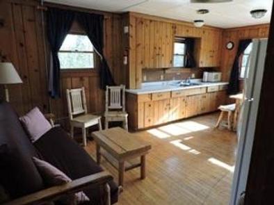
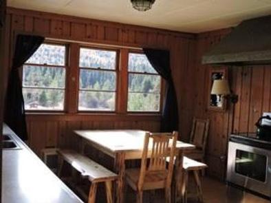
The two-room cabin comfortably sleeps up to six people and the bunkhouse sleeps four. It is furnished with four single beds and a futon couch that sleeps two. There are electric heaters throughout the cabin and in the bunkhouse. The kitchen comes complete with refrigerator, oven, microwave and coffeemaker; dishes, utensils and pots and pans are provided. Cleaning supplies are provided and the cabin must be cleaned upon departure. All garbage must be packed out.
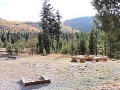
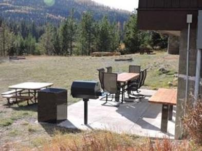
The restroom is a wood paneled vault toilet 20 yards from the cabin and has electric lights. A well with a hand pump is also located 30 yards from the cabin and water is available approximately April 1st through November 30th. There is no running water. A patio provides an outdoor area with tables, chairs and a charcoal grill. Please bring your own charcoal and empty it in the receptacle provided. An outdoor fire pit, picnic tables and horse shoe pit are in the large backyard.
Dogs are allowed. No pets are allowed on the furniture and cleaning up after them is required. Pets may not be left in the cabin while renters are away; an outdoor kennel is provided.
The site is also an excellent area for large family gatherings, with ample room in the lower meadow for several RVs or tents. Stock animals are allowed, but there is no corral or running water on site. Renters with stock or additional camp units should contact the district prior to their stay for access to the lower meadow.
Guests must bring their own bedding and food, among other necessities. Guests will also need to bring water if the reservation falls outside of the range of dates when water is available nearby. There is no cell phone service at the cabin. During winter storms or snowfall accumulation, the paved access road may not be plowed, so be prepared for winter driving and road emergencies. This is a non-smoking facility. Please be respectful to adjacent neighbors.
Natural Features
The cabin sits in a valley near the foot of Mt. Swaney, providing views of the surrounding forested mountains. It is in the northwestern corner of Flathead National Forest in the Tally Lake Ranger District nearest to the Kootenai National Forest.
Nearby Attractions
Groceries and other conveniences are located in the town of Whitefish, about 45 minutes away.


