


Directions
From Melrose, travel west on Forest Road 187 for about 13 miles, then continue southwest for 6 miles on Forest Road 7401. Four-wheel drive or high clearance vehicles are required to access the cabin. Depending on conditions, skis and snowmobiles may be necessary to complete the route. Maps may be purchased by calling the Dillon Ranger District.
Phone
406-832-3178
Activities
BIKING, HISTORIC & CULTURAL SITE, CAMPING, FISHING, HIKING, HUNTING, WILDLIFE VIEWING
Keywords
CACC,CAKC,CANYON CABIN,CREEK CABIN,CANYON,BEAVERHEAD-DEERLODGE NF -FS
Related Link(s)
Overview
Canyon Creek Cabin is located in the middle of an old mining district. Historic sites that can be explored on foot or on a bike are nearby. A variety of trails exist in the area, as does abundant wildlife. The cabin is a quaint location for guests to enjoy the scenic Pioneer Mountains in southwestern Montana.
The cabin is accessible by a four-wheel drive or high clearance vehicle, depending on conditions. Snowmobiles, skis or snowshoes may be necessary during the months between December and April each year. Guests are responsible for their own travel arrangements and safety, and must bring several of their own amenities.
Recreation
A variety of old roads exist in the area, providing plentiful hiking and biking opportunities. A trail climbs 5 miles up to a group of glacial lakes in the Pioneer Mountains, and can be accessed near the ranch on Forest Road 7401. Charcoal kilns, which date back to mining days, are situated in the area near the cabin, as another point of exploration.
Hunting is a popular activity. Canyon Creek is available for fishing. Anglers might see brook, rainbow and cutthroat trout, among other species, in the cold creek. Fishing is also available in the lakes in the area.
The trails and roadways provide excellent snowmobiling, cross-country skiing and snowshoeing in the winter. Guests must realize the potential for avalanche danger, and carry and know how to use proper backcountry equipment, including a beacon, shovel and probe while recreating (learn about avalanche danger).
Facilities
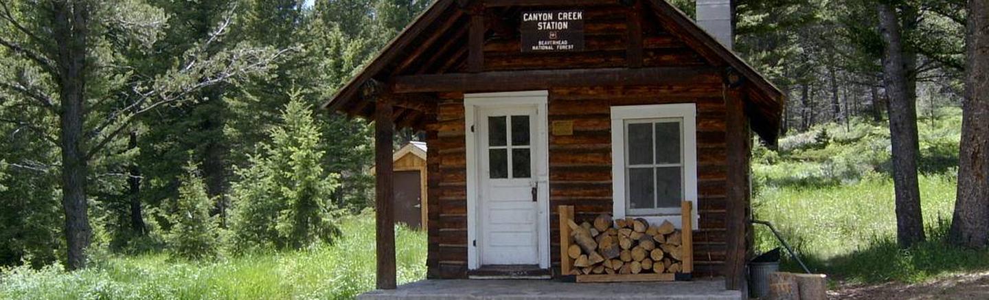
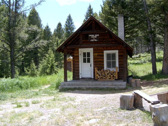
The small wood cabin can accommodate four people and is equipped with bunkbeds. A fold-down table and folding chairs are also provided, as well as a wood stove for heat. Firewood is also available but is not guaranteed.
A variety of equipment is available inside the cabin, including a saw, an axe and some dishes and pans. A broom, dust pan, shovel, bucket and a propane stove may also be available. The cabin has no electricity or running water. An outside vault toilet is provided.
Guests will need to bring water for drinking, cooking and cleaning, as well as bedding, matches, food, propane fuel canisters and necessary cooking equipment, among other amenities. Water from the creek must be treated before drinking or cooking use. Guests are asked to replenish the split firewood supply and clean the cabin prior to leaving.
Natural Features
The cabin was built in 1930 to be used as a guard station. It is situated at the base of a sheer cliff in the eastern Pioneer Mountain Range at an elevation of about 7,300 feet. The Wise River runs nearby and a mountain creek is adjacent to the cabin.
The cliff and surrounding area is home to many mountain goats. Moose can usually be found in nearby willow bottoms. During the winter, deer and elk can be seen on their winter range located up and down-canyon from the cabin. Black bears also frequent the area.
Nearby Attractions
A short drive takes visitors to Vipond Park where there are spectacular wildflowers in early summer. Glendale, an old smelter town, is nearby. There isn’t much left of Glendale, just a few old buildings, the red brick smelter stack and the foundations of many buildings. Two cemeteries are located nearby. Most of the area around Glendale is privately owned.