WILLIS KNOB HORSE CAMP, GA Campground Reservation, Info, Images, Map, Directions

WILLIS KNOB HORSE CAMP, Georgia Campground Images, Info & Reservations

Directions

From Clayton, Georgia, take Warwoman Road east for about 12 miles. Turn right on Forest Service Road 157 and continue for 2 miles to the campground on the left.

Phone

706-754-6221

Activities

CAMPING, HORSEBACK RIDING, HUNTING, WILDLIFE VIEWING, HORSE CAMPING

Keywords

KNOB,CHATTAHOOCHEE-OCONEE NF – FS,HORSE CAMP

Related Link(s)

Rec Area Info & Images

Georgia State Road Conditions

Forest Service Concessionaire

Georgia State Tourism

Overview

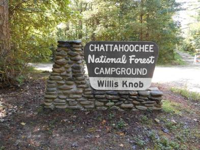
Located in the northern Georgia mountains, far from civilization, Willis Knob Horse Campground is one of the Chattahoochee-Oconee National Forests most beloved horse-lover hideaways.

The campground features equestrian camping, riding and hiking trails and fishing in the nearby Chattooga River.

Recreation

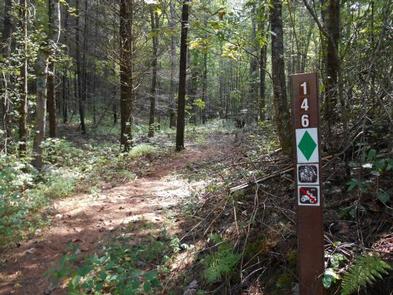
The 12.5-mile Rocky Gap Trail and the 15-mile Willis Knob Trail provide some of the most scenic horseback riding and hiking in the southern Blue Ridge Mountains. Winding across deeply dissected ridges, the trails descend into the vast Chattooga River.

The 10.7-mile Chattooga River Trail and the 37-mile Bartram Trail are also accessible nearby and are for hiking only. Fishing is available in the Chattooga River.

Facilities

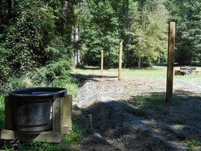
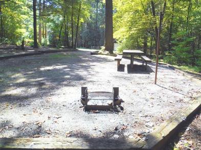
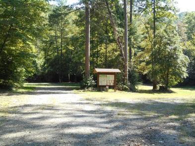
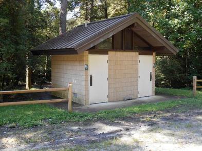
The campground provides single, double and group campsites for tent and RV camping. There are water and electric hookups at each of the campsites, along with tables, lantern posts and campfire rings with grills. Accessible flush toilets and drinking water are also provided.

Hitching racks and a horse watering station are available. Campers are required to clean up after their horses using trailers provided on-site for manure and hay.

Natural Features

The horse camp is located in a heavily wooded area of the forest, amid deep canyons and near to the Georgia-South Carolina border.

Reservation

More from CampingHiking.net:

Creek Pasture Group Site, Utah Campground Images, Info & Reservations

Directions Turn west off US 191 onto Highway 211 and travel approximately 27 miles. The turn off to the campground is on the north side of the highway. It is located approximately 7.5 miles southeast of the Canyonlands National Park visitor’s center and 14.5 miles northwest of Newspaper Rock. The

TWIN DIKES, Texas Campground Images, Info & Reservations

Directions From Jasper, TX, take US 96 north 13 miles. Go west on Recreation Rd, (FM 255) for 5 miles to the park entrance. Phone 409-384-5716 Activities BOATING, CAMPING, FISHING, HUNTING Keywords TWID,SAM RAYBURN RESERVOIR,SAM RAYBURN LAKE,TWIN DIKES PARK,SAM RAYBURN RESERVOIR Related Link(s) Rec Area Info & Images Texas State

NORTH FORK CAMPGROUND (OR), Oregon Campground Images, Info & Reservations

Directions From Medford OR, take OR-140 (Lake of the Woods Hwy) about 28 miles and turn right on Forest Road 37. Continue 1 mile on Forest Road 37, campground is located on the right. Phone 541-560-3900 Activities CAMPING, VISITOR CENTER, DAY USE AREA, HOTEL/LODGE/RESORT PRIVATELY OWNED Keywords Related Link(s) Rec

MEADOW RIDGE, Colorado Campground Images, Info & Reservations

Directions From Colorado Springs, drive west on Highway 24 for about 24 miles to Woodland Park. Turn right (north) on Baldwin St. (which becomes Rampart Range Road). Drive about 2 miles to Loy Creek Road, turn right, and then take another right on Forest Road 300 (Rampart Range Road). Follow

COEUR D’ALENE, Kansas Campground Images, Info & Reservations

Directions From US-75, take the Melvern Exit and travel 2 miles south on Melvern Lake Parkway, then 1 mile northwest on Coeur d’Alene Parkway (campground road). Phone 785-549-3318 Activities BOATING, CAMPING, HIKING, SWIMMING SITE Keywords COEU,MELVERN LAKE,MELVERN PROJECT,MELVERN SATE LK CDA OVERLOOK,COEUR D’ALENE PICNIC AREA,MELVERN STATE LK CDA OVERLOOK,MELVERN LAKE