Directions
From Troy, Montana, follow Highway 2 west for 3 miles to the East Side Road 176. Follow the East Side Road 176 for 2 miles north to the Kilbrennen Lake Road 2394. Follow Kilbrennen Lake Road 2394 approximately 2 miles to the Yaak Mountain Road 4407.
You will find a gate on this road and need the combination code to enter. Keep gate locked after entry. Follow Road 4407 to the Yaak Mountain Lookout. Total distance from Highway 2 to the lookout gate is 4.15 miles, then 5.3 miles from the gate to the lookout.
Phone
406-295-4693
Activities
CAMPING, HIKING, WILDLIFE VIEWING
Keywords
YAAK,YAAK MTN LOOKOUT RENTAL,KOOTENAI NF – FS
Related Link(s)
Overview
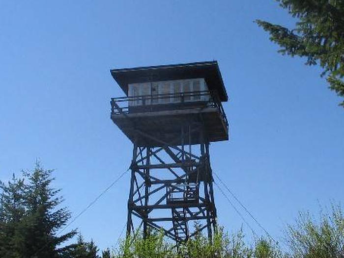
Yaak Mountain Lookout rests atop its namesake peak at an elevation of 4,977 feet within the Rocky Mountains in the Kootenai National Forest. The lookout tower has been used as an observation point for spotting forest fires since 1958.
The lookout is typically open from mid-June through late September. Access is available via primitive roads, and high clearance vehicles are recommended. This rustic retreat offers a few amenities, but guests will need to bring most of their own gear and supplies.
Recreation
Yaak Mountain Road is for non-motorized use only, with the exception of guests who reserve the lookout. Hikers can hike along this road, as well as explore the remnants of the structures that stood here before the current lookout.
Anglers can fish for rainbow trout in the Kootenai River. The Yaak River and its many tributaries provide habitat for cutthroat, rainbow, brook and bull trout.
Facilities
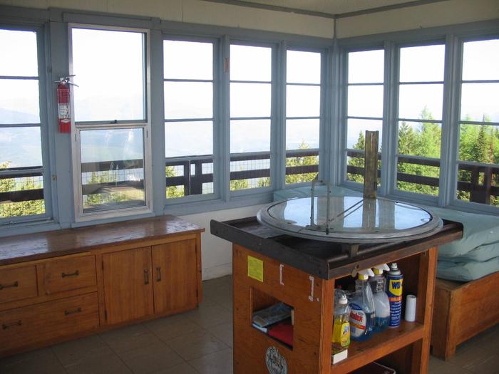
The lookout sits atop a 45-foot tower and has a catwalk encircling the cabin. It can accommodate up to 4 people and comes equipped with 2 twin beds and 4 mattresses.
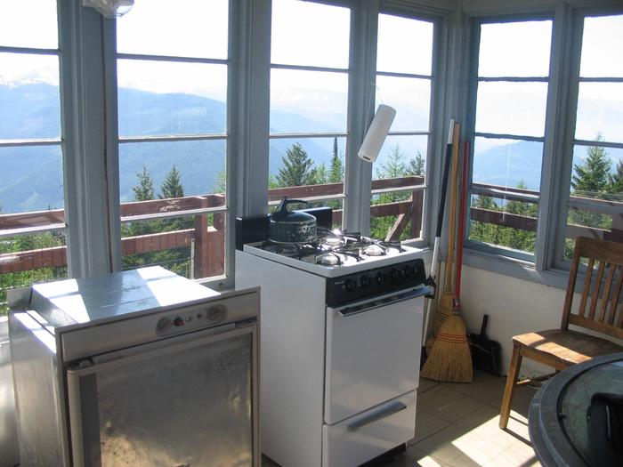
Other amenities include a propane stove, heater, lights, table and chairs, fire extinguisher and cleaning gear. An outhouse with vault toilet is located a short distance away.
No electricity or water is available. Guests must bring their own supply of water for drinking, cooking and washing.
Items such as cooking gear, bedding, lanterns or flashlights, matches, extra toilet paper, first aid supplies, trash bags, dish soap, and towels are not available. Guests are expected to pack out their trash and clean the cabin before leaving.
Natural Features
The lookout is located in the Yaak Area, which features mountainous and heavily forested terrain, as well as several lakes scattered at varying elevations. Guests can enjoy outstanding views of the town of Troy, especially for 4th of July fireworks, as well as the Kootenai and Yaak River valleys and the surrounding mountains.
Kootenai National Forest supports populations of deer, elk, moose, grizzly and black bears, wolves and mountain lions (bear safety). A variety of smaller mammals and birds can also be found.
Nearby Attractions
Yaak Falls is a popular destination just a short drive northwest from Yaak Mountain. Spring and early summer are the best times to visit, when the snowmelt finds its way over the falls.


