


Directions
From Libby travel 1 mile north on Highway 37 to the Pipe Creek Road. Turn left and follow for 19 miles, then turn east (right) onto East Fork Pipe Creek Road/Big Creek Baldy Road 336. Proceed about three quarters of a mile and then turn right onto Big Creek Baldy Mountain Road 309. Follow this road for 5 miles to the lookout. The last mile is fairly rough but can be negotiated with vehicles having high ground clearance.
Phone
406-293-7773
Activities
CAMPING, HIKING, WILDLIFE VIEWING, FIRE LOOKOUTS/CABINS OVERNIGHT
Keywords
BCBA,KOOTENAI NF – FS
Related Link(s)
Overview
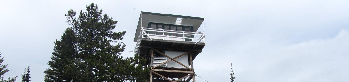
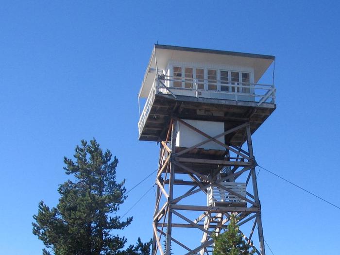
Big Creek Baldy Lookout sits atop its namesake mountain at an elevation of 5,780 feet in the Kootenai National Forest. The lookout has been used as an observation point for spotting forest fires for over 60 years.
The lookout is typically open from mid-June through late September. High clearance vehicles are recommended. This mountain hideaway offers some amenities, but guests should plan to pack in some of their own supplies. Cell service is available at the lookout.
Recreation
Hikers can find places to explore around the lookout, and the surrounding Libby Area offers more than 400 miles of summer use trails.
The lookout offers an ideal vantage point for star gazing on clear nights.
Facilities
The lookout stands 52 feet tall and has a 225 square foot cabin, which is encircled by a catwalk. It sleeps four and comes furnished with one double bed and one twin bed, both with mattresses. Other amenities include propane lights, a two-burner cooktop, table and chairs, heater, fire extinguisher, cleaning supplies and some cooking utensils. Propane is provided.
An outhouse with vault toilet is located near the tower. A campfire ring is located outside, but firewood is not provided.
Water and electricity are not available. Guests must bring enough for drinking, cooking and washing.
Items such as cookware, bedding, lanterns or flashlights, matches, extra toilet paper, first aid supplies, trash bags, dish soap, towels and an ice chest are not available. Guests are expected to pack out their trash and clean the cabin before leaving.
Natural Features
The lookout is located in the Purcell Range of the Rocky Mountains and offers panoramic views of densely forested peaks. Lake Koocanusa and the Yaak River valley are prominent features of the landscape.
Kootenai National Forest supports populations of deer, elk, moose, grizzly and black bears, wolves and mountain lions (bear safety). A variety of smaller mammals and birds can also be found.