

Directions
From Big Timber, travel 25 miles south on Highway 298 to the National Forest Boundary. At this point, the paved road becomes county-maintained gravel road (Main Boulder Road or Forest Road 6639). Continue on this gravel road another 17 miles. The cabin is on the west (right) side of the road across from the Fourmile Trailhead parking area. The Forest Service sign at the entrance to the cabin reads Fourmile Ranger Station.
During winter months it is advisable to call the Livingston Office of the Yellowstone Ranger District at (406) 222-1892 for current conditions.
Phone
406-222-1892
Activities
CAMPING, FISHING, HIKING, HUNTING, WINTER SPORTS
Keywords
FOUR,FOURMILE,GALLATIN NF – FS
Related Link(s)
Overview
Fourmile Cabin is open year-round and offers guests a rustic mountain retreat surrounded by majestic scenery. The cabin offers an electric cooking stove, lights. A refrigerator is no longer provided. Guests will need to bring most of their own gear and supplies to ensure a comfortable stay.
The cabin is accessible by vehicle during warmer months, along a gravel county road. Late-season ice may require guests to snowshoe, hike or snowmobile up to 3.5 miles to the cabin. Guests arriving in winter should be prepared to snowmobile, ski or snowshoe up to 11 miles along the access road to the cabin. Guests are responsible for their own travel arrangements and safety.
Recreation
Equestian and hiking trails are accessible from the cabin and head west into the Absaroka Mountains, branching out through the Absaroka-Beartooth Wilderness. The winter landscape is ideal for cross-country skiing and snowshoeing.
Anglers can fish for Yellowstone cutthroat or rainbow trout in Fourmile Creek or the Boulder River. Hunting is a popular fall activity.
Facilities
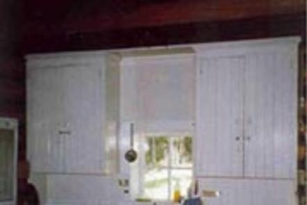
The two-room cabin has an electric stove and lights. A wood-burning stove is provided for heat. Firewood is not available from June 1st through September 30th. Please bring firewood or gather from the forest during the summer season. Do no burn provided firewood for outdoor fires ever, as it is extremely difficult to replace. Firewood is available during winter months as long as supplies last.
The cabin can sleep up to four people on provided twin beds with mattresses. Other amenities include basic cookware and utensils, some cleaning supplies, a table with chairs, axe, maul, bucket and shovel.
There is a campfire ring and a vault toilet outside.
Water is not available at the cabin. Guests need to bring their own water supply or be prepared to treat water taken from an outside source. Garbage bags are needed to pack out trash, and guests are expected to clean the cabin before leaving.
Guests should also bring their own flashlight, bedding, cookware, dishes, utensils, newspaper, matches, toilet paper and first aid kit, among other necessities. Please note, a refrigerator is not available, please plan accordingly.
Natural Features
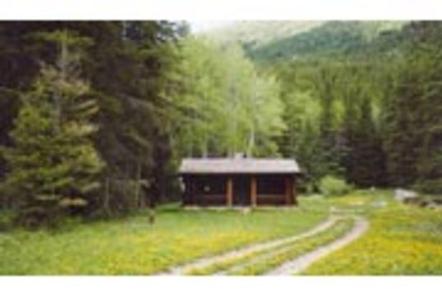
The cabin sits at an elevation of 6,186 feet on the Boulder River, near Fourmile Creek. The Boulder River carves out a canyon between the peaks of The Needles, Carbonate Mountain and Hawley Mountain in the Absaroka Range. The cabin is nestled in the canyon in an open, grassy area surrounded by mixed forest.
The location provides habitat for a variety of wildlife, including bear, moose, antelope, elk and deer. Many species of birds also inhabit the area.