
Directions
From Great Falls, travel east on U.S. Highway 87 for about 63 miles to Windham, Montana, from Windham turn right off HWY 200/87 and head south for approximately 10 miles until the town of Utica. Turn right at Utica, continue south for approximately 13 miles on the county road. At the “Y” junction turn right nto the Middlefork road 822 and continue southwest for about 1 mile until you reack the “Y”, stay to the left and continue for about 1 mile to the Judith Gaurd Station
Phone
406-566-2292 OR 406-236-5511
Activities
BIKING, CAMPING, FISHING, HIKING, HUNTING, OFF HIGHWAY VEHICLE, WILDLIFE VIEWING, PHOTOGRAPHY, SNOWMOBILE, MOUNTAIN BIKING, BIRDING, CROSS COUNTRY SKIING, BACKPACKING, ARCHERY
Keywords
JUDI,JUDITH,GUARD,STATION,LEWIS AND CLARK NF – FS
Related Link(s)
Overview
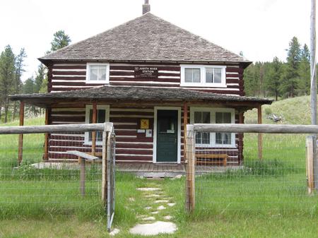
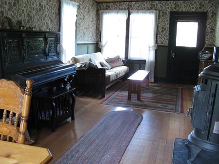
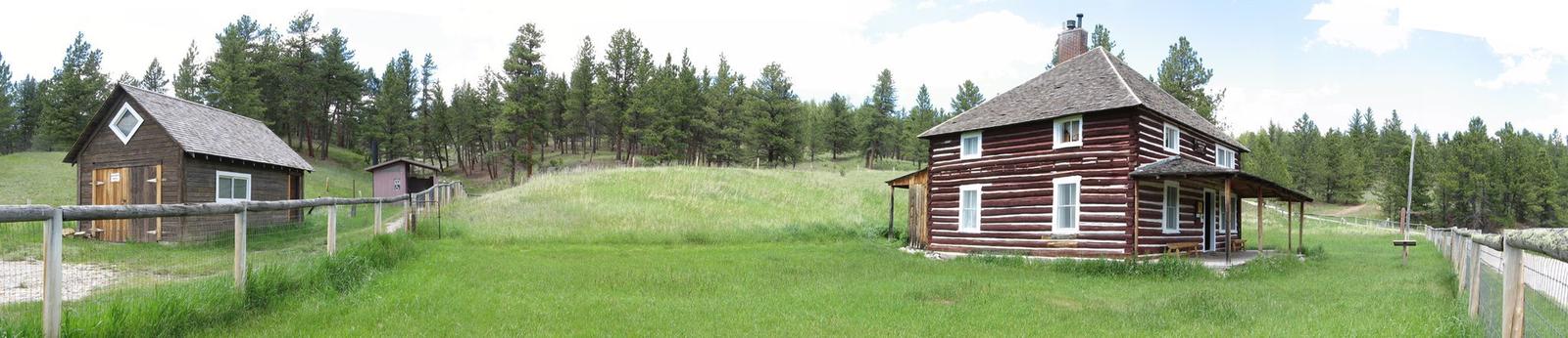
Judith Guard Station is a historic Ranger Station dating back to the early 1900s. Designated as a National Historic Site, the cabin is decorated with historically accurate furnishings and wallpaper. It is just a stone’s throw from the Middle Fork of the Judith River and a small campground with a picnic area. Mandatory bear food storage requirements apply, with specfic compliance information posted at the cabin. The cabin, located about 30 miles south of Stanford, may be accessed by regular passenger vehicle until snow season. The road is usually plowed within 2 miles of the station, and a four-wheel-drive vehicle can often make the trip. In times of heavy snowfall, the last half-mile to the cabin may require a snowmobile, skis or snowshoes.
Recreation
Hiking, OHVing, hunting and mountain biking opportunities abound. Nearby hunting includes deer and elk in designated areas. Snow shoeing and cross country skiing are popular activities during the winter months.
Facilities
The two-story frame building has a modern vault toilet outside and a porch with chairs. Furnishings include propane cook stove and heat, beds to fit eight guests, table and chairs plus cooking utensils are provided in the kitchen. Portable propane lanterns are available, but users must bring their own propane cylinders.
A hand well with drinking water is available outside from May to September. No water is available during the winter so guests should bring plenty of water during this time period. Guests are asked to bring garbage bags, toilet paper, flashlights, bedding, an ice chest and all personal toiletries. Click here for more cabin details.
Natural Features
Judith Guard Station sits at an elevation of 5,000 feet on the northern banks of the Middle Fork of the Judith River. The region boasts wooded hills topped with Ponderosa Pine, lodgepole pine and Douglas fir.
Wildlife in the area includes deer, elk, bear, bobcats and montain lions.
Nearby Attractions
Judith River State Wildlfe Management Area lies north of the cabin and Middle fork of the Judith River in close proximity .Grocery stores and gas is available in Stanford, about 30 miles from the cabin. Sapphire Village 5 miles to the northeast