
Directions
Grouse Creek Campground is located approximately 7 miles up the Forest Service Road 6200/Chiwawa River Road. There is a gated spur road just off the main paved road on the left. The campground is at the end of the road alongside Grouse Creek.
Phone
509-763-0700
Activities
BIKING, CAMPING, FISHING, WILDLIFE VIEWING, SWIMMING SITE
Keywords
GROUSE CREEK GROUP SITE (WA),GROUSE CREEK CAMPGROUND,GROUSE CREEK GROUP RESERVATION CAMPGROUND,GROUSE CREEK CAMP SITE
Related Link(s)
Washington State Road Conditions
Overview
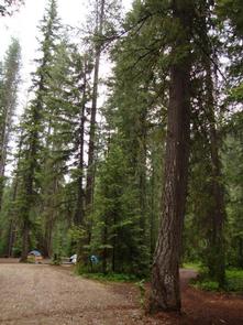
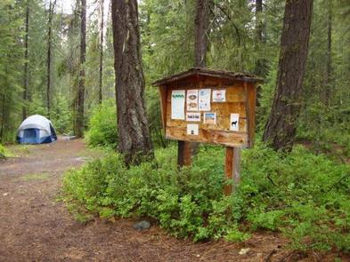
Nestled in a secluded forest setting, Grouse Creek Group Campground is a hidden gem for groups looking for a quiet getaway trip.
The campground is located near the confluence of Grouse Creek and the Chiwawa River, offering scenic landscapes and a multitude of recreational activities.
Recreation
Grouse Creek Group Campground offers outdoor enthusiasts the opportunity to hike, fish, bike and enjoy a long list of outdoor recreational activities throughout the year.
At an elevation of 1,850 feet, Wenatchee Lake provides outdoor enthusiasts with a multitude of recreational opportunities year-round. The area offers a scenic backdrop for swimmers braving its cold, refreshing waters, and for anglers casting a lines from boat or shoreline. Brook trout, smallmouth bass, largemouth bass and cutthroat trout thrive in the lake.
Skiing, snowmobiling, tubing, and skijouring are popular winter activities for visitors to the Wenatchee Ranger District. Both motorized and non-motorized Sno-Parks in the area offer access to both groomed trails and natural settings for those wanting to explore the winter wonderland.
Facilities
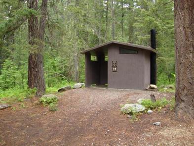
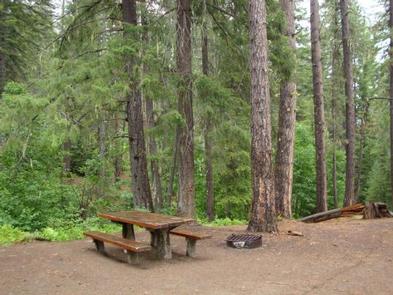
Grouse Creek Group Campground can accommodate up to 50 guests and is equipped with picnic tables, campfire rings and accessible vault toilets.
Natural Features
Okanogan-Wenatchee National Forest offers stunning scenic views, with high, glaciated alpine peaks, valleys of old growth forest and rugged shrub-steppe country making up the diverse landscape. Elevations range from below 1,000 feet to over 9,000 feet.
Precipitation varies greatly throughout the area, ranging from approximately 140 inches along the Cascade Crest to only 10 inches along the eastern edge. Visitors can expect many days of warm, sunny weather in the summer, and winters with clear skies and plenty of snow.
The surrounding undeveloped wilderness, clean streams and diverse forests support an abundance of wildlife, including mountain goats, porcupine, pine marten, native fish and migratory birds.
Nearby Attractions
Visitors enjoy the North Cascades and Mt. Rainer National Parks, where interpretive programs and exhibits offer education about the diverse landscape and history of the area.
The spectacular Pacific Crest Trail (PCT), one of the world’s premier National Scenic Trails, showcases some of North America’s most fantastic scenery, winding its way its way from Mexico to Canada through California, Oregon and Washington, and is accessible near the campground.