
Directions
From Flagstaff, follow Interstate 40 west for about 30 miles and take exit 178 at Parks. Proceed one-tenth of a mile and turn left onto Old Route 66. Follow this road about a half-mile, then turn right onto Spring Valley Road/County Road 141, at the Old Parks Store. Continue on County Road 141 to the intersection of Forest Road 76, just past milepost 8 (pavement ends just before reaching milepost 6). Look for the Spring Valley Cabin sign. Turn left on Forest Road 76, and proceed less than a mile. The cabin will be on the left.
From Williams, travel east on Interstate 40 for about 14 miles and take exit 178 at Parks. Follow the directions above to the cabin.
Phone
928-635-5600 WILLIAMS RANGER STATION 8-4:30 M-F
Activities
BIKING, CAMPING, HIKING, HORSEBACK RIDING, HUNTING, WINTER SPORTS, WILDLIFE VIEWING
Keywords
SPRV,ROOM WITH A VIEW,SPRING VALLEY WORKCENTER,SPRING VALLEY RANGER STATION,SPRING VALLEY RENTAL CABIN,FOREST SERVICE RENTAL CABIN,KAIBAB NF – FS
Related Link(s)
Overview
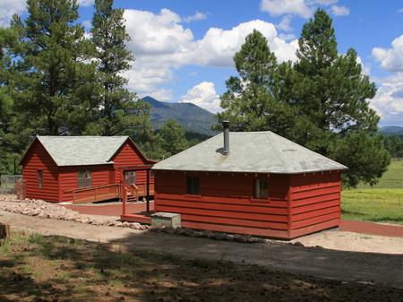
Spring Valley Cabin and Bunkhouse offer a peaceful retreat with spectacular views, quiet solitude, wildlife viewing opportunities and access to cross country ski trails, all just minutes away from Flagstaff, and one hour from Grand Canyon National Park. This year-round getaway can host up to 14 people between the cabin and adjacent bunkhouse.
The facility can be accessed by vehicle, however, drive-in access may not be available in winter. Forest Road 74 is not maintained during winter and the road may be closed during heavy snowfall.Cross country ski access is available when conditions require it. The distance from the winter parking area to the cabin is one mile. Guests are responsible for their own travel arrangements and safety, and must bring several of their own amenities.
Recreation
With miles upon miles of national forest and park lands to explore, visitors have no shortage of outdoor activities from which to choose. The cabin is adjacent to a cross country ski trail, which provides access to the cabin when the roads are covered in snow, and an area for snow tubing is nearby.
Hiking, horseback riding and mountain biking are very popular in this area, and there are plenty of trails. Visitors might be lucky enough to spot wildlife such as elk, mule deer, wild turkeys, javelina, coyote and numerous birds and raptors that live in the area.
Facilities
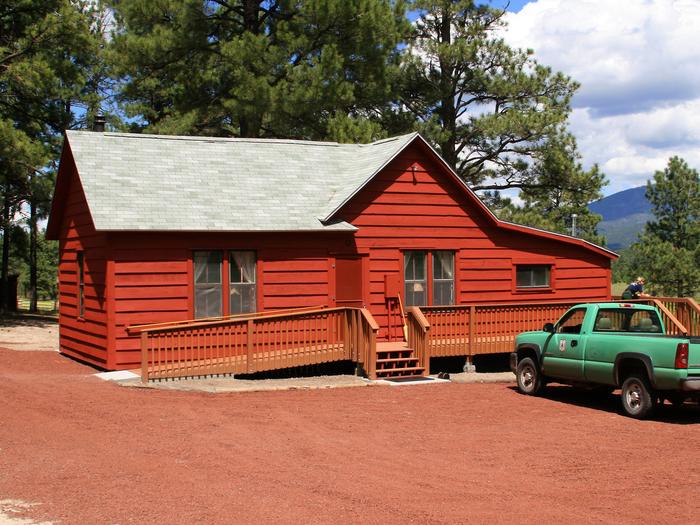
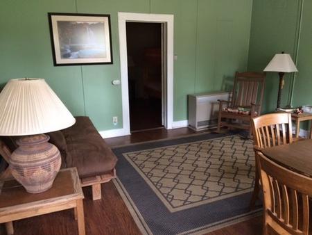
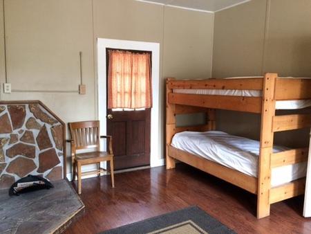
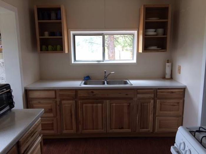
The facility is made up of two buildings, a cabin and bunkhouse. The cabin is equipped with three twin bunk beds with mattresses and two futon couches, to sleep up to nine people. A maximum of ten peoples are allowed within the cabin. There is a living/dining area, a restroom with flush toilet and shower, and a kitchen with drinking water and plenty of kitchen supplies.
The bunkhouse offers three twin size bunkbeds with mattresses and one full-size futon couch available to sleep up to seven people. Gas/propane heaters, wood stoves and firewood are provided. A parking area, picnic tables are located outside.
Campers must bring their own food, bedding (sheets, pillows, blankets and/or sleeping bags), bath and kitchen towels, garbage bags, warm clothing, dish soap and flashlights, among other necessities. The facility must be cleaned and all food and trash removed prior to departure.
Natural Features
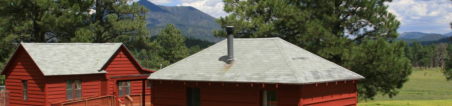
The structures are located at an elevation of 7,320 feet, overlooking a wide meadow while being nestled beneath mature ponderosa pines. The cabin was constructed in 1917 as the residence for rangers who worked at the guard station. The bunkhouse served as the office. It is still occasionally used as a field station for U.S. Forest Service employees.
Winter brings a mix of sun with cold temperatures and occasional winter storms. Summer temperatures are relatively pleasant, but weather can be unpredictable. Visitors should come prepared for changeable mountain weather, cold nights, thunderstorms and snow from fall through spring.
Nearby Attractions
Grand Canyon National Park’s South Rim is a must-see attraction just over an hour away. The nearby town of Williams and the city of Flagstaff have numerous restaurants, hotels, gift shops, grocery stores and cultural attractions.