


Directions
From Weston, Oregon: Travel 20 miles east of Weston on Highway 204. Turn left (north) onto Forest Service Road 64 and follow it for approximately 11 miles to the junction with Forest Service Road 63. Turn right onto Forest Service Road 63 and travel about 8.8 miles to the junction with Forest Service Road 62. Turn left onto Forest Service Road 62 and travel for 3.9 miles to Forest Service Road 6235. Turn right onto Forest Service Road 6235 and travel for about 1.1 miles to the Fry Meadows Guard Station, which will be on the right. From Elgin, OR, drive on the Elgin-Palmer Junction County Road for about 15 miles to the junction with the Lookingglass Road/FSR 63. Go down Lookingglass Road for about 2 miles to the end of the pavement; FSR 63 starts here. Continue on FSR 63 for about 4.7 miles to the junction with FSR 62. Turn right on FSR 62 and travel about 3.9 miles to FSR 6235. Turn right on FSR 6235 and travel about 1.1 miles to the Fry Meadow Cabin, which will be on the right. Generally, Fry Meadows can be accessed by vehicle from mid-May to mid-November, and parking is available at the cabin. .
Phone
509-522-6290
Activities
HISTORIC & CULTURAL SITE, CAMPING, HUNTING, WILDLIFE VIEWING, BIRDING, MOUNTAIN CLIMBING
Keywords
FRYM,FRY MEADOWS,FRY MEADOWS CABIN,FRY,MEADOWS,GUARD,STATION,FRY MEADOWS GUARD STATION,FRY MEADOWS GUARD,UMATILLA NF – FS
Related Link(s)
Overview
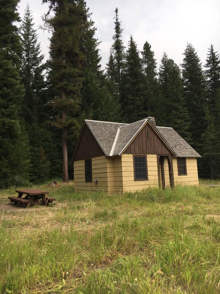
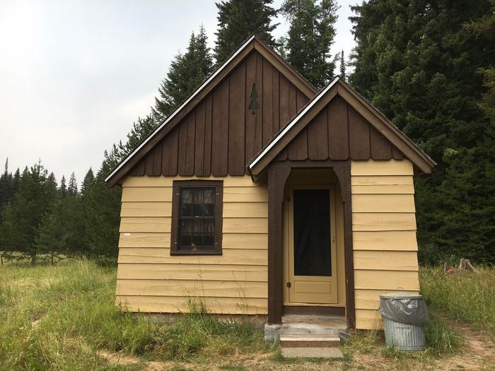
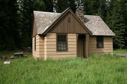
Fry Meadows Guard Station offers the peaceful solitude of a remote nature-lover’s paradise just south of the Wenaha-Tucannon Wilderness and west of the Grande Ronde Wild and Scenic River. The surrounding area is steeped with native history and culture as it was once home to the Nez Perce, Umatilla, Walla Walla and Cayuse Indians. This site was originally established as a ranger station before 1908, part of the former Wenaha National Forest. The existing cabin was constructed in 1935 by the Civilian Conservation Corps and was used as a remote guard station until about 1980. The two-room cabin provides a pleasant escape for up to six guests. Additional guests may pitch a tent in the yard. Pets are welcome but must be leashed and outside
Recreation
The Wenaha-Tucannon Wilderness offers more than 200 miles of managed trails for hiking and horseback riding in summer. The Grande Ronde Wild and Scenic River offers float boating, salmon and steelhead fishing. Hunting is available nearby.
Seasonal mushroom and berry picking can also be enjoyed. Huckleberries, blackberries and morel mushrooms are among the edible picks.
Facilities
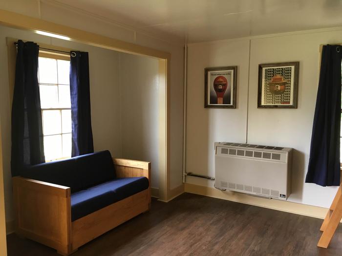
The cabin is a classic 1930s Civilian Conservation Corps two-room design. It is equipped with a propane cook stove, propane heater and propane lights. Furnishings include two full beds and two twin beds with mattresses, tables and chairs, limited cleaning supplies, cooking pots and utensils. A vault toilet is located a short distance from the cabin. The cabin has no water. Visitors must bring plenty for drinking, cooking and washing. Please bring sleeping bags or bedding, a flashlight, first aid kit, washcloths, towels and dish soap. Click here for more cabin details.
Natural Features
Tucked beneath the shady canopy of towering spruce and fir, the guard station sits at the edge of an expansive meadow of grasses and wildflowers, such as lupine, larkspur, monkey flower and orchid.
As the afternoon slides into evening, deer and elk come out to graze. Hawks perch in treetops or glide over the meadow, scanning the grass for field mice and other critters. In the morning, many varieties of birds, including flycatchers, hummingbirds, swallows, chickadees, creepers, wrens, kinglets, thrushes, sparrows, warblers, tanagers and finches, greet the day.
Nearby Attractions
This site is located about 25 miles northeast of Elgin, Oregon, which offers general stores and gas stations.