
Directions
From Blainsville, take U.S. 19/129 south for 10 miles. Turn right (west) on Georgia 180 for 7 miles. Turn right onto Forest Road 37 at Lake Winfield Scott Recreation Area entrance.
From Dahlonega, take U.S. 19 north for approximately 20 miles. Turn left (west) on Georgia 180 for 7 miles. Turn left onto Forest Road 37 at Lake Winfield Scott Recreation Area entrance.
Phone
706-747-3816
Activities
BOATING, CAMPING, FISHING, HIKING, SWIMMING SITE
Keywords
LWSC,BRASSTOWN,CHATTAHOOCHEE-OCONEE NF – FS
Related Link(s)
Overview
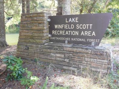
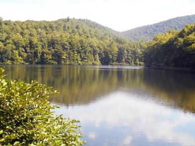
Lake Winfield Scott Recreation Area offers visitors year-round recreation opportunities including camping, picnicking, boating, swimming and hiking, all centered around beautiful Lake Winfield Scott.
The area is situated high in a mountain valley within the Chattahoochee-Oconee National Forest, approximately 80 miles from Atlanta, Georgia. The facility offers a rental cabin with electricity and water, as well as sites for tent and RV camping.
Recreation
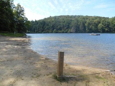
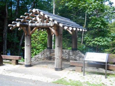
The Lake Winfield Scott Beach includes a designated swimming area, picnic tables, a bathhouse, pavilions (by reservation only), a playground and trash bins.
Day-use hiking trails are found within the recreation area, ideal for a short stroll. A 0.4-mile trail parallels the lakeshore. In addition, the 1-mile Jarrard Gap Trail and 2.7-mile Slaughter Creek Trail both begin within the recreation area and connect to the Appalachian Trail.
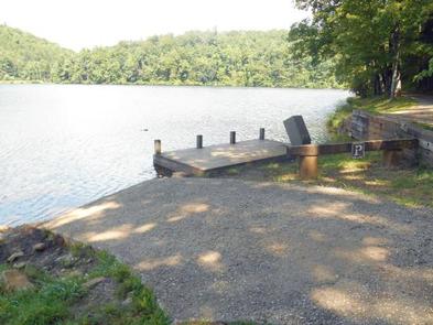
Lake Winfield Scott is open to hand-powered and electric motor boats only. Fishing for catfish, trout, perch, brim and bass is a popular activity. See the Georgia Department of Natural Resources for a complete listing of freshwater fishing regulations for the lake. A boat ramp and accessible fishing dock provide year-round lake access.
Facilities
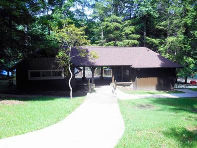
Lake Winfield Scott Recreation Area’s cabin is a short walk to the lake, and can accommodate up to 12 people. A sleeping area upstairs is furnished with six twin beds and three double beds, all with mattresses. Visitors must provide their own bed and bath linens. The main floor houses a living room with wood stove (no wood provided), dining room and kitchen, which is equipped with a refrigerator, electric stove, microwave, assorted pots and pans, utensils, plates, glasses, cups and flatware. The bathroom has a flush toilet, shower and an electric heater. Lake Winfield Scott Recreation Area’s campground consists of 31 campsites configured in two loops for tent or RV camping. Showers, flush and vault toilets, grills, picnic tables and lantern posts are provided. The campground has no dump station, water or electric hookups. The North Loop is open November – March (sites 21 – 37). Fees are temporarily reduced because water is not available.
Natural Features
The recreation area includes 18-acre Lake Winfield Scott, which forms the headwaters of Cooper Creek. The lake was built by the Civilian Conservation Corps in the 1930s.
A variety of wildlife makes its home in the surrounding forest, including deer, bear, wild turkey, grouse and songbirds.
Nearby Attractions
Suches, Georgia is five miles southwest of the recreation area and offers a general store and fuel station.
Blairsville, Georgia is 16 miles north on U.S. Highway 19/129 and offers the nearest full-service grocery stores and shopping villages.