
Directions
Ten-X Campground is located 2 miles south of Tusayan, Arizona and 47 miles north of Williams on U.S. Highway 180/State Highway 64.
From Williams: Take Highway 64 north. The campground is on the right, just before the town of Tusayan.
From Cameron: Take Highway 64 west to Grand Canyon National Park. Continue through the park and exit through the south entrance station. The campground is on the east side of Highway 64, 2 miles south of the town of Tusayan.
Note: entrance fees into the Grand Canyon National Park are $25 and are good for seven days.
Phone
928-638-2443
Activities
CAMPING, HIKING, PICNICKING
Keywords
TENX,Ten-X,10-X,10X,TEN X CAMPGROUND GROUP SITES,KAIBAB NF – FS
Related Link(s)
Overview
PLEASE BE ADVISED: Reservation and walk-in fees for Ten-X Campground have been increased according to the Federal Lands Recreation Enhancement Act. The Kaibab National Forest invited public comment during the 2019 season and went before the Arizona BLM Resource Advisory Council on November 14th, 2019 to get proposed fees approved. Fees for both standard and group sites will be raised for the 2020 peak season beginning on May 1st, 2020. 95% of the fees generated at Ten-X Campground are retained on the local unit and reinvested to support recreational opportunities in the area. Most of the fee dollars from Ten-X will go to expansion of the campground and the amenities provided there.
Perhaps the biggest draw to Ten-X Campground in northern Arizona is its proximity to the South Rim of Grand Canyon National Park. Located just 4 miles south of the park entrance in beautiful Kaibab National Forest, Ten-X is a quiet, peaceful campground that generally has open camping sites.
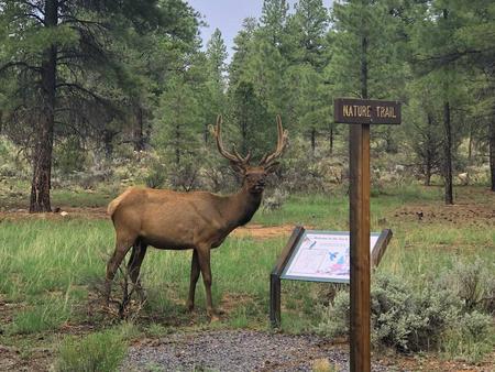
A nature trail weaves its way through the pine forest, and many more hiking opportunities are within a short drive. The facility can accommodate individual and family visitors, as well as large groups up to 75 people.
Recreation
The campground has a short nature hike that allows visitors to view local flora and fauna. Elsewhere, the nearby town of Tusayan offers horseback riding, helicopter rides and other tours.
Many hiking, sightseeing, cultural history and outdoor recreation opportunities lie just a few miles away in Grand Canyon National Park.
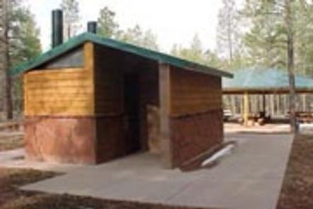
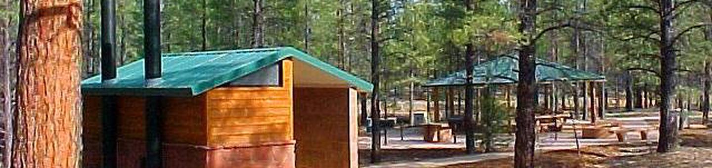
Facilities
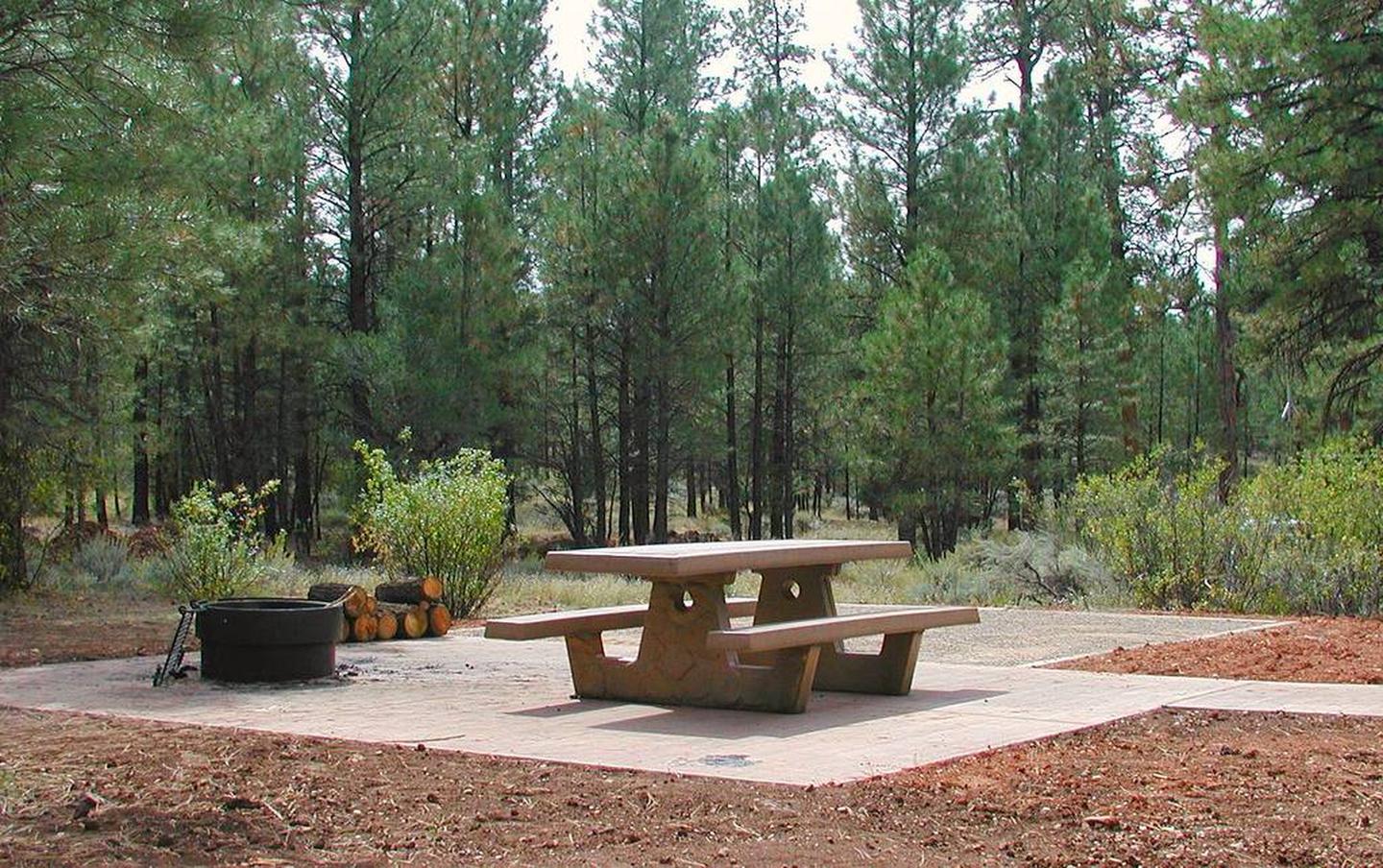
The facility is attractive, well-maintained and spacious. There are 70 single-unit campsites organized in a large loop, each accommodating up to eight people.
Single-family sites 1-13, 22-30 and 45-70 are non-reservable and only available on a first-come, first-served basis. Sites are comfortable with bathrooms, water and paved parking nearby. Sites 2, 3 and 4 have tent pads.
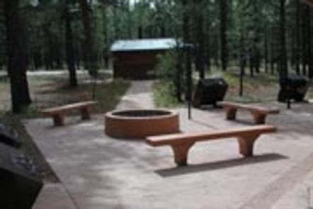
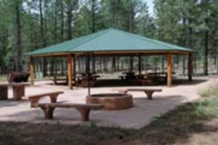
There are also two group sites. Group Site A accommodates up to 75 people. Group Site B accommodates up to 50 people. Groups larger than 75 people can reserve both Group Sites A and B. The group sites have picnic shelters, tables and tent pads.
Due to limited water supply, RVs are not allowed to fill up at the campground.
Natural Features
Ten-X is situated in a pleasant Ponderosa pine and Gambel oak forest at an elevation of 6,600 ft. The forest is nestled on the Colorado Plateau, an area of land that was uplifted by geologic processes.
Summer temperatures range from 50 degrees at night to 80-90 degrees during the day. Summer thunderstorms, known as the monsoon, can build up quickly, especially during July and August. Snow is common from December through March.
Nearby Attractions
Grand Canyon National Park’s South Rim, just 4 miles away, is a must-see for Ten-X campers.
The adjacent town of Tusayan has a wide array of amenities, such as a gas station, restaurants, small grocery store, banks, hotels, internet access, mountain biking trails and many different tours.