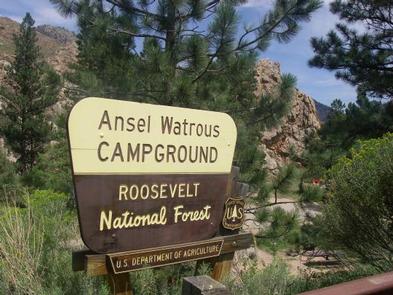
ANSEL WATROUS, CO Campground Reservation, Info, Images, Map, Directions

ANSEL WATROUS, Colorado Campground Images, Info & Reservations

Directions

From Fort Collins, take Highway 14 northwest for 13 miles.

Phone

970-295-6700

Activities

BIKING, BOATING, CAMPING, FISHING, HIKING, WILDLIFE VIEWING, MOUNTAIN BIKING, KAYAKING, CANOEING, BIRDING, RAFTING

Keywords

ANSE,ANSEL,WATROUS,ANSEL WATROUS,ARAPAHO AND ROOSEVELT NF – FS

Related Link(s)

Rec Area Info & Images

Colorado State Road Conditions

Forest Service Concessionaire

Colorado State Tourism

Overview

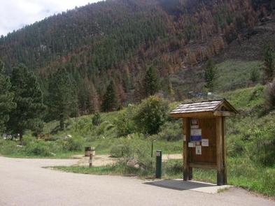
Ansel Watrous Campground is located on the Cache la Poudre River, 22 miles northwest of Fort Collins, Colo., along Highway 14. Visitors enjoy the area for its great rafting, fishing and hiking opportunities.

Recreation

The Cache la Poudre River offers whitewater rafting and fishing. Anglers cast for brown, cutthroat and rainbow trout, among other species of fish.

Hiking, biking and horseback riding trails are in the surrounding area, including the 4-mile Young Gulch Trail.

Other popular activities enjoyed by visitors to the campground include birding and wildlife viewing.

Facilities

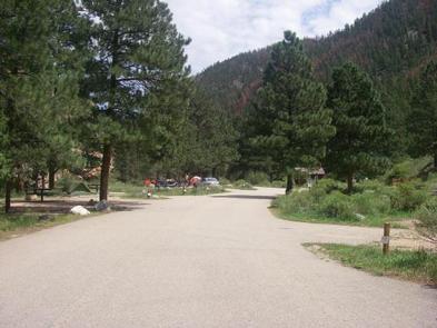
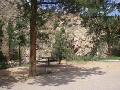
The campground offers accessible single-family sites, each equipped with a 12-by-15 tent pad, a picnic table and a campfire ring with grill.

Vault toilets and drinking water are provided. Dead and downed firewood may be gathered in the forest or purchased from the campground host.

Natural Features

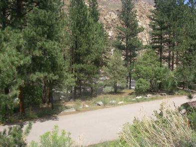
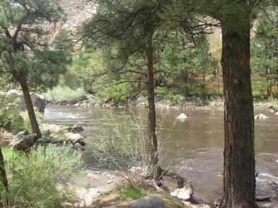
The canyon’s vegetation varies from dense forests to open meadows and the campground is surrounded by steep mountains. The campground is situated among Ponderosa pines on the banks of the Cache la Poudre River, Colorado’s first river designated as a National Wild and Scenic River.

Charges & Cancellations

A $10.00 service fee will apply if you change or cancel your reservation. Late cancellations are subject to additional fees. For full details see NRRS Reservation Policy.

Reservation

More from CampingHiking.net:

MILL DAM GROUP CAMP, Florida Campground Images, Info & Reservations

Directions Mill Dam is located just off of Highway 40, approximately 15 miles east of Silver Springs, Florida, and 50 miles west of Ormond Beach. From 40, look for the Mill Dam/Half Moon signs about a quarter-mile from the recreational area turnoffs. Phone 352-625-2520 Activities CAMPING, HIKING, WATER SPORTS, SWIMMING

DEARHAMER CAMPGROUND, Colorado Campground Images, Info & Reservations

Directions From Basalt, travel east on Frying Pan River Road for approximately 20 miles, just past Ruedi Reservoir to Dearhamer Campground. Phone 970-927-0107 Activities BIKING, CAMPING, INTERPRETIVE PROGRAMS, HIKING, WATER SPORTS, WILDLIFE VIEWING Keywords Related Link(s) Rec Area Info & Images Forest Service Concessionaire Colorado State Road Conditions Colorado State

HAWTHORN BLUFF, Oklahoma Campground Images, Info & Reservations

Directions From Tulsa, Oklahoma, take U.S. Highway 169 north for 27 miles to Highway 88. The campground is 2 miles east of the town of Oologah on Highway 88. Phone 918-443-2319 Activities BOATING, CAMPING, FISHING, HIKING, VISITOR CENTER, WATER SPORTS, DAY USE AREA, SWIMMING SITE Keywords HAWT,OOLOGAH LAKE,OOLOGAH LAKE Related

LITTLE COON CREEK PARK, Arkansas Campground Images, Info & Reservations

Directions From US-59/71 at Grannis, Arkansas, turn east onto County Rd 3/Frachiseur Rd and stay on this road for 5 miles and then follow the signs on into the park. Phone 870-385-7126 Activities BOATING, CAMPING, FISHING Keywords COON CREEK Related Link(s) Rec Area Info & Images Arkansas State Road Conditions

WALKER CABIN, Idaho Campground Images, Info & Reservations

Directions From State Highway 14, turn south on Crooked River Road #233 and proceed approximately 8 miles to the cabin on the right. Phone 208-842-2245 Activities BIKING, CAMPING, FISHING, HIKING, HUNTING, WILDLIFE VIEWING Keywords WALB,NEZPERCE NF – FS Related Link(s) Rec Area Info & Images Idaho State Tourism Idaho State

OAK PARK DAY USE, Texas Campground Images, Info & Reservations

Directions From Waco or Corsicana, Texas, take State Highway 31 to the intersection with FM 667. Turn north on FM 667 and travel about 1.5 miles to the park entrance on the left side of the road. Phone 254-578-1431 Activities SWIMMING Keywords Oak park Related Link(s) Rec Area Info &