BIG SCRUB CAMPGROUND, FL Campground Reservation, Info, Images, Map, Directions

BIG SCRUB CAMPGROUND, Florida Campground Images, Info & Reservations

Directions

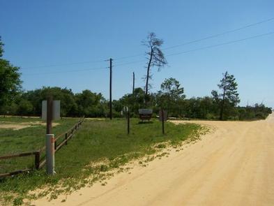
From I-75 east, travel on State Route 40 to Forest Road 588. Turn south on 588 and go approximately 8 miles. The campground is on the west side of the road.

Phone

352-625-2520

Activities

CAMPING, PICNICKING, WILDLIFE VIEWING

Keywords

BSCG,SCRUB,NFs IN FLORIDA – FS

Related Link(s)

Rec Area Info & Images

Florida State Tourism

Florida State Road Conditions

Overview

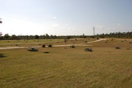
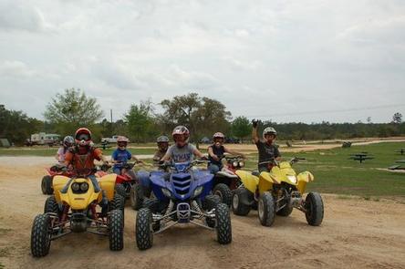
Perennially popular with off-road vehicle enthusiasts, Big Scrub Campground sits in the Ocala National Forest in central Florida. A trailhead within the facility offers riders campsite-to-trail access.

Recreation

Big Scrub Campground offers direct access to the 47-mile Ocala Adventure Trail. All off-road vehicle riders will enjoy exploring the Tread Lightly Four Wheel Drive Way. A permit is required for use of the trail system.

Learn more about off-road vehicle use in Ocala National Forest.

Facilities

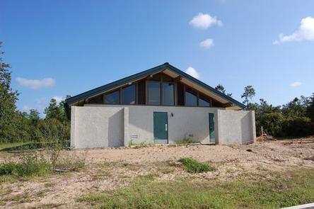
Big Scrub can accommodate tents, campers and RVs. The campground is equipped with showers, restrooms and drinking water.

Natural Features

The Ocala National Forest spans four counties and 383,000 acres. It is the southernmost and oldest national forest east of the Mississippi River and protects the world’s largest contiguous sand pine scrub forest.

Miles of trails offer plenty of open space and blue skies for off-road vehicles.

Nearby Attractions

The warm, turquoise waters of Alexander Springs are a short drive away. Visitors can swim, canoe and dive in a natural spring-fed lake and creek.

Reservation

More from CampingHiking.net:

NORTH PINES, California Campground Images, Info & Reservations

Directions Take Highway 41 north from Fresno, Highway 140 east from Merced, or Highway 120 east from Manteca into Yosemite National Park. Follow signs to Yosemite Valley and the campgrounds. Phone (209) 372-8502 Activities CAMPING Keywords Yosemite National Park,The Valley Related Link(s) Rec Area Info & Images California State Road

ONION VALLEY, California Campground Images, Info & Reservations

Directions The campground is 13 miles west of the town of Independence, California. Take U.S. Highway 395 to Independence. Turn west on Market Street, which turns into Onion Valley Road. Follow Onion Valley Road for 13 miles to the campground. Phone 760-937-6070 Activities CAMPING, FISHING, HIKING, HORSEBACK RIDING, WILDLIFE VIEWING

BULL RIVER PAVILION, Montana Campground Images, Info & Reservations

Directions From Noxon, travel 6 miles northwest on Highway 200. Bull River Pavilion is located at the back of Bull River Campground. Phone 406-827-3533 Activities BOATING, CAMPING, FISHING, WATER SPORTS, WILDLIFE VIEWING Keywords BRPA,KOOTENAI NF – FS Related Link(s) Rec Area Info & Images Montana State Tourism Montana State Road

TUTTLE CREEK COVE, Kansas Campground Images, Info & Reservations

Directions From the intersection of US-24 and K-13 at the west end of the dam, turn east onto K-13, then immediately turn north onto Tuttle Cove Road and continue 3 miles to the campground entrance. Phone (785)539-6523 Activities BIKING, BOATING, CAMPING, FISHING, HIKING, HUNTING, WILDLIFE VIEWING, SWIMMING SITE Keywords TTLE,TUTTLE

LAKESIDE (OK), Oklahoma Campground Images, Info & Reservations

Directions From Durant, Oklahoma, travel 10 miles west on HWY 70 to Streetman Road. Turn south on Streetman Road and follow it 4 miles to the park entrance. Physical address: 3991 Streetman Road, Mead, OK 73449 Phone 580-920-0176 Activities CAMPING Keywords LASD,TEXOMA LAKE,TEXOMA LAKE Related Link(s) Rec Area Info &

HAYFORK GROUP CG, Idaho Campground Images, Info & Reservations

Directions From Idaho City, take Highway 21 north for about 11 miles to the campground. The entrance is on the east side of the road. Phone 208-392-6681 Activities CAMPING, FISHING, WILDLIFE VIEWING Keywords HAUF,BOISE NF – FS Related Link(s) Rec Area Info & Images Idaho State Tourism Idaho State Road