RIBBONWOOD EQUESTRIAN CG, CA Campground Reservation, Info, Images, Map, Directions

RIBBONWOOD EQUESTRIAN CG, California Campground Images, Info & Reservations

Listen

Directions

From Palm Desert, California, take the Palms to Pines Highway/Highway 74 south for approximately 16 miles to the community of Pinyon. Turn left onto South Pinyon Drive and the entrance to the campground is on the right.

Phone

(760) 862-9984

Activities

CAMPING, FISHING, HORSEBACK RIDING, HORSE CAMPING, MOUNTAIN BIKING

Keywords

RIBN,SAN BERNARDINO NF – FS

Related Link(s)

Rec Area Info & Images

California State Road Conditions
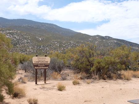
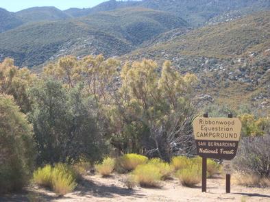
California State Tourism

Overview

Ribbonwood is an ideal mountain escape for equestrian campers. The campground overlooks Palm Desert and the Salton Sea in southern California and provides visitors with access to hundreds of miles of terrain for exploration and enjoyment.

Recreation

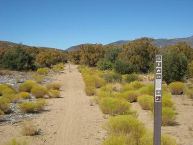
Horseback riding and mountain biking are popular activities. The 5.3-mile Sawmill Trail begins within the campground and traverses an old road with 2,220 feet of elevation gain. It also intersects with the Cactus Spring Trail near the campground’s parking area.

Bountiful botanical species exist along the trail, providing scenic views for travelers.
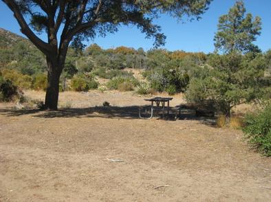
Facilities

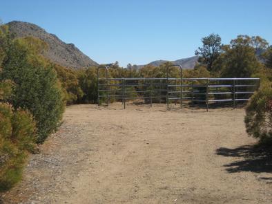
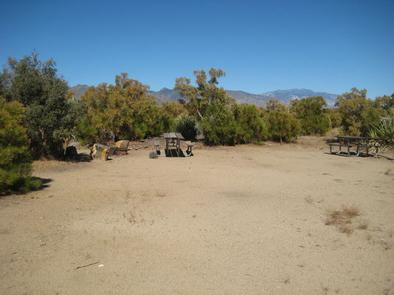
The campground offers less than a dozen large, single-family campsites for both tent or RV camping. Each is equipped with tables and campfire rings with grills. Accessible flush toilets, showers and drinking water are provided, and campsites each have access to two horse corrals and hitching racks.

Natural Features

The campground is located approximately 16 miles southeast of Palm Desert, California, at an elevation of about 4,000 feet. It is nestled in a chaparral brush, high desert environment of cactus, pinyon pine and yucca plants. Roads and spurs are gravel.

Reservation

More from CampingHiking.net:

REDWOOD MEADOW, California Campground Images, Info & Reservations

Listen Directions From Highway 99 turn east on J22. Travel on J22 through California Hot Springs to the "T" intersection and turn left on M50. Travel on M50, 10 miles. Turn left at M107 and travel approximately 4 more miles to the campground entrance on the right. Phone 559-539-5230 Activities

POOLE CREEK, Oregon Campground Images, Info & Reservations

Listen Directions From Roseburg, OR, travel east on OR-138 / NE Diamond Lake Boulevard for approximately 72 miles, turn left onto Forest Road 2610 (Bird’s Point Road). Proceed 4 miles and turn right at the Poole Creek Campground sign. The campground is located on the west shore of Lemolo Lake.

GREENBELT PARK PICNIC AREAS, Maryland Campground Images, Info & Reservations

Listen Directions From I-95/495 (Capital Beltway), take Exit 23 Kenilworth Avenue South (Route 201) to Greenbelt Road East (Route 193). The park entrance is a quarter mile down Greenbelt Road on the right. The park address is 6565 Greenbelt Road. Phone 301 344-3944 Activities BIKING, CAMPING, HIKING, PICNICKING, WILDLIFE VIEWING

OWENS CREEK CAMPGROUND, Maryland Campground Images, Info & Reservations

Listen Directions For GPS Use Only: The street address is 15882 Foxville Deerfield Road, Sabillasville, MD. This is not the mailing address. The Park mailing address is: Catoctin Mountain Park, 6602 Foxville Road, Thurmont, MD 21788. From Washington DC Take the George Washington Memorial Parkway north to I495 to I270

Kentuck Lake Campground, Wisconsin Campground Images, Info & Reservations

Listen Directions From Eagle River travel east 13.4 miles on STH 70 to FR2176 (Divide Road). Turn left (north) on FR2176 and continue 2.7 miles to the campground entrance on the left. Phone (715) 479-2827 Activities BIKING, BOATING, CAMPING, FISHING, HIKING, WILDLIFE VIEWING, KAYAKING, CANOEING Keywords Related Link(s) Rec Area