
Directions
North (From Richmond, VA) Follow I-95 South to Richmond, VA. Take I-64 East toward Norfolk/Virginia Beach, VA. Take I-64 or I-664 to Chesapeake, VA. From I-64, take Exit 291B to Route 168, the Chesapeake Expressway (a toll-road costing $3.00- $6.00 each way). Once in North Carolina, Route 168 turns into US-158 East. Follow US-158 East through Nags Head, NC to the junction of NC-12 South. Continue on NC-12 South, and the campground will be on your left just before you reach Bonner Bridge over Oregon Inlet.
West (From Rocky Mount, NC) Follow US-64 East through Tarboro, Williamston, Plymouth, Columbia, and Manteo, crossing the Alligator River Bridge and the Virginia Dare Bridge. Keep going on US-64 East to Nags Head, NC, going over the Washington Baum Bridge, to the junction of NC-12 South. Turn right onto NC-12 South and you will be at the north entrance. Continue on NC-12 South, and the campground will be on your left just before you reach Bonner Bridge over Oregon Inlet.
South (From Florence, SC) Take I-95 North to Wilson, NC. Take US-264 East through Greenville, NC and Washington, NC. From Washington, NC, take US-17 to Williamston and follow US-64 East to Nags Head, NC and the junction of NC-12 South. Continue on NC-12 South, and the campground will be on your left just before you reach Bonner Bridge over Oregon Inlet.
Phone
252-441-6246
Activities
BOATING, CAMPING, VISITOR CENTER
Keywords
Oregon Inlet
Related Link(s)
North Carolina State Road Conditions
Overview
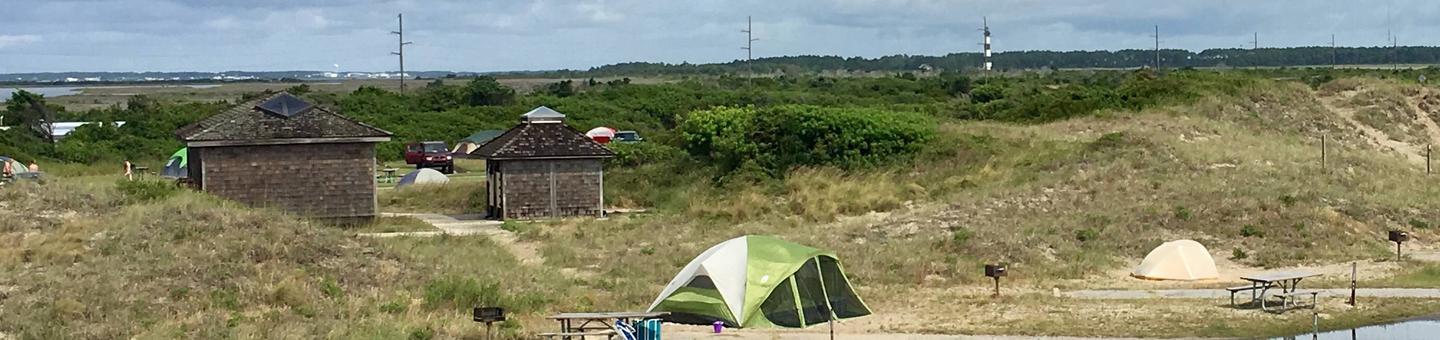
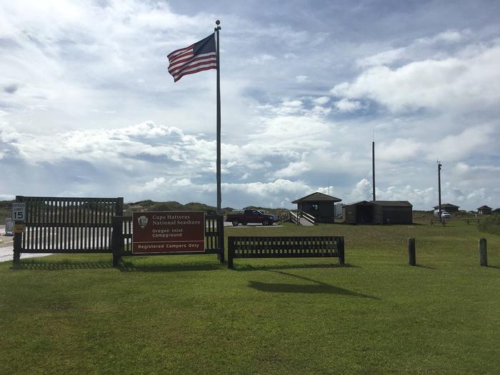
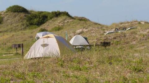
Oregon Inlet Campground is the northernmost campground on Cape Hatteras National Seashore. When camping here, you are within a short distance of the full service town of Nags Head to the north, and the world class fishing at Oregon Inlet to the south.
Recreation
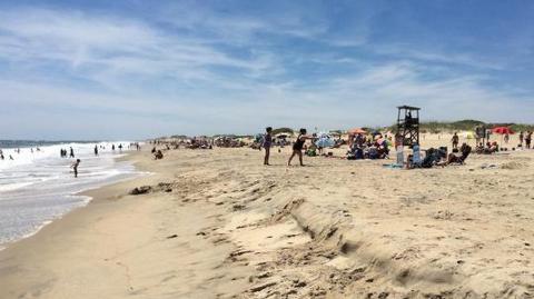
The beach adjacent to the campground can be reached by foot from your campsite as well as by vehicle with a Cape Hatteras Off-Road Vehicle Permit. Popular activities include fishing, swimming, surfing, birding, and shell hunting. The calmer waters of the sound to the west of the campground can be accessed at the public boat launch at Oregon Inlet Fishing Center. Popular sound side opportunities include crabbing, clamming, paddle-boarding, boating, and fishing.
Facilities
Each of the three loops in the campground have a bath house with flush toilets, potable water, and heated outdoor showers. Each campsite has a paved parking pad, picnic table, and charcoal grill. There are limited sites with RV hook-ups. A dump and water fill station are located directly across Highway 12 at Oregon Inlet Fishing Center, and are free of charge for campers.
Natural Features
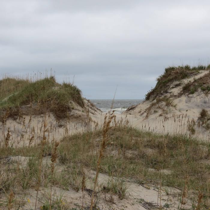
The campground is located on the east side of the barrier island, just a short walk through the dunes to the expansive waters of the Atlantic Ocean. Sea Oats and other native flowering plants blanket the dunes providing a picturesque backdrop for your camping experience.
Nearby Attractions
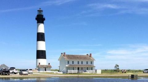
The historic Bodie Island Lighthouse is approximately four miles north of Oregon Inlet Campground on NC Highway 12. From the third Friday in April until Columbus Day visitors can climb the lighthouse with a ticket that can be purchased in the lighthouse visitor center. Coquina Beach Day Use Area is located directly across HWY 12 from the Bodie Island Lighthouse access road. The day use area provides a vehicle free beach perfect for families. From Memorial Day to Labor Day, Coquina Beach is staffed with lifeguards to ensure the safety of visitors. Other amenities at Coquina Beach include a bathhouse with outdoor cold showers, flush toilet restrooms, water fountains, and a boardwalk to the beach.