
Directions
From Downieville, take Highway 49 north about 6 miles. The campground is on the right side of the highway.
Phone
(530)478-6253
Activities
BIKING, CAMPING, FISHING, HUNTING, SWIMMING SITE, MOUNTAIN BIKING, WATER ACTIVITIES, KAYAKING, WATER ACCESS, SCENIC DRIVE
Keywords
UNFL,TAHOE NF – FS
Related Link(s)
California State Road Conditions
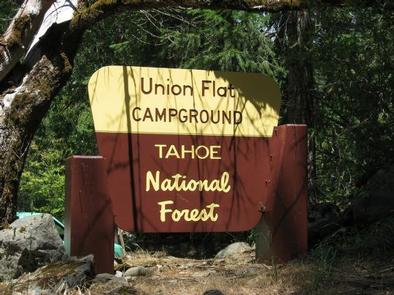
Overview
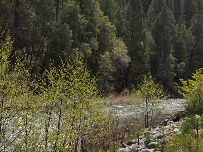
Union Flat Campground is located on the North Yuba River, near Highway 49. Visitors enjoy a wide variety of recreational activities in the area, including hiking, hunting, fishing, canoeing and gold panning.
Recreation
The North Yuba River offers swimming, wading and rainbow trout fishing. Seasonal rafting, tubing and kayaking is available.
Facilities
The campground offers several single-family campsites and one double site. Some sites are designated for tent camping only. Each site is equipped with a picnic table and campfire ring. Vault toilets are provided.
Natural Features
The campground stretches along the north bank of the North Yuba River. A tumbled rock wall from early gold dredging activity separates campsites from the river. A forest of pine, fir, maple and oak trees covers the area, offering shade in many sites.
Nearby Attractions
Union Flat Campground is located on the Yuba Donner Scenic Byway (Highway 49) near many gold rush era historical sites and old mining towns such as Goodyears Bar, Sierra City, and Downieville. Many points of interest lie along Highway 49 and are part of the 49 miles of Highway 49 driving tour; look for interpretive signs and other historical sites along this tour route. Gold Lakes Basin offers boating, fishing, biking, and hiking. Boating, fishing and swimming are available at nearby Sardine Lakes, about 14 miles east of the campground. Sardine Lakes Resort offers boat rentals, lodging, and a restaurant. On the water, visitors enjoy boating and fishing. Anglers will find rainbow and brook trout in many of the lakes, streams, and rivers throughout the basin. Over 30 miles of maintained trails for hiking, mountain biking, and motorcycle singletrack branch out across the area and the Pacific Crest Trail can be accessed at a few spots east of Sierra City and in the Gold Lakes Basin area. The historic towns of Sierra City and Downieville offer historic and cultural attractions, restaurants, shops, churches, and vistor information.