MCCLINTIC POINT, VA Campground Reservation, Info, Images, Map, Directions

MCCLINTIC POINT, Virginia Campground Images, Info & Reservations

Directions

From Warm Springs, Virginia take US 39 west 12 miles to state route (SR) 600, turn left (south)on SR 600. Continue 10 miles on SR 600 (2.25 miles past entrance of Bolar Flat Marina) to the McClintic Point Sign. Turn right at the McClintic Point Sign.

Phone

540-279-4144

Activities

BOATING, CAMPING, FISHING, HIKING, HUNTING, WATER SPORTS, WILDLIFE VIEWING, SWIMMING SITE

Keywords

MCNT,LAKE MOOMAW,MOOMAW,GEORGE WASHINGTON/JEFFERSON NF-FS

Related Link(s)

Rec Area Info & Images

Virginia State Tourism

Forest Service Concessionaire

Virginia State Road Conditions

Overview

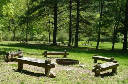
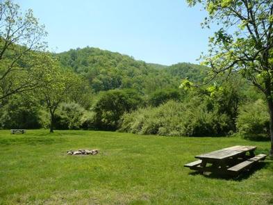
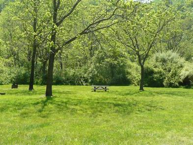
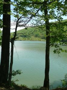
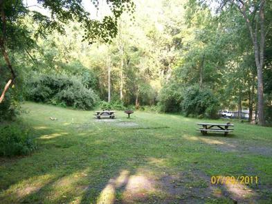
Enjoy the easygoing, peaceful vibe of McClintic Point’s rustic campground set among scattered trees and open fields. This angler’s paradise provides plentiful shoreline fishing and some lakefront campsites.

Recreation

Boating, canoeing, water skiing and and fishing are popular activities on the lake. Brown and rainbow trout, bass and crappie are some of the popular species anglers catch. The campground’s open spaces are also handy for running around of stretching out on the grass.

Facilities

Amenities include vault toilets and seasonal drinking water, which is available April through October. The three group campsites range in capacity from 20 to 35 guests.

Natural Features

The campground sits on the northern end of Lake Moomaw. The lake boasts 2,530 surface acres with 43.5 miles of shore line and a maximum depth of 150 feet.

Nearby Attractions

Head to the quaint town of Warm Springs for restaurants or to visit the Bath County Historical Society.

Reservation

More from CampingHiking.net:

PRAIRIE CREEK (AR), Arkansas Campground Images, Info & Reservations

Directions From Rogers, Arkansas, take Highway 12/Prairie Creek Drive east for just over 3 miles. Turn left onto North Park Road and follow to the campground. Phone 479-925-3957 Activities BOATING, CAMPING, FISHING, HIKING, WATER SPORTS, SWIMMING SITE Keywords PRA2,BEAVER LAKE,BEAVER LAKE Related Link(s) Rec Area Info & Images Arkansas State

BIG COON CREEK, Arkansas Campground Images, Info & Reservations

Directions From Gillham on Hwy 71, go east on Tower Rd. for 1.3 miles; Turn left onto Gillham Lake Rd. for 4.3 miles; Turn left onto Polk Road 474 for 1.7 miles. Phone 870-385-7126 Activities BOATING, CAMPING, FISHING, HIKING, HUNTING, SWIMMING SITE Keywords BIGC,GILLHAM LAKE,GILLHAM LAKE Related Link(s) Rec Area Info

WOODRING CAMPGROUND, Georgia Campground Images, Info & Reservations

Directions From Atlanta, take I-75 north to Exit 293; follow Highway 411 north. Turn right on Highway 136, then left on old Highway 411. Turn right on Highway 282/76. Campground is located 4.5 miles off Highway 282. From Ellijay, GA, take Highway 282/76 west for 11 miles to the access

EAGLE GUARD STATION, Montana Campground Images, Info & Reservations

Directions All mileage is approximate from the highway. From Helena, take Highway 287 for 26 miles southeast towards Townsend, Montana. Turn right on Indian Creek Road just before crossing the Missouri River. Travel for 3 miles, then turn left onto Forest Road #4031 (purple sign). Travel 5 miles to an

NAT CALDWELL PARK, Tennessee Campground Images, Info & Reservations

Directions From Nashville, take I-65 North to TN-386/Vietnam Veterans Blvd. Continue East on TN-386/Vietnam Veterans Boulevard to exit 9. Merge onto US-31E N/Johnny Cash Pkwy/E Main St. and continue approximately 2.5 miles. Nat Caldwell Park will be on your left just before crossing over Station Camp Creek. Phone (615) 822-4846