AIRPORT BEACH SHELTER, TX Campground Reservation, Info, Images, Map, Directions

AIRPORT BEACH SHELTER, Texas Campground Images, Info & Reservations

Directions

From I-35 take Lake Shore Drive exit (Exit 339) and drive west to Steinbeck Bend Road. Turn right and proceed to second stop light. At intersection with FM1637 (China Spring Highway) turn right. Go to next stop light (Flat Rock Road). Turn left and drive approximately 1 mile to Skeet Eason Road. Turn left and drive about a 1/2 mile. Airport Beach Park is on the second road to the right.

Phone

254-756-5359

Activities

BOATING, CAMPING, FISHING, SWIMMING

Keywords

ABEA,WACO LAKE

Related Link(s)

Rec Area Info & Images

Texas State Tourism

Texas State Road Conditions

Overview

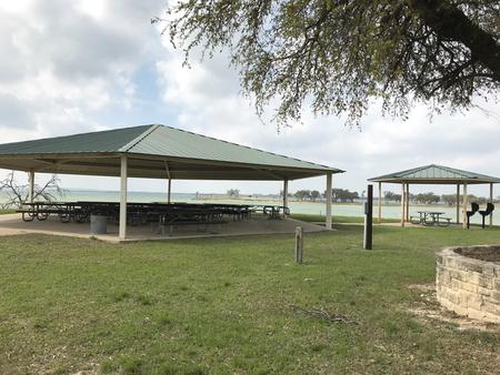
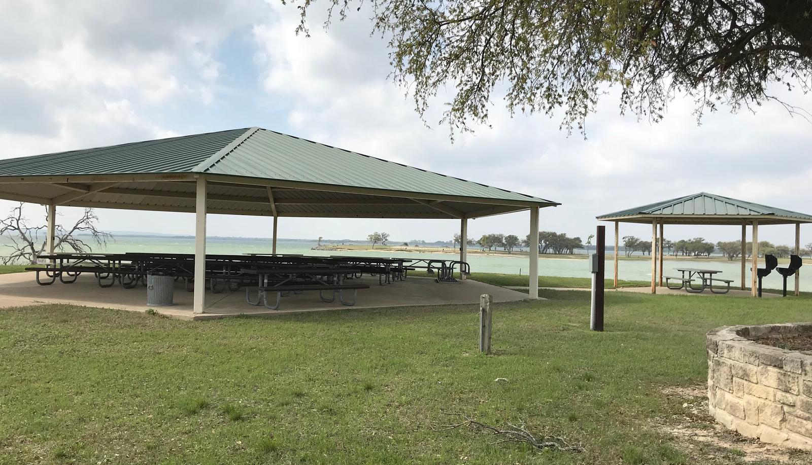
Airport Beach Shelter, located on one of Waco Lake’s sandy beaches, is ideal for families and friends to enjoy picnicking, sightseeing and water activities, all while staying within the Waco city limits.

Recreation

The main lake shoreline has a large amount of submerged timber, which typically holds fish year-round. Anglers will find plenty of catfish, crappie, large and smallmouth bass as well as sunfish.

A swimming beach, boat ramp and dock all help visitors enjoy the lake.

Facilities

The accessible shelter fits 110 guests, and a picnic area with grills and tables makes the park ideal for large parties and family functions.

Natural Features

Airport Beach Park is located on the North Shore of Waco Lake, about a quarter-mile west of the dam. The lake is primarily fed by the Bosque River, which runs for 115 miles through central Texas.

Nearby Attractions

Waco Lake Wetlands educational tours take visitors through a six-acre nursery of aquatic plants and more than 130 species of birds. A zoo is also located nearby.

Reservation

More from CampingHiking.net:

SERRANO, California Campground Images, Info & Reservations

Directions From I-10 in Redlands, take Highway 330 to Highway 18 in Running Springs. Continue east on Highway 18 at Big Bear Lake Dam, but do not cross the dam. Turn left onto highway 38 Continue on Highway 38 to North Shore Lane. Campground is 1/2 mile on left side

MATTERHORN, Colorado Campground Images, Info & Reservations

Directions From Telluride, travel approximately 7 miles south on Highway 145. Watch for campground signs; the turn off from the road is on the left. Phone 970-249-4552 Activities BIKING, CAMPING, FISHING, HIKING, HUNTING, WILDLIFE VIEWING Keywords MATT,MATTERHORN UNCOMPAHGRE N F,GUNNISON,GM,UNCOMP NF – FS Related Link(s) Rec Area Info & Images

ROBINSON CREEK NORTH, California Campground Images, Info & Reservations

Directions Take U.S. Highway 395 through Bridgeport. Turn south on Twin Lakes Road at the Shell gas station. Travel 9.3 miles on Twin Lakes Road, then turn left into the campground. Phone 760-932-7092 Activities CAMPING, FISHING, HIKING, WILDLIFE VIEWING Keywords ROBI,HUMBOLDT-TOIYABE NF-FS Related Link(s) Rec Area Info & Images California

CUB RIVER GUARD STATION, Idaho Campground Images, Info & Reservations

Directions From Preston, Idaho, head approximately 3 miles south on U.S. Highway 91. Turn east on Cub River Road/Forest Road 406. Proceed about 10 miles to the guard station. This road is heavily traveled throughout the summer with other recreationists, so please travel slowly and use caution. Phone 208-847-0375 Activities

COEUR D’ALENE, Kansas Campground Images, Info & Reservations

Directions From US-75, take the Melvern Exit and travel 2 miles south on Melvern Lake Parkway, then 1 mile northwest on Coeur d’Alene Parkway (campground road). Phone 785-549-3318 Activities BOATING, CAMPING, HIKING, SWIMMING SITE Keywords COEU,MELVERN LAKE,MELVERN PROJECT,MELVERN SATE LK CDA OVERLOOK,COEUR D’ALENE PICNIC AREA,MELVERN STATE LK CDA OVERLOOK,MELVERN LAKE

LODGEPOLE CAMPGROUND (WA), Washington Campground Images, Info & Reservations

Directions From Yakima, take Highway 12 west to the junction with Highway 410. Travel 39 miles on Highway 410 to the campground entrance. Phone 541-338-7869 Activities CAMPING, FISHING, HIKING, SWIMMING SITE Keywords LDPL,OKANOGAN – WENATCHEE NF -FS,LODGEPOLE,LODGEPOLE CAMPGROUND Related Link(s) Rec Area Info & Images Washington State Tourism Forest Service