LAGOON CAMPGROUND, OR Campground Reservation, Info, Images, Map, Directions

LAGOON CAMPGROUND, Oregon Campground Images, Info & Reservations

Directions

From Florence, Oregon, drive south on Highway 101 to the Siltcoos Beach Access Road. Turn right on Siltcoos Beach Access Road and proceed 1 mile to Lagoon Campground which will be on the left.

Phone

541-271-6000

Activities

CAMPING, FISHING, HIKING, WILDLIFE VIEWING, BERRY PICKING, BIRDING

Keywords

LAGC,SIUSLAW NF – FS

Related Link(s)

Rec Area Info & Images

Oregon State Road Conditions

Oregon State Tourism

Overview

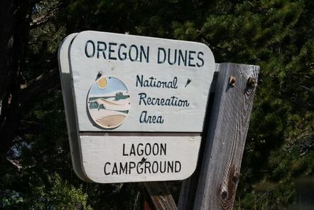
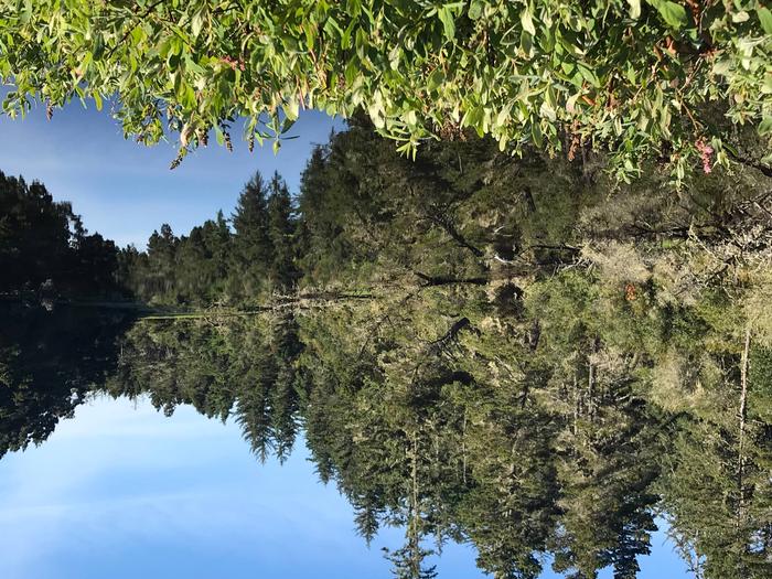
Lagoon Campground is about 7 miles south of Florence. Most sites are surrounded by beautiful coastal shrubbery. Fishing and hiking are popular, and a beach on Oregon’s Pacific Coast is in walking distance.

Recreation

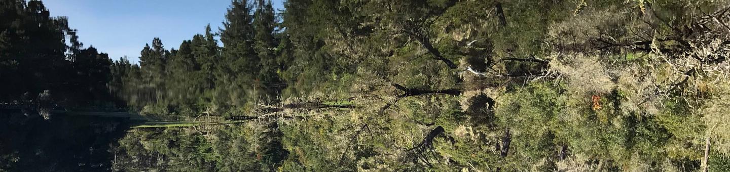
The Lagoon Trail is an accessible loop trail that provides wetland wildlife viewing on boardwalks. The Wax myrtle Trail is a 1.3-mile interpretive trail that offers outstanding views of the lower river estuary and the Pacific Ocean as it winds its way along the river to the beach. The Chief Tsiltcoos Trail is also nearby. Anglers can find rainbow trout in the lagoon in winter and spring. In Siltcoos Lake, bass, steelhead, cutthroat trout, yellow perch and bluegill may take the bait.

Facilities

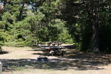
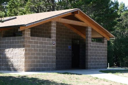
Amenities include flush toilets, drinking water, picnic tables, trash collection, recycling and fire rings with grills. Parking aprons are paved. A dump station is located less than 4 miles away at Honeyman State Park.

Natural Features

At an elevation of 100 feet, the campground sits among shore pine and huckleberry along the Siltcoos Lagoon and the Siltcoos River. The campground is part of the Oregon Dunes National Recreation Area, known for its wind-sculpted sand dunes towering to 500 feet above sea level. Wildlife is abundant in the campground and along the Lagoon trail, attracting many happy photographers. Native inhabitants include beavers, ducks, herons, and bitterns – a waterfowl relative of the heron.

Nearby Attractions

Boating is available at Tahkenitch Lake and Siltcoos Lake. Off-road vehicle riding trails weave along the nearby dunes.

Reservation

More from CampingHiking.net:

PAHA, California Campground Images, Info & Reservations

Directions Take U.S. Highway 395 through Bridgeport. Turn south on Twin Lakes Road at the Shell gas station. Travel 9.6 miles on Twin Lakes Road. Turn left into the campground. Phone 760-932-7092 Activities CAMPING, INTERPRETIVE PROGRAMS, FISHING, HIKING Keywords PAHA,HUMBOLDT-TOIYABE NF-FS Related Link(s) Rec Area Info & Images California State

ARCH DAM CAMPGROUND, Utah Campground Images, Info & Reservations

Directions From Vernal, Utah, take U.S. 191 north for about 46 miles. From Manila, Utah, take Highway 44 for 28 miles. Turn left on U.S. 191 and go about 6 miles north. From Rock Springs, Wyoming, take I-80 west toward Green River about 6 miles to the junction with U.S.

YEGUA CREEK, Texas Campground Images, Info & Reservations

Directions From Austin, Texas, take US 290 east to Brenham. Follow HWY 36 north 11.5 miles to FM 1948. Turn left and follow FM 1948 2.5 miles. Turn right into park complex, following campground signs. From Houston, Texas, take HWY 290 west to Brenham. Follow HWY 36 north 11.5 miles

COAL MINE, New Mexico Campground Images, Info & Reservations

Directions From Grants, take New Mexico State Highway 547 for 10 miles to the campground. Phone 505-287-8833 Activities CAMPING, HIKING, SCENIC DRIVE Keywords COAM,CIBOLA NF – FS Related Link(s) Rec Area Info & Images New Mexico State Tourism New Mexico State Road Conditions Overview Coal Mine Campground is situated in

WELDON ISLAND, Georgia Campground Images, Info & Reservations

Directions From Interstate 85, take Exit 4 and turn East onto Old Dobbins Bridge Road.Turn right on Andersonville Road and follow the brown directional signs. Hattons Ford ramp is located at the end of Andersonville Road. Townville, SC, 29689 Phone 888-893-0678 HARTWELL PROJECT OFFICE Activities BOATING, FISHING, PICNICKING, SWIMMING, WATER