BLUEBILL CAMPGROUND, OR Campground Reservation, Info, Images, Map, Directions

BLUEBILL CAMPGROUND, Oregon Campground Images, Info & Reservations

Directions

From Reedsport, Oregon, take Highway 101 south for 22 miles to the Horsfall Dunes and Beach road sign; turn right and follow signs.

From Coos Bay/North Bend, Oregon, take Highway 101 north for about 2 miles to the Horsfall Dunes and Beach road sign, turn left and follow signs.

Phone

541-271-6000

Activities

CAMPING, FISHING, HIKING, WILDLIFE VIEWING

Keywords

BLBL,SIUSLAW NF – FS

Related Link(s)

Rec Area Info & Images

Oregon State Road Conditions

Oregon State Tourism

Overview

Bluebill Campground is located in the Horsfall Area, known for its excellent off-road vehicle trails. It is also conveniently located less than a mile from Pacific Coast beaches and 2 miles north of North Bend, Oregon. With such an ideal location for recreation, it’s no wonder families love this site.

Recreation

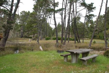
Rainbow trout fishing in Bluebill Lake is great, and the campground links up to the Bluebill Trail, which is a one-mile loop around the lake.

Off-road vehicle enthusiasts flock to the campground to cruise the surrounding dunes. Some parts of the dunes are designated for hiking and horseback riding only.

Facilities

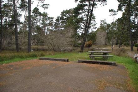
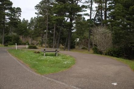
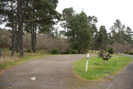
Bluebill is equipped with drinking water, vault toilets, campfire pits and dumpsters. There are 18 sites available for reservation and a host is available to answer campers’ questions. First come first serve sites may be available.

Natural Features

Surrounded by shore pine, huckleberry and wax myrtle, Bluebill lies near Bluebill Lake, within a short drive from the coast. It is part of the Oregon Dunes National Recreation Area, known for its wind-sculpted sand dunes towering up to 500 feet above sea level.

Nearby Attractions

Scenic waterways are in every direction of the campground. Head south to Coos Bay, west to the Pacific, and northeast to Horsfall Lake.

Reservation

More from CampingHiking.net:

FARNSWORTH CABIN, Pennsylvania Campground Images, Info & Reservations

Directions If traveling on Route 6, in the town of Claredon, turn at the street light onto Railroad Road, continue toward Chapman Dam. Turn left on Farnsworth Rd., travel approximately 7 miles and the cabin will be on your right, look for the Trout Hatchery sign. For details, click here,

STARRIGAVAN CREEK CABIN, Alaska Campground Images, Info & Reservations

Directions Located 7 miles northeast of Sitka at the end of Halibut Point Road, about 3/4 mile from the local Alaska Marine Highway ferry terminal. There are no roads to Sitka. Access is via the Alaska Marine Highway or Alaska Airlines. Upon exiting the Ferry Terminal parking lot, turn left.

CHEOAH POINT CAMPGROUND, North Carolina Campground Images, Info & Reservations

Directions From Robbinsville, North Carolina, continue on Highway 129 north for approximately 6 miles. Turn left on SR # 1145 – Thunderbird Mountain Road. Continue approximately 1.3 miles on Thunderbird Mountain Road to the Cheoah Point Campground. Phone 828-479-6431 Activities BOATING, CAMPING, FISHING, HIKING, SWIMMING, WATER ACTIVITIES, KAYAKING, CANOEING, NON-MOTORIZED

GLACIER VIEW CAMPGROUND, Idaho Campground Images, Info & Reservations

Directions From Stanley, Idaho, take State Highway 75 south approximately 4 miles. Go west onto Forest Road 214. Turn left at Glacier View Campground entrance sign. Phone 928-537-8888 Activities BIKING, BOATING, CAMPING, FISHING, HIKING, HORSEBACK RIDING, WILDLIFE VIEWING, SWIMMING SITE Keywords GLAC,SAWTOOTH NF – FS Related Link(s) Rec Area Info

BUTTE LAKE, California Campground Images, Info & Reservations

Directions From Redding, California drive 63 miles east on State Highway 44 to Old Station. From the intersection of 44 and State Highway 89, continue east on 44 for 11 miles. Watch for sign to Butte Lake Campground. Turn right and continue for six miles on a rough gravel road.

WATAUGA POINT RECREATION AREA, Tennessee Campground Images, Info & Reservations

Directions From Elizabethton, take US 19E/321 south for five miles to Hampton. Turn left on US 321/TN 67 south for six miles, then turn left into Watauga Point.  Phone 423-735-1500 Activities BOATING, FISHING, HIKING, KAYAKING, CANOEING, STAR GAZING, NON-MOTORIZED BOATING, WATER ACCESS, SCENIC DRIVE Keywords WATAUGA POINT RECREATION AREA PAVILION