


Directions
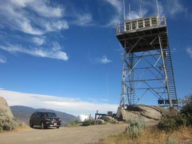
From Bakersfield, California, take Highway 99 to Highway 178 and travel east towards the Kern River Canyon. After passing through the last traffic light (Miramonte Drive) east of town, you will travel downhill. Rancheria Road will be the next left turn off the highway. Proceed 15 miles north along this road. The first part of Rancheria Road is paved and then it becomes an unimproved gravel road. It is approximately 45 minutes to reach the turnoff to Oak Flat. Watch for livestock and other traffic along this route. Turn right onto the Oak Flat spur road and travel up .7 miles to the Lookout tower.
Phone
760-376-3781
Activities
CAMPING
Keywords
OKLK,SEQUOIA NF – FS
Related Link(s)
California State Road Conditions
Overview
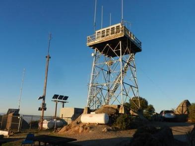
The Oak Flat Lookout sits the Greenhorn Mountains in the Sequoia National Forest and Sequoia National Monument, about an hour from Bakersfield, California. Perched at an elevation of 4,900 feet, the tower overlooks the scenic Kern River and Kern River Valley and has panoramic views of the mountains, river and valley.
Oak Flat Lookout was constructed in 1934 to provide fire detection views along the Kern River Canyon. In the early years of the Forest Service, lookouts provided a crucial link in wild land management, often being the only source of communication and fire detection for many miles. The lookout was operational until the 1980s.
There is no electricity or water in the lookout. All provisions, including food, water and bedding, must be carried up 40 steep steps to the tower space or pulled hand-over-hand in a small basket pulley system.
Recreation
Birdwatching and stargazing from the tower or the mountaintop are popular pastimes.
For guests who wish to visit an operating lookout, Breckenridge Lookout located southeast of Oak Flat is open during the summer months.
Facilities
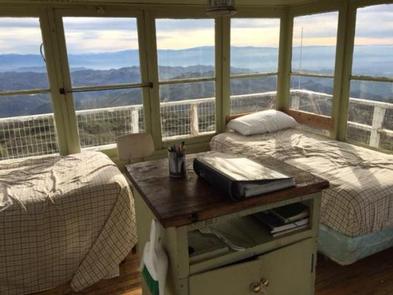
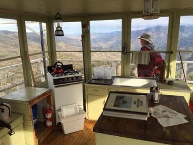
The lookout has no electricity or water. A thermostat-controlled propane heater provides heat. The one-room cabin contains two twin beds. The tower can hold up to four adults.
The kitchen area includes a propane range, a counter and a sink with a drain. A propane light, fire extinguisher, a bucket and cleaning gear are all provided.
There is a single vault toilet 100 yards northwest of the lookout, and an outdoor barbecue fire ring and picnic table near the tower.
For more details, see the the Sequoia National Forest summary page.
Natural Features
The lookout tower has panoramic views of the mountains, the canyon and the river.