Directions
From Bozeman, MT: Drive south on S. 19th Ave. for about 7 miles. Turn left onto Hyalite Canyon Road FS 62. Drive 11.1 miles on the Hyalite Canyon Road to the Maxey Cabin access road which is on the left (east) side of Hyalite Road 62. You have driven too far if you come to the entrance of Hood Creek Campground or Chisholm Campground. Travel about a tenth of a mile on the Maxey Cabin access road to the gate. The cabin combination will unlock the gate. Please close the gate behind you. Pass through the gate and travel for about 1/2 mile to the cabin.
Winter Route, December to March 31: Park at the Maxey Cabin access road just off Hyalite Canyon Road FS 62. Ski, snowshoe or hike the final 2/3 mile to the cabin. Please park in the wide pullouts to the side of the road so that snowplows and other forest visitors can pass.
ROAD CLOSURE INFORMATION: (Please Refer to the Motor Vehicle Use Map )
Hyalite Canyon Road, FS 62, closes to all motorized vehicles the evening of March 31 through May 16. Cabin renters must be prepared to walk, ski, or bike approximately 9 miles to the cabin when the road is closed.
Snowmobiles are not allowed at this cabin or anywhere in Hyalite Canyon past Moser Road FS 6210.
Hyalite Canyon Road FS 62 is intermittently plowed during the winter.
Phone
406-522-2520
Activities
CAMPING, FISHING, HIKING, HUNTING, WINTER SPORTS, WILDLIFE VIEWING
Keywords
MAXE,GALLATIN NF – FS
Related Link(s)
Overview
Maxey Cabin offers a quaint mountain retreat that is ideally located in one of Gallatin National Forest’s most popular recreation areas. Guests can expect a few creature comforts at the cabin, but they will need to bring some of their own supplies and gear. The cabin is accessible by car in the summer. During the spring (from March 31st through May 15th) the road to the cabin is closed to motorized vehicle traffic every year. Guest should be prepared to hike or bike 12 miles to the cabin during this period. During winter months the access road is infrequently plowed, so guests should be prepared with a four wheel drive, high clearance vehicle or to ski up to 12 miles to the cabin. The final mile on the Maxey Cabin Road are not plowed during the winter and guests should come prepared to ski or snowshoe the final distance to the cabin. Guests are responsible for their own travel arrangements and safety, and must bring several of their own amenities.
Recreation
Hikers and equestrians have access to the Hyalite Peak trailhead that leads into an area of the Gallatin Range known for its waterfalls. Two accessible trails in Hyalite Canyon lead to the waterfalls. Bicyclists can use Hyalite Canyon Road. Hyalite Canyon is a popular destination for backcountry skiers and ice climbers. Hyalite Reservoir is a mile away, offering opportunities for non-motorized boating and trout fishing. Elk hunting is excellent in Hyalite Canyon in the fall.
Facilities
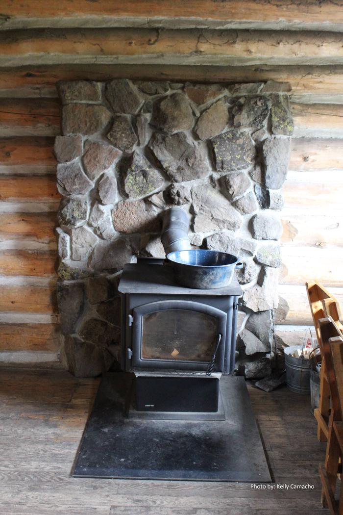
The main cabin has bunk beds with mattresses to sleep up to four people. There is also a wood stove for heat, a table and chairs, a propane lantern, broom and dust pan. A smaller cabin is unheated and is only available in the summer. It provides bunk beds with mattresses to sleep up to two people. The two cabins together can accommodate up to 15 people. A vault toilet and campfire ring are located outside. The cabin does not have water or electricity. Guests need to supply their own drinking water, as well as cooking gear, lanterns or flashlights, bedding, matches, toilet paper, dish soap, towels and other necessities. The cabin will need to be cleaned and all trash removed prior to leaving.
Natural Features
The cabin is nestled in Hyalite Canyon, an area with beautiful wildflower meadows during the summer and thick blankets of pristine snow in winter. Evergreen forest and the steep ridges of the Gallatin Mountains surround the cabin. Hyalite Reservoir is nearby. This area is important habitat for grizzly bears, elk, mule deer, mountain lions, bighorn sheep, wolves and mountain goats.


