

Directions
Entry to the cabin is by combination lock box. Please call the Forest Service office at 541-383-5300 if you are having difficulty with the combination provided. You can also stop by the office, located at 63095 Deschutes Market Rd. Bend, OR 97701.
From Bend, Oregon, take Highway 97 south. Exit at Sunriver and drive west. Go through the roundabout to Century Drive and turn left. Follow Century Drive south for 3 miles to the junction with South Century Drive (State Route 42). Turn right and head 11 miles west. Fall River Guard Station is on the left side of the road.
Phone
541-383-5300
Activities
HISTORIC & CULTURAL SITE, CAMPING, FISHING, WILDLIFE VIEWING
Keywords
Fall River,Wickiup,Cascade Range,Pringle Falls,Crane Prairie,Cascade Lakes Highway,Central Oregon,Deschutes River,,Fall River Guard Station,FALL RIVER GUARD STATION (OR)
Related Link(s)
Overview
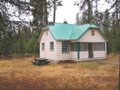
Fall River Guard Station is situated beneath a canopy of lodgepole pine on the banks of the Fall River in Deschutes National Forest. Built by the Civilian Conservation Corps in the 1930’s, the cabin was originally used as an outpost to fight forest fires. The cabin is an ideal setting for relaxation and recreation, and is available for reservation from April to October.
Recreation
Fall River Guard Station is a prime location for fishing, swimming and hiking in summer and early fall.
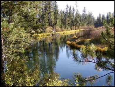
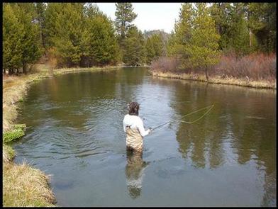
Anglers will enjoy casting a line into Fall River, located just steps from the cabin. The river is open only to fly-fishing, is an outstanding contributor of brown trout to the Deschutes River and provides excellent winter habitat for numerous species. Brook, brown and rainbow trout inhabit the river, and native whitefish can be found below the falls.
Access to Fall River Trail is available from the guard station, winding through lodgepole and ponderosa pine along the river.
Facilities
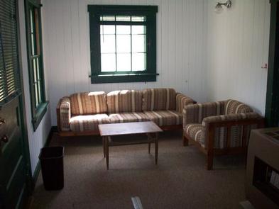
This rustic, 600-square-foot, single story cabin was constructed in the Cascadia style of the Pacific Northwest Region. It has two bedrooms, a kitchen and a living room. The cabin is furnished with one full bed, a twin bed and a two-person futon in the living room. Cabin amenities include a heater, refrigerator, lights and stove, all powered by propane. The kitchen is furnished with cooking utensils, pots and pans. A picnic table is provided for outdoor dining. Guests must bring several of their own amenities, including food, preferred cooking utensils, sleeping bags or preferred bedding, towels, dish soap, matches, a first aid kit, toilet paper and garbage bags. There is no water available at the site. Guests must bring water for drinking, cooking and washing. A vault toilet is located on the premises. RV camping is allowed on-site.
Natural Features
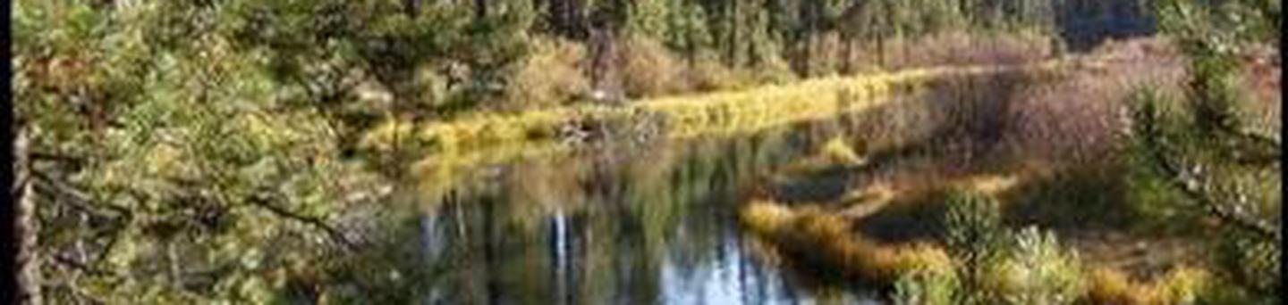
A forest of lodgepole pine provides the backdrop for this area, with the beautiful, spring-fed Fall River flowing adjacent to the cabin. Clear and cold, it originates two miles northwest of Pringle Falls and winds its way northeast to join the mighty Deschutes River.
Towering nearby peaks, designated wilderness and remnants of volcanic activity in the area showcase ecosystems typical of central Oregon.
Wildlife in the area abounds, including deer, native fish and migratory birds. These species, along with many others, depend on surrounding undeveloped wilderness, clean streams and diverse forests to live.
Nearby Attractions
Lava Lands Visitor Center in Bend, Oregon, and the unique geological landscape of Newberry National Volcanic Monument draw visitors to the region. Visitors may also enjoy traveling the Cascade Lakes Scenic Byway. The 66-mile drive through the Cascade Mountain Range weaves through snow-capped peaks and alpine lakes, highlighting the beauty of central Oregon. Call the Bend Fort Rock district office to confirm road access and operating seasons.