
Directions
From South Lake Tahoe, take Hwy 89 over Luther Pass to the 88/89 interchange. Turn left on 88; go approximately 1 mile to campground entrance on your left. From Gardnerville, Carson City or Minden, Nevada, take Hwy 395 to Hwy 88. Head south on Hwy 88 for approximately 19 miles to the campground entrance in Woodfords Canyon on north side.
Phone
530-694-1002
Activities
BIKING, CAMPING, FISHING, HIKING
Keywords
Related Link(s)
California State Road Conditions
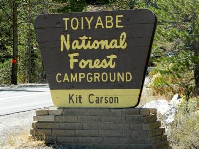
Overview
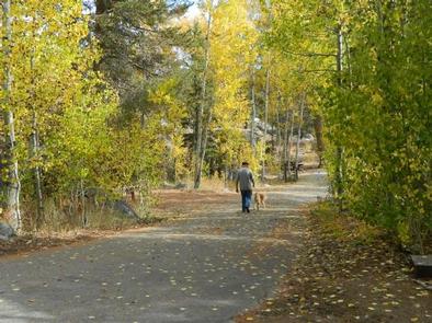
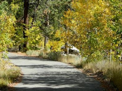
Nestled in a forest of Jeffrey pines and aspens, Kit Carson campground is perfect for tent camping and smaller RVs. The west fork of the Carson River is located next to the campground, with several sites right next to the water. Great fishing and views! Kit Carson is exceptionally beautiful in the fall.
Recreation
Visitors can explore scenic driving and photography along the Carson Pass Scenic Byway. Enjoy the splendor of fall with colorful foliage displays or fishing and boating in one of the several nearby lakes. Hikers are surrounded by trailheads within a short drive – Mokelumne Wilderness, and the Pacific Crest Trail, among many others. Whether it is rock climbing or exploring the canyon, outdoor enthusiasts will relish the options in this area.
Facilities
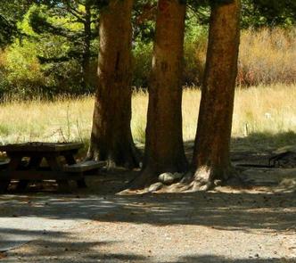
This campground has drinking water, garbage containers, and vault toilets. Each campsite has a bear box, fire pit and picnic table. There is a camp host on site and firewood is available for sale.
Natural Features
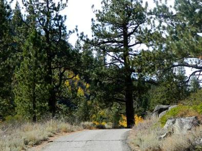
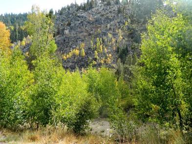
Kit Carson is situated on the west fork of the Carson River in Woodfords Canyon along Highway 88. In addition to the beauty of the river, the campsites are surrounded by quaking aspens and rugged canyon walls.
Nearby Attractions
There are a number of nearby attractions that have something for everyone. Sorensen’s Resort has limited groceries and a restaurant. Lake Tahoe is within 20 miles; a trailhead for the Tahoe Rim Trail is within 5 miles; Grover Hot Springs State Park in Markleeville offers public soaking in natural spring-fed pools; numerous local restaurants and, for those who like night life, nearby casinos and theaters in Minden and Carson City, Nevada.