PINK BEDS PICNIC SHELTER, NC Campground Reservation, Info, Images, Map, Directions

PINK BEDS PICNIC SHELTER, North Carolina Campground Images, Info & Reservations

Directions

From Pisgah Ranger Station/ Visitor Center parking lot, turn right onto US 276. Drive north approximately 10 miles to Pink Beds Picnic Area. The facility is located along Hwy 276 (Forest Heritage National Scenic Byway) 4 miles from the Blue Ridge Parkway and 11 miles from the intersection of Hwy 280 and US 64 in Pisgah Forest, NC.

Phone

828 877-3265

Activities

HISTORIC & CULTURAL SITE, CAMPING

Keywords

Related Link(s)

Rec Area Info & Images

North Carolina State Tourism

North Carolina State Road Conditions

Overview

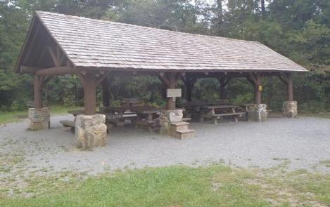
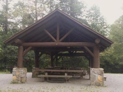
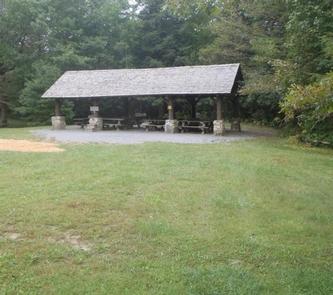
The Pink Beds Picnic Shelter is the larger of two available shelters. It is adjacent to the Cradle of Forestry in America, a 6,500 acre historic site commemorating the beginning of forest conservation in the United States.

Recreation

As part of the Pisgah National Forest, the Pink Beds area offers excellent hiking trails. An easy, five mile loop trail begins on the left side of the parking area. The surrounding area is ideal for other types of recreation including fishing, horseback riding, and swimming.

Facilities

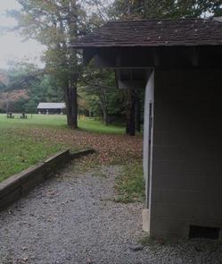
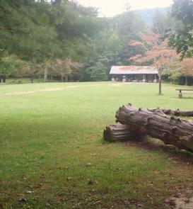
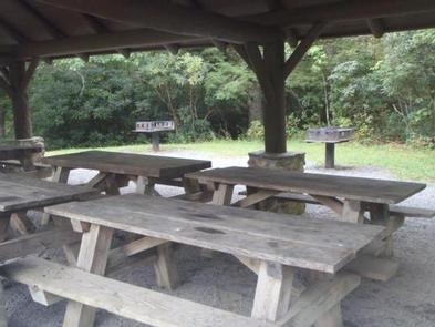
The area has a flush toilet restroom, 21 picnic tables, grills, an old Civilian Conservation Corps gazebo, and this larger shelter.

Natural Features

Named for the rhododendron, mountain laurel and azalea that bloom in spring and summer, the Pink Beds Picnic Shelter is renowned for its scenic forest setting and small stream nearby. At an elevation of 3,280 feet, it is appealing to visitors for its relatively flat valley which sustains some very large pine trees and rare mountain bogs.

Nearby Attractions

The area is next door to the Cradle of Forestry in America Historic Site, and four miles from both the Blue Ridge Parkway and Sliding Rock Recreation Area.

Reservation

More from CampingHiking.net:

HALLSTED, California Campground Images, Info & Reservations

Directions From Oroville, travel east on Highway 70 for about 65 miles. From Quincy, travel west on Highway 70 for 17 miles. Phone 530-283-0555 Activities CAMPING Keywords HALL,TWAIN,FEATHER RIVER CANYON,PLUMAS NF – FS Related Link(s) Rec Area Info & Images California State Road Conditions California State Tourism Forest Service Concessionaire

ALTO PIT OHV CAMPGROUND, Arizona Campground Images, Info & Reservations

Directions From the courthouse located in downtown City of Prescott, go northwest on Iron Spring Road. Continue 5 miles past the junction of Gale Gardner Way and Iron Springs Road. Alto Pit is on the right side of the road. Phone 1 (877) 444-6777 Activities CAMPING Keywords Alto Pit Related

MT. TIMPANOGOS, Utah Campground Images, Info & Reservations

Directions From I-15, take exit 272 for 800 north toward Orem and proceed east on Highway 52 to the mouth of Provo Canyon. Go east on Highway 189 for 7 miles to the Sundance Resort turnoff. Take Highway 92 for 6 miles. Campground will be on your right, past Sundance

CEDAR CREEK (TN), Tennessee Campground Images, Info & Reservations

Directions From Nashville, TN. Travel East on I-40 to exit 221A. Continue onto TN-45/Old Hickory Blvd. Turn right onto US-70/Lebanon Pike. Turn left onto Nonaville Road and travel until reaching a 4-way stop. Turn right at the 4-way stop onto Saundersville Road. The recreation area will be at the end

EAST FORK CAMPGROUND, Colorado Campground Images, Info & Reservations

Directions From downtown Pagosa Springs, travel 11 miles east on Highway 160 to the junction with East Fork Road (Forest Road 667). Turn right and continue less than a mile to the campground on the right. Phone 970-264-5255 Activities BIKING, CAMPING, FISHING, HIKING Keywords None Related Link(s) Rec Area Info