
Directions
Travel east on I-70 to Exit 180 for East Vail. Turn right and follow the south frontage road (Bighorn Road) east to the road closure gate at about 2 miles. The campground is on the left just before the gate.
For more White River National Forest on the Eagle-Holy Cross Ranger District information visit www.fs.usda.gov/whiteriver or call 970-827-5715.
Phone
970-468-7681
Activities
BIKING, CAMPING, HIKING, WILDLIFE VIEWING
Keywords
Gore Creek Campground,GORE GREEK CAMPGROUND,Gore Creek
Related Link(s)
Colorado State Road Conditions
Overview
Gore Creek Campground is situated six miles east of Vail, Colorado, at an elevation of 8,700 feet and centrally located for recreation and relaxation in the White River National Forest.
Recreation
The Gore Creek campground is located along Gore Creek in a forested setting near the boundary of the Eagles Nest Wilderness. This is the closest campground to the town of Vail and there are several trailheads nearby into the Eagles Nest Wilderness; all wilderness regulations must be observed when traveling in the wilderness (foot and horse travel only). The campground is also located at the west end of the paved Vail Pass/Tenmile Canyon recreation trail open to foot traffic and bicycles.
Facilities
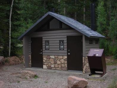
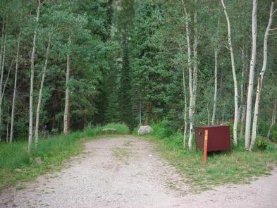
The campground offers 16 back-in sites, eight walk-in tent sites; number 18 is a fully accessible tent site, four handicapped accessible bathrooms and bear-resistant food lockers. Parking spurs for campsites are up to 35 feet long. RVs longer than this would not fit in this campground.
Natural Features
In the heart of the Rocky Mountains, the 2.3 million acre White River National Forest is a place of serenity and adventure, boasting eight wilderness areas, four defined seasons, and 10 peaks surpassing 14,000 feet in elevation.
Wildlife in the area abounds. Bighorn sheep navigate rocky ridges and bull elk bugle at dusk. Black bear and mule deer are common. Scenic rivers sustain populations of cutthroat, rainbow, and brown trout. Alpine regions provide habitat for pika and ptarmigan. These species, along with many others, depend on surrounding undeveloped wilderness, clean streams, and diverse forests to live.
Nearby Attractions
The nearby town of Vail is a popular destination for visitors to the area. From downhill skiing and world-class fly fishing, to dining and resorts, there are a multitude of outdoor and indoor opportunities in this resort mountain town.