
Directions
For GPS Use Only: The street address is 15882 Foxville Deerfield Road, Sabillasville, MD. This is not the mailing address.
The Park mailing address is: Catoctin Mountain Park, 6602 Foxville Road, Thurmont, MD 21788.
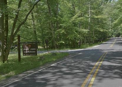
From Washington DC Take the George Washington Memorial Parkway north to I495 to I270 north 27 miles to Frederick, MD. Take Route 15 17 miles north to Thurmont, MD. Take Route 77 West, the exit sign is marked Catoctin Mountain Park. Travel approximately 6 miles west on 77 (you will pass Park Central Road and the park Visitor Center) and turn right onto Foxville-Deerfield Road. As the road forks, keep left and continue on Foxville-Deerfield Road for approximately 1 mile and turn left into Owens Creek Campground.
From Baltimore, MD Take I695 beltway to I70 West to Frederick, MD. Take Route 15 North to Thurmont, MD. Take Route 77 West (the exit sign says Catoctin Mountain Park.) Travel approximately 6 miles west on 77 (you will pass Park Central Road and the park Visitor Center) and turn right onto Foxville-Deerfield Road. As the road forks, keep left and continue on Foxville-Deerfield Road for approximately 1 mile and turn left into Owens Creek Campground.
From Hagerstown, MD Take I70 East to Route 66 North for 7 miles. Turn right onto Route 64 (East) for 1 mile then turn right at a traffic light onto Route 77 East for approximately 4 miles. Turn left onto Foxville-Deerfield Road. As the road forks, keep left and continue on Foxville-Deerfield Road for approximately 1 mile and turn left into Owens Creek Campground.
From Gettysburg, PA Take Route 15 South. In Thurmont, MD, exit onto Route 77 West (the exit sign says Catoctin Mountain Park.) Travel approximately 6 miles west on 77 (you will pass Park Central Road and the park Visitor Center) and turn right onto Foxville-Deerfield Road. As the road forks, keep left and continue on Foxville-Deerfield Road for approximately 1 mile and turn left into Owens Creek Campground.
Phone
301-663-9388
Activities
CLIMBING, HISTORIC & CULTURAL SITE, CAMPING, INTERPRETIVE PROGRAMS, FISHING, HIKING, VISITOR CENTER, WILDLIFE VIEWING, DAY USE AREA, SWIMMING SITE
Keywords
Catoctin Mountain,Catoctin Mt,Catoctin
Related Link(s)
Maryland State Road Conditions
Overview
Owens Creek Campground offers families and individuals enjoyable primitive tent camping. Located just five miles from Thurmont, Maryland, in the rolling hills of Catoctin Mountain Park.
Recreation
As a primitive camping area, Owens Creek encourages visitors to use healthy doses of imagination while surrounded by the natural landscape. Nature hikes and campfire circles are popular activities. The Deerfield Nature Trail connects directly to the campground and is a 1.5 mile loop with a connection to the park’s western system of trails. Browns Farm Trail is nearby in the Owens Creek Picnic Area and offers budding archeologists with a peek into the history of the area. This trail is also a youth friendly ‘Track Trail’. For more information go to: www.kidsinparks.com. Catoctin Mountain Park boasts 25 miles of trails.
Facilities
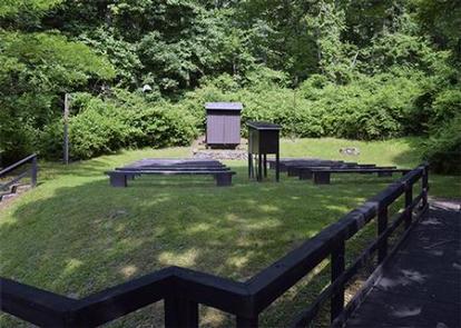
This campground contains 50 single campsites with a limit of five people, or immediate family, per site. There are no-hookups. Maximum 22′ trailer length and RVs up to 30′. There are three pull through sites.
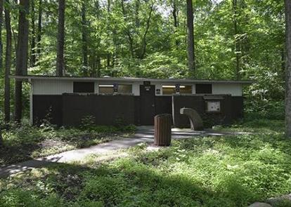
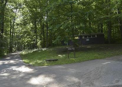
Flush toilets, showers and drinking water are available and centrally located in the campground. All sites are equipped with a tent pad, picnic tables, and fire ring. All tents must fit on the tent pads. Firewood is available.
Natural Features
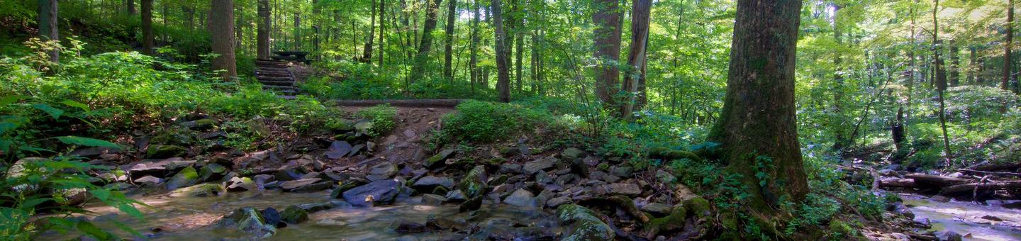
The campground is surrounded by a rolling landscape, perfect for hikes of any level from easy to extremely strenuous. Owens Creek flows past the campground providing a peaceful setting beside a bubbling brook. Whether blanketed in snow in winter months, brilliant with color in the fall or blooming with wildflowers in the spring, Owens Creek offers beautiful scenery all year.
Nearby Attractions
Other National Park Service units in the area are: Antietam National Battlefield www.nps.gov/ancm/index.htm 26 miles, Chesapeake & Ohio Canal National Historical Park www.nps.gov/choh/index.htm 28 miles, Eisenhower National Historic Site www.nps.gov/eise/index.htm 20 miles, Gettysburg National Military Park www.nps.gov/gett/index/htm 20 miles, Harpers Ferry National Historical Park www.nps.gov/hafe/index.htm 37 miles, Monocacy National Battlefield www.nps.gov/mono/index.htm 18 miles, Appalachian National Scenic Trail www.nps.gov/appa/index.htm , 8 miles, Potomac Heritage National Scenic Trail www.nps.gov/pohe/index.htm , 26 miles.
Other Attractions: Catoctin Wildlife Preserve and Zoo www.cwpzoo.com , Tourism Council of Frederick County www.fredericktourism.org , Washington County Hagerstown, MD www.marylandmemories.org/home.html .