BOOMER PARK SHELTER, NC Campground Reservation, Info, Images, Map, Directions

BOOMER PARK SHELTER, North Carolina Campground Images, Info & Reservations

Directions

From Charlotte, North Carolina, take I-77 North (approximately 60 miles) before merging onto Highway 421 North towards Wilkesboro/Boone. Continue to Exit 286B (approximately 20 miles), turn left onto Highway 268 and continue for approximately 6 miles. Turn left onto Boomer Road and the park will be on the right in approximately 1/4 mile. From Winston-Salem, North Carolina, take Highway 421 North (approximately 55 miles) to Exit 286B, turn left onto Highway 268 and continue for approximately 6 miles. Turn left onto Boomer Road and the park will be on the right in approximately 1/4 mile.

Phone

336-921-3390

Activities

BOATING, DAY USE AREA, SWIMMING, WATER ACCESS

Keywords

BOOMER PARK SHELTER

Related Link(s)

Rec Area Info & Images

North Carolina State Tourism

North Carolina State Road Conditions

Overview

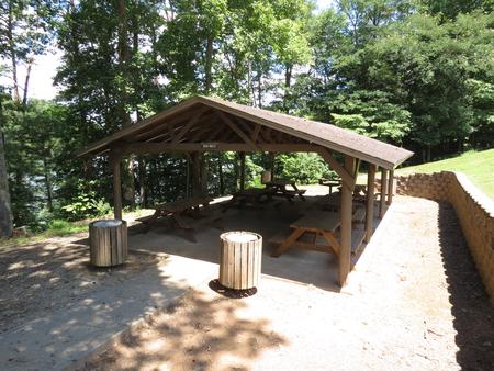
Boomer Park Shelter is located in Boomer Park at W. Kerr Scott Dam and Reservoir in northwestern North Carolina.

Recreation

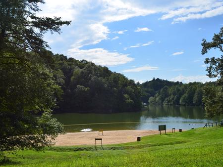
The 1,475-acre reservoir offers excellent boating, canoeing, kayaking and swimming opportunities. Anglers will find channel catfish, large and smallmouth bass, bluegill, threadfin shad, spotted bass, striped bass, and hybrid striped bass.

Facilities

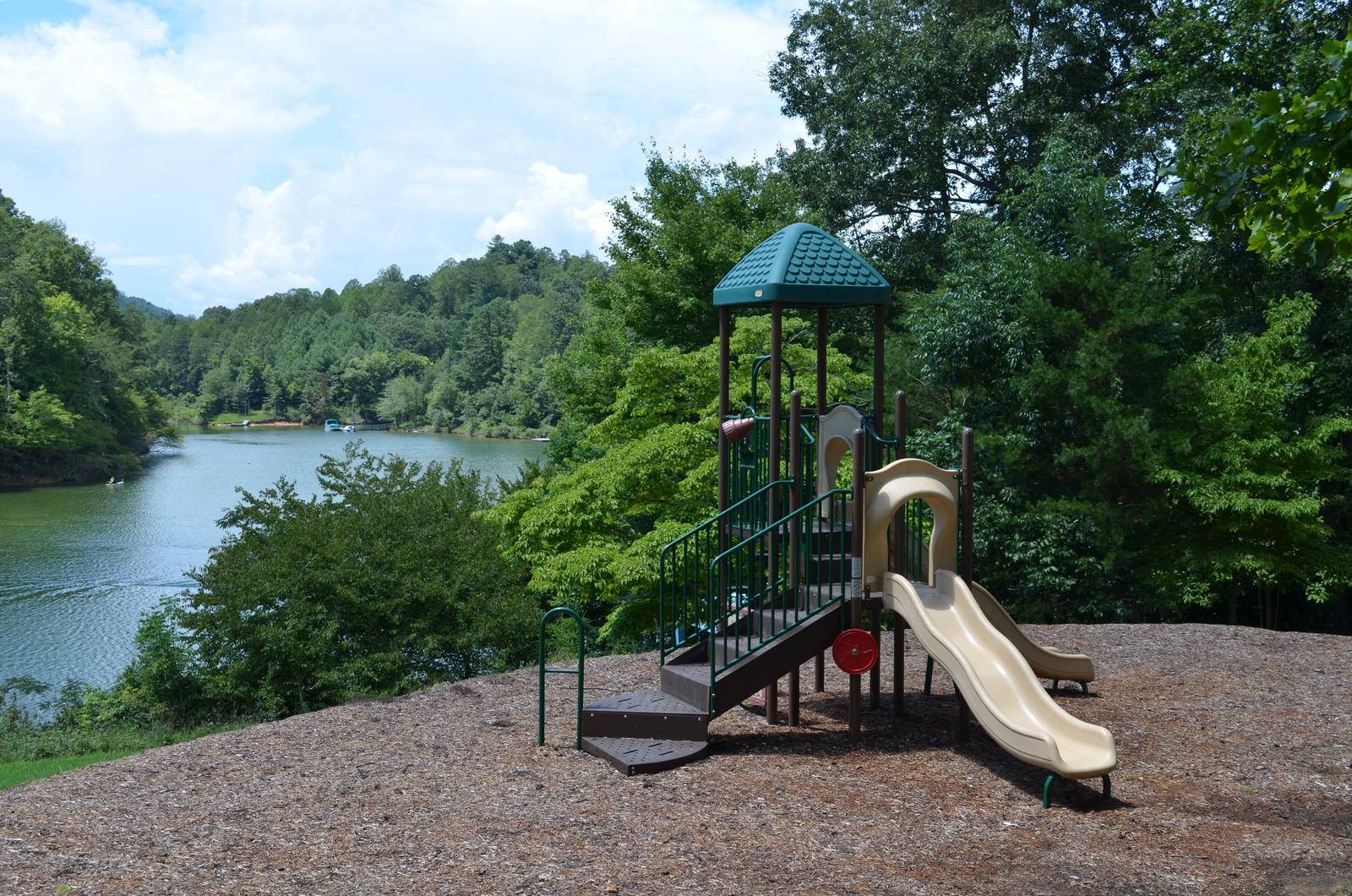
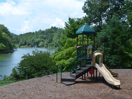
This lakefront shelter offers six, 7-foot picnic tables. A water spigot can be found at the shelter but there is no electricity available. You can enjoy other park amenities which include a playground, grill, accessible vault toilets, swim beach, and a boat ramp.

Natural Features

The gentle Yadkin River flows through its scenic namesake valley in the foothills of the eastern Blue Ridge Mountains. Forests of mixed hardwoods, including sycamore, poplar, oak and hickory, cover the region. Wildlife is abundant in the valley. White-tailed deer, black bear, eastern cottontails and more can be found among the hills. Birds in the area include wild turkey, woodpeckers, Carolina chickadees, red-eyed vireo, ovenbirds, mallards and wood ducks.

Reservation

More from CampingHiking.net:

DAVIDOF LAKE CABIN, Alaska Campground Images, Info & Reservations

Directions Accessible early June through October. Located 40 air miles southeast of Sitka, east of Whale Bay, within South Baranof Wilderness Area. Access is by float plane only, and takes 35 minutes from Sitka. For geographic features surrounding cabin, refer to USGS topographic map Port Alexander C-3. Phone 907-747-6671 Activities

SEELY CREEK GUARD STATION, Utah Campground Images, Info & Reservations

Directions From Orangeville, travel west on State Highway 29 to Joe’s Valley Reservoir. At the reservoir, turn right and follow the road around to the other side. When you start heading away from the reservoir and toward the plateau, you’ll pass Orange Olsen Administrative Site on the right and then

PEACE VALLEY CAMPGROUND, Idaho Campground Images, Info & Reservations

Directions From Garden Valley, Idaho, take Forest Road 698 north approximately 16 miles north. Turn right at the junction of FR 698 and FR 671. Take FR 671 for about 10 miles to the campground, which is on the left-hand side of the road. Phone 541-351-1182 Activities BIKING, CAMPING, HIKING,

NORTH DICKEY LAKE, Montana Campground Images, Info & Reservations

Directions From Eureka, travel south on Highway 93 for approximately 13 miles to Fortine. Continue south on Highway 93 for over a mile to the campground. Phone 406-296-2536 Activities BIKING, BOATING, CAMPING, FISHING, HIKING, WATER SPORTS, SWIMMING SITE Keywords NODI,DICKEY LAKE,KOOTENAI NF – FS Related Link(s) Rec Area Info &

SOUTH DICKEY LAKE, Montana Campground Images, Info & Reservations

Directions From Eureka travel South on Hwy 93 for approximately 20 miles. Take a left on Lake Shore road 3788 and follow for 2 miles to the day use site. Phone 406-296-2536 Activities BOATING, CAMPING, FISHING, SWIMMING SITE Keywords SODI,SOUTH,DICKEY,LAKE,KOOTENAI NF – FS Related Link(s) Rec Area Info & Images