


Directions
The cabin can be accessed by traveling west from Kilgore, Idaho, via Forest Road 006 approximately 8 miles to Forest Road 478. Travel Forest Road 478 to the Steel Creek Group Area. The cabin is located just outside of the group area and can be reached by driving through the group area to the cabin. The cabin can also be reached from I-15 at Stoddard Creek Exit. Exit at the Stoddard Creek Exit and travel east on Forest Road 006 approximately 13 miles to Forest Road 478.
Phone
208-374-5422
Activities
CAMPING, FISHING, HIKING, HUNTING, WILDLIFE VIEWING, PHOTOGRAPHY, STAR GAZING, BIRDING, OFF HIGHWAY VEHICLE TRAILS
Keywords
AL TAYLOR CABIN
Related Link(s)
Overview
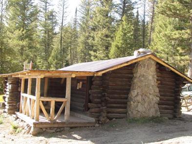
Al Taylor Cabin is located adjacent to Steel Creek near the Continental Divide, at an elevation of 6,300 feet. Visitors come to this area for its beautiful scenery and solitude. Guests can drive to the cabin from mid-May through mid-November with the majority of the trip on gravel roads. These roads are only accessible by snowmobile the remainder of the year. The cabin provides several conveniences, but guests should be prepared to bring some of their own supplies and gear for a comfortable stay.
Recreation
An off-highway vehicle trail system can be accessed from the cabin. Small streams in the area provide fishing opportunities for brook trout. Other popular activities in the area include hiking, horseback riding and sightseeing.
Facilities
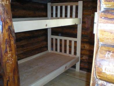
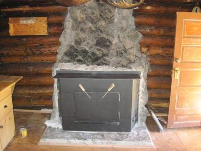
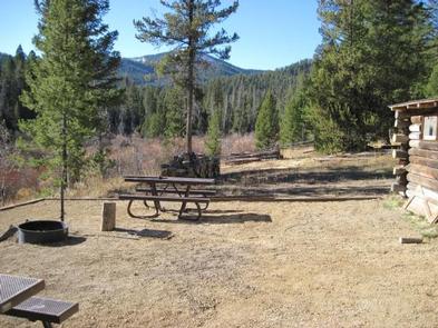
The cabin can accommodate six people. The cabin has a wood cook stove and wood fireplace as well as propane lights. It provides a small dining table with four chairs. The beds are wooden bunk beds. Other amenities include a fire ring, charcoal grill, picnic tables and a vault toilet – all provided adjacent to the cabin. There is no electricity at the cabin.
Water is available at the Steel Creek Campground, located just before the gate to the cabin.
Natural Features
The cabin is surrounded by large douglas fir trees. It is near both Camas Meadows and the Continental Divide, providing incredible views.
Nearby Attractions
There are many miles of off-highway vehicle, horseback and hiking trails in the area. The Camas Meadows Battlefield located on the Nez Perce National Historic Trail is located nearby.