LOFERS BEND DAY USE (TX), TX Campground Reservation, Info, Images, Map, Directions

LOFERS BEND DAY USE (TX), Texas Campground Images, Info & Reservations

Directions

From I-35 in Hillsboro, take Hwy 22 West for 12 miles to Whitney, continue 7 miles past Whitney, and turn right before the dam. Take the first left turn.

Phone

254-622-3332

Activities

CAMPING, HIKING, SWIMMING SITE

Keywords

Lofers,Lofer’s Bend,Day Use,Lofers Day Use

Related Link(s)

Rec Area Info & Images

Overview

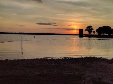
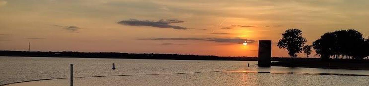
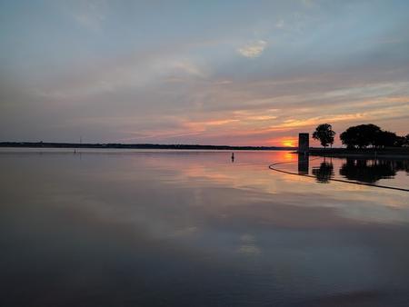
Lofers Bend Day Use Park is located on Whitney Lake on the Brazos River in central Texas. Whitney Lake gets over two million visitors a year. Visitors enjoy many recreational activities in the area and the scenic beauty that Whitney Lake provides. Lofers Bend Day Use gates will open at 6:00 am and the park will close at 10:00 pm.

Recreation

Boating, fishing, swimming, volleyball, and hiking opportunities are provided in the park.

Facilities

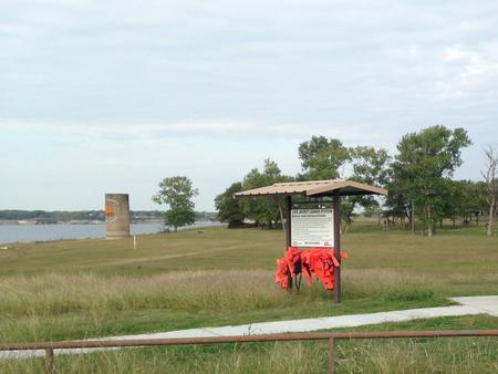
Lofers Bend Day Use Park offers 29 picnic sites, a reserveable day use group pavilion, a two lane boat ramp, playground, 2 swim beaches, 2 sand volleyball courts, a 1.5 mile fitness trail, and 2 restrooms.

Natural Features

The park is located in Hill County on the upstream side of Whitney Dam and features an oak-savannah landscape including a variety of oak trees, native grasses, and wildflowers. Whitetail deer can often be seen in the park.

Nearby Attractions

The 12.5 mile Hopewell Trail is nearby. The trail allows hiking, mountain biking, and horseback riding. Visitors can choose to travel north on the trail to Kimball Bend Park, or south to Lakeside Village and Powelidale Mountain.

Reservation

More from CampingHiking.net:

LOWER PINES, California Campground Images, Info & Reservations

Directions Take Highway 41 north from Fresno, Highway 140 east from Merced, or Highway 120 east from Manteca into Yosemite National Park. Follow signs to Yosemite Valley and the campgrounds. Phone (209) 372-8502 Activities CAMPING Keywords Yosemite National Park,The Valley Related Link(s) Rec Area Info & Images California State Road

South Shore, Oregon Campground Images, Info & Reservations

Directions From Sisters, Oregon, take Highway 20/126 northwest for about 12 miles. Turn left onto Forest Service Road 2070 toward Suttle Lake Campgrounds. Travel just less than a half-mile to the South Shore entrance on the right. Phone 541-323-1746 Activities BOATING, CAMPING, FISHING, HIKING, SWIMMING SITE Keywords SOUH,SUTTLE LAKE CAMPGROUND,DESCHUTES

SPRUCES CAMPGROUND (DIXIE NF), Utah Campground Images, Info & Reservations

Directions Go east from Cedar City on Scenic Byway SR 14, 25 miles to the Navajo Lake road turnoff to the south. Follow the Navajo Lake road 7 miles to Spruces campground. Phone 801-226-3564 Activities BIKING, BOATING, CAMPING, FISHING, HIKING, WILDLIFE VIEWING, PHOTOGRAPHY, MOUNTAIN BIKING, KAYAKING, CANOEING, WATER ACCESS, SCENIC

DONALDSON PARK, Tennessee Campground Images, Info & Reservations

Directions From Celina, TN (Highway 52), travel East Lake Avenue. Turn onto Jefferson Street. Follow signs into the park. Phone 931-243-3136 Activities BOATING, FISHING, PICNICKING, DAY USE AREA, PHOTOGRAPHY, KAYAKING, CANOEING, WATER ACCESS Keywords DONA,CELINA PARK,DALE HOLLOW LAKE,DALE HOLLOW,DONALDSON,CORDELL HULL DAM Related Link(s) Rec Area Info & Images Tennessee State

LADYBIRD LANDING, Oklahoma Campground Images, Info & Reservations

Directions From Porum, Oklahoma, take Highway 71 west for 8 miles, then follow signs to the campground. Phone 918-799-5843 Activities BOATING, CAMPING, FISHING, HIKING, SWIMMING SITE Keywords Dam Site South Related Link(s) Rec Area Info & Images Oklahoma State Road Conditions Oklahoma State Tourism Overview Ladybird Landing Campground sits along

MCDONALD LAKE CABIN, Alaska Campground Images, Info & Reservations

Directions Approximately 50 miles from Ketchikan. Located on Cleveland Peninsula, north of Yes Bay. Cabin site is on Wolverine Island near outlet of lake. Access is by float plane or boat. There is a 1.5-mile hike by trail from Yes Bay Lodge at saltwater. Refer to USGS Ketchikan D-6. In