


Directions
From East and West:
Take I-89 to White River Junction, and take I-91N.
From the North: (Bradford, VT)
Take exit 14 off of route I-91, and turn right onto Rt. 113.
Continue up the hill on Rt. 113 for about 3/4 mile.
Turn left onto Academy Rd. just before the white church.
(If you reach the elementary school you have gone too far)
Follow Academy Rd. about 2 3/4 miles until you reach the covered bridge.
Pass through the covered bridge and take an immediate right.
In 1/10th mile the Picnic Shelter will be on the left. (Look for the sign that says Union Village Dam)
From the South: (White River Junction, Massachusetts, etc.)
Take exit 13 off of I-91 North.
Take a left at the bottom of the ramp and follow Rt. 5 North.
Bear right in the center of Norwich to continue on Rt. 5 North.
Continue following Rt. 5 North for about 5 1/2 Miles.
Turn left onto Rt. 132.
Follow Rt. 132 for about 2 3/4 miles and then bear right onto Academy Rd.
Bear left at the covered bridge.
In 1/10th mile the Picnic Shelters will be on the left. (Look for the sign that says Union Village Dam)
Union Village Dam
2 Main St.
East Thetford, VT 05043
Office: (802) 649-1606
Phone
(802) 649-1606
Activities
CAMPING, PICNICKING, SWIMMING SITE
Keywords
Union Village,Union Village,Union Dam,Thetford Dam
Related Link(s)
Overview
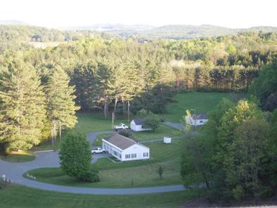
Union Village Dam is a US Army Corps of Engineers facility located on the Ompompanoosuc River in Thetford, VT. Close to the towns of Hanover, New Hampshire, and Norwich, Vermont, Union Village Dam is a popular destination for outdoor recreation in the Upper Valley.
Recreation
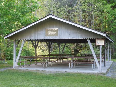
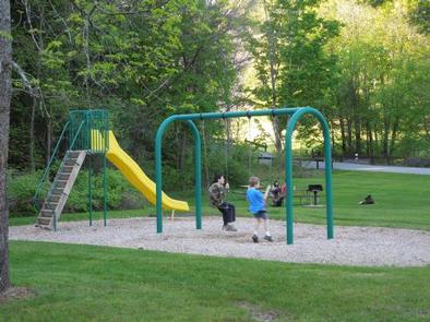
Swimming, fishing, and hiking are all popular activities at Union Village Dam. A playground, horseshoe pit, volleyball net, picnic tables and grills are available for all to enjoy. Family gatherings and events are also popular at our picnic pavilion.
Facilities
The picnic pavilion at Union Village Dam can accommodate approximately 65 people. Flush toilets are located next to the pavilion, while portable toilets are provided at the beach area and picnic tables and grills are dispersed throughout the park.
Natural Features
Union Village Dam provides a sandy swimming beach and over a mile of trails to explore on the property. Shaded areas and open lawns provide a variety of picnic opportunities along the Ompompanoosuc River.