THE LAURELS PICNIC AREA PAVILIONS, TENNESSEE Campground Reservation, Info, Images, Map, Directions

THE LAURELS PICNIC AREA PAVILIONS, Tennessee Campground Images, Info & Reservations

Directions

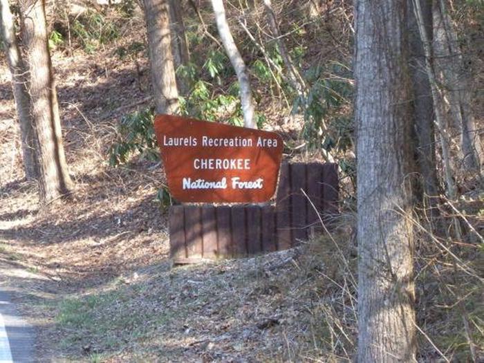
The Laurels is located on TN Hwy 361 near Sciota Road in Carter County.

From Johnson City, take I-26 E to Okalona exit. Turn left, drive under I-26 to TN 359. Turn right onto TN 359. Travel 1.4 miles, then turn right onto TN 361 for 3.7 miles to The Laurels. 

Phone

423-735-1500

Activities

HIKING, WILDLIFE VIEWING, WATER ACCESS

Keywords

THE LAURELS PICNIC AREA PAVILIONS

Related Link(s)

Rec Area Info & Images

Overview

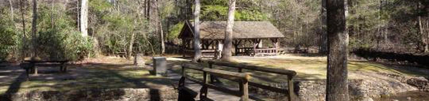
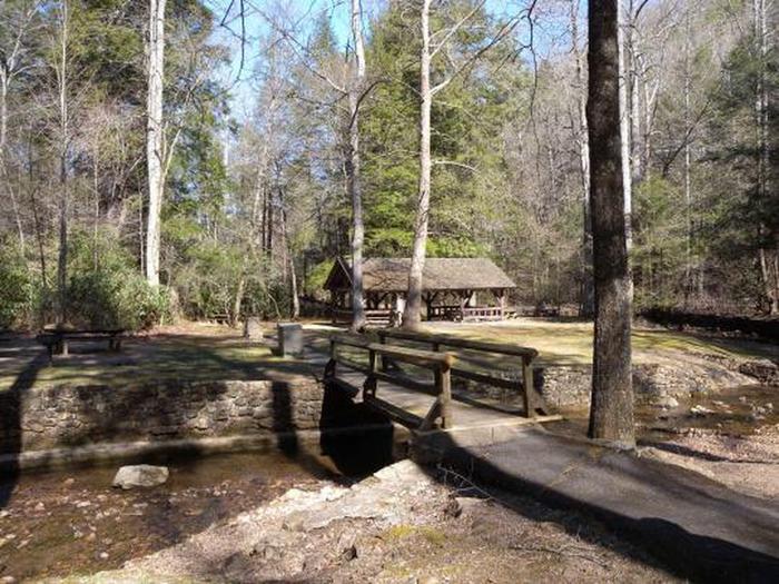
The Laurels Picnic Area Pavilions will close for the season on Monday, October 14, 2019. The Laurels has been a popular area since the early days in East Tennessee. It was a common evening stopover for farmers from North Carolina taking produce to markets in Johnson City. The site is named for the native Rhododendron that thrives in the area, locally called “laurel.” The Civilian Conservation Corps helped construct the current facilities in the early 1930’s. Today, it is a popular day-use area, providing a nice shady place for family picnics and group gatherings.  

Recreation

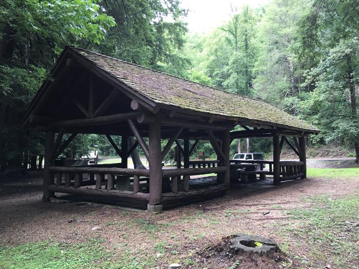
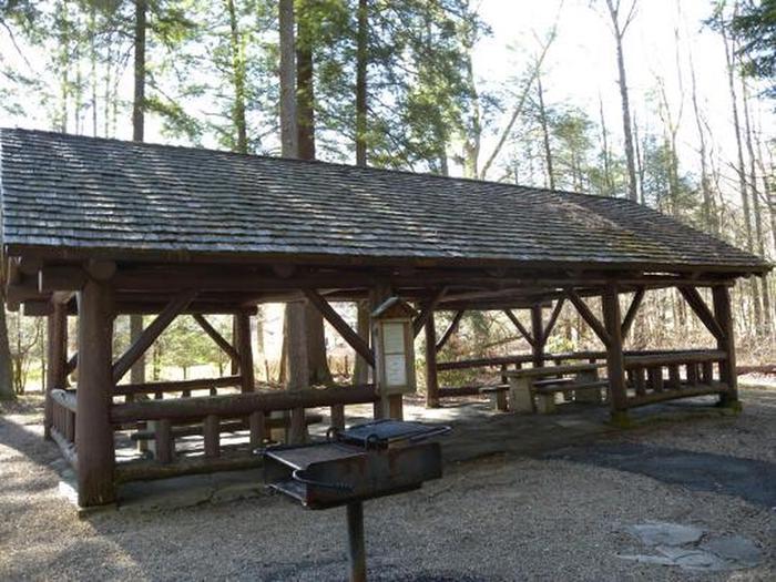
The Laurels has two pavilions, each with picnic tables and grills. An old foot path meanders through the nearby woods.

Facilities

The Laurels includes two picnic pavilions, numerous tables connected by paths and trash cans. There are vault toilets on site. There is no potable water.

Natural Features

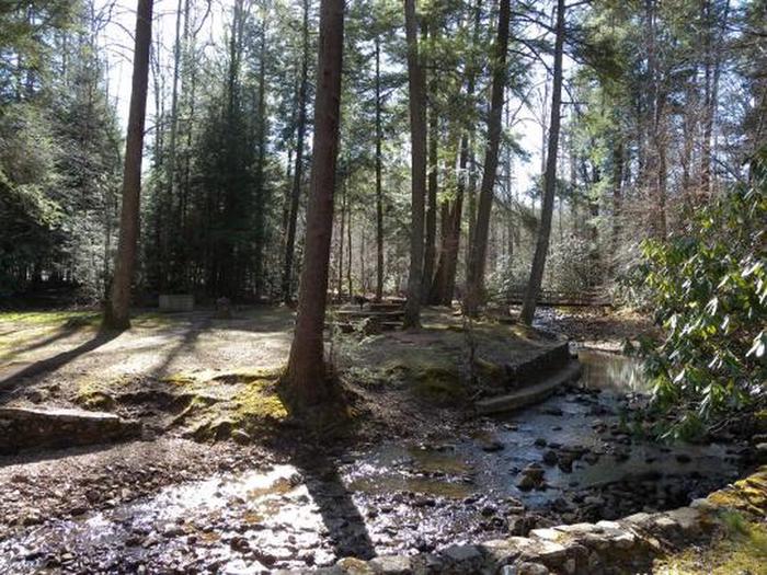
Honeycomb Creek flows through the picnic area and is enjoyed by kids of all ages on warm summer days.

Reservation

More from CampingHiking.net:

SOUTH SANDUSKY CAMPGROUND, Illinois Campground Images, Info & Reservations

Directions From I-57 take exit 71 and turn west onto Route 14. After 3 miles turn right on Rend City Road, then continue for 6 miles to the campground entrance on the right. Phone 618-724-2493 Activities BIKING, CAMPING, INTERPRETIVE PROGRAMS, FISHING, HIKING, WILDLIFE VIEWING, SWIMMING SITE, STAR GAZING Keywords SSAN,REND

FRENCH CREEK, Idaho Campground Images, Info & Reservations

Directions From Boise, Idaho, travel north on Highway 55 for 85 miles to Cascade. Turn west on Old State Highway and go a half-mile to Lakeshore Drive. Turn south and travel 3 miles to West Mountain Road. Turn west and follow the road 5 miles to the campground. Phone 208-382-7400

CANDLE CREEK CAMPGROUND, Oregon Campground Images, Info & Reservations

Directions From Sisters, OR: Travel 12.4 miles northwest on Highway 20, then 12.3 miles north on Forest Road 12, and then 1.6 miles east on Forest Road 1200 980. Phone 541-323-1746 Activities CAMPING Keywords Related Link(s) Rec Area Info & Images Oregon State Tourism Oregon State Road Conditions Overview Candle

HUNTERS GROUP SITE, Washington Campground Images, Info & Reservations

Directions Take State Highway 2 west of Spokane for 32 miles to the town of Davenport. Turn north on State Highway 25 and travel 37 miles. Follow signs for the campground. Turn left (west) on Campground Road in the town of Hunters. Phone 509-754-7889 Activities BOATING, HISTORIC & CULTURAL SITE,

BUFFALO CAMPGROUND, Colorado Campground Images, Info & Reservations

Directions From Denver, travel southwest on Highway 285. Turn south on Jefferson County Road 126 and travel 15 miles. Turn right on Forest Road 550 and drive 5 miles to the campground. Phone (303) 275-5610 Activities BIKING, CAMPING, FISHING, HIKING Keywords BUF1,RED SKIN,PIKE AND SAN ISABEL NF- FS Related Link(s)