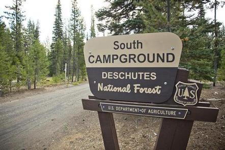
SOUTH CAMPGROUND, Oregon Campground Reservation, Info, Images, Map, Directions

SOUTH CAMPGROUND, Oregon Campground Images, Info & Reservations

Directions

From Bend, travel 35.5 miles southwest on Cascade Lakes Hwy (46), then 1.3 miles east on Forest Road 4625. South Campground will come up on the right side first and then Mallard Marsh.

Phone

541-323-1746

Activities

CAMPING

Keywords

Related Link(s)

Rec Area Info & Images

Oregon State Tourism

Oregon State Road Conditions

Overview

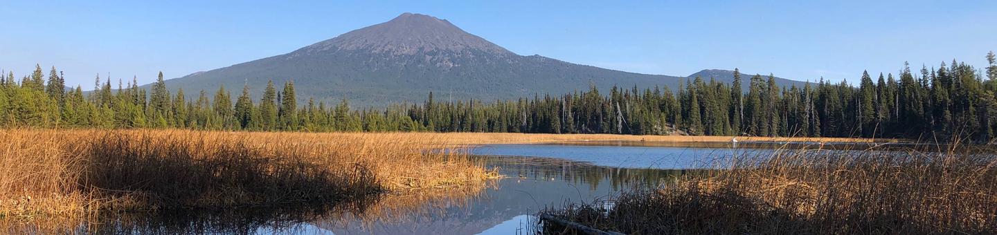
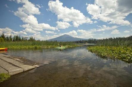
Located WITHIN OREGON on Hosmer Lake, South Campground provides visitors with access to flyfishing, paddling and hiking.

Recreation

Nearby Hosmer Lake offers opportunities for fly fishing and boating as well as spectacular views. There are also trails and other opportunities for hiking and horseback riding.

Facilities

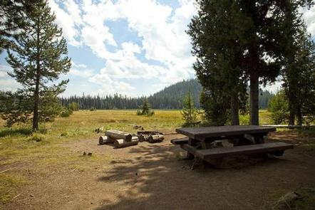
This facility has vault toilets and each site is equipped with a picnic table and fire pit with grill. Please note campers will need to bring their own water supply. There is also a boat ramp that provides access to Hosmer Lake. Boat launch parking is for day use only and requires a recreation fee separate from camping fees.

Natural Features

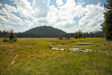
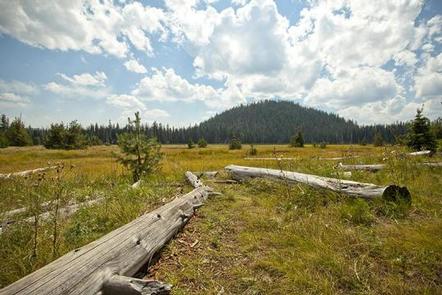
At the north end of Hosmer Lake, water drains into a porous rim of lava. Hosmer is a fly fishing only lake well known for its breath taking views of Mt. Bachelor, South Sisters, Broken Top as well as wildlife viewing and the big Atlantic salmon, brook trout and rainbows that are quite visible in this shallow clear lake. The best way to experience this lake is by canoe or kayak as shore access is limited due to marshy vegetation.

Nearby Attractions

Visitors enjoy traveling the Cascade Lakes Scenic Byway which climbs 66-miles through the Cascade Range, weaving past snow-capped peaks and alpine lakes.

Reservation

More from CampingHiking.net:

TOWERS ARM CABIN, Alaska Campground Images, Info & Reservations

Directions Access is by boat or float plane only. From Petersburg the journey is 16 miles by float plane or 38 miles by boat. A 15-foot tide is required for boat access to the cabin. A 16-foot tide is recommended for float plane access. Lower tides may require up to

WINFIELD, Georgia Campground Images, Info & Reservations

Directions From I-20, take Exit 175 (HWY 150) north 7 miles to campground sign. Turn left onto Mistletoe Road, go 2 miles and turn left onto Winfield Road. Campground is at the end of the road. Phone 706-541-0147 Activities BOATING, CAMPING, FISHING, HUNTING, WATER SPORTS Keywords WINF,J STROM THURMOND LAKE

ALLRED FLATS GROUP PICNIC SITE, Wyoming Campground Images, Info & Reservations

Directions From Afton, Wyoming, take Highway 89 south for approximately 21 miles over Salt Pass and look for a brown sign signaling the right-hand turn for Allred Flats Campground. The picnic area is on the left, just before the campground entrance kiosk. Phone 307-828-5100 Activities BIKING, CAMPING, FISHING, HIKING, WILDLIFE

SILVER CREEK GROUP CAMPGROUND, California Campground Images, Info & Reservations

Directions Travel 23 miles east of Placerville on Highway 50. Turn north and travel 9 miles on Forest Road 3 (Ice House Road). Look for signs to Silver Creek Campground. Phone 831-245-6891 Activities BIKING, BOATING, CAMPING, FISHING, HIKING, WATER SPORTS, WILDLIFE VIEWING, SWIMMING SITE, BIRDING Keywords SILG,ELDORADO NF – FS

BLACK MOUNTAIN LOOKOUT, California Campground Images, Info & Reservations

Directions Access to the lookout is by a dirt road; high clearance vehicles are recommended. Visitors should be aware that access is subject to inclement weather during the early and late season. Black Mountain Lookout is located on the eastern edge of the Beckwourth Ranger District, 10 miles from Highway