
Directions
From Sisters, OR: Travel 9.6 miles northwest on Highway 20, then 12.6 miles north on Forest Road 14.
Phone
541-323-1746
Activities
CAMPING
Keywords
Related Link(s)
Overview
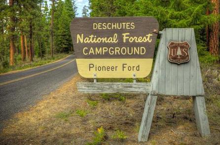
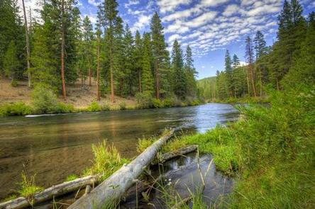
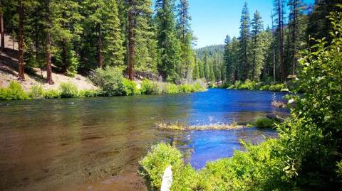
Pioneer Ford is one of the most popular of the campgrounds in the area since many of the sites are well suited to RVs and most of the sites are mostly private, shaded amongst a mixture of pine and cedar trees. As you travel north away from the first in a series of Metolius-area campgrounds and Camp Sherman, the facilities become more and more isolated which is why Pioneer Ford can be so quiet. Located on the Metolius River, this campground provides access to fishing and hiking trails.
Recreation
Hiking and fishing top the list of recreational activities for visitors.
For anglers, the spring-fed Metolius River offers a stunning setting for fly-fishing. Its clear, cold water supports rainbow trout, whitefish, bull trout and kokanee salmon.
For day hikers and backpackers, the area offers a wide variety of scenic terrain, ranging from riverside trails to routes in subalpine forests.
Facilities
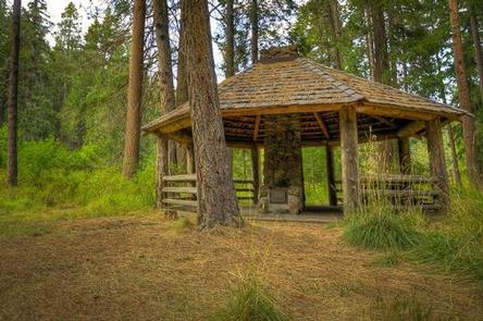
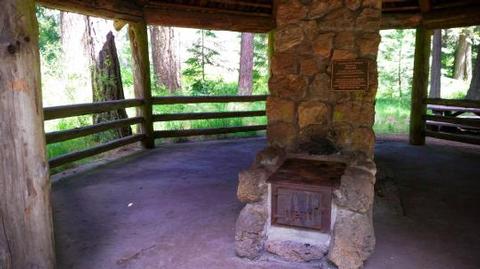
With 20 campsites Pioneer Ford Campground is well-suited to trailers, tents or RVs with its mix of back-in and pull-through sites. Many sites are right along the Metolius River and site 8 also has an adjacent picnic shelter. This facility has vault toilets as well as drinking water available. Each site is equipped with a fire ring and picnic table.
Natural Features
The headwaters of the river are at Metolius Springs at the base of Black Butte, a 3,076-foot cinder cone. The clear, cold river flows north from the springs through diverse coniferous forest and a landscape of volcanic activity.
The area provides habitat for mammals such as mule deer, coyote and cougar. Migratory birds and native fish also call the area home.
Nearby Attractions
The Metolius-Windigo Trail, open to hikers, bikers and horses, is more than 100 miles in length, and begins near the Metolius River headwaters west of the town of Sisters, Oregon. The trail was created in the 1980s primarily to serve long-distance horse riders seeking an alternative to the Pacific Crest Trail.
Lava Lands Visitor Center in Bend, Oregon, offers visitors the opportunity to learn about the diverse landscape and history of the area through interpretive programs and exhibits.