COLD SPRINGS CAMPGROUND (OR), OR Campground Reservation, Info, Images, Map, Directions

COLD SPRINGS CAMPGROUND (OR), Oregon Campground Images, Info & Reservations

Directions

From Sisters, OR: Travel 4.2 miles west on Highway 242 (McKenzie Pass Highway).

Phone

541-323-1746

Activities

CAMPING

Keywords

Related Link(s)

Rec Area Info & Images

Oregon State Tourism

Oregon State Road Conditions

Overview

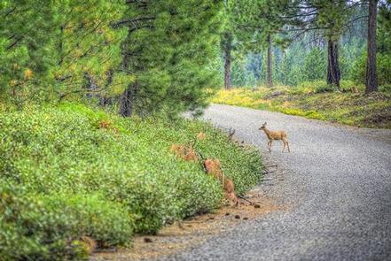
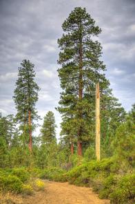
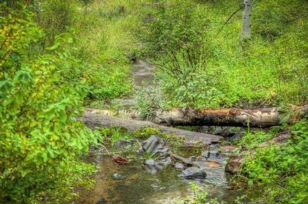
A pleasant, small spring runs through the center of this popular, shaded campground. Located just southwest of Sisters, Oregon, Cold Springs Campground is nestled below a thick Ponderosa Pine forest mixed with aspen in the wet areas. This campground offers opportunities for hiking and bird watching and is a great option for the whole family.

Recreation

This campground offers many opportunities for hiking and biking with the many trails nearby. The ponderosa pine forest provides shade as well as the chance to go bird or nature watching.

Facilities

There are 23 single campsites in this facility. Water is available by hand pump and there are three vault style toilets. Each site is equipped with a picnic table and fire ring.

With a loop road, bicycling throughout the campground is a favorite pastime for families that come to Cold Springs Campground.

Natural Features

Nestled in the forest with a pleasant, small spring running through the center of this facility, Cold Springs Campground is a great shady family spot with short hikes all around.

Nearby Attractions

The close proximity to the town of Sisters offers many additional amenities and attractions, as well as the nearby Sisters Wilderness Trails.

Reservation

More from CampingHiking.net:

KOOK LAKE CABIN, Alaska Campground Images, Info & Reservations

Directions Accessible May through November. Located near the eastern shore of Chichagof Island between the outlets of Tenakee Inlet and Peril Strait, about 45 miles northeast of Sitka. Access is by floatplane, 30 minutes from Sitka or Juneau; or by boating to Corner Bay and hiking 7 miles on logging

CRANE VALLEY, California Campground Images, Info & Reservations

Directions From Fresno, California, take Highway 41 north through Oakhurst. Turn right on Forest Road 222, towards Bass Lake. Keep right for 3.5 miles to the campground. Phone 559-642-3212 Activities BOATING, CAMPING, INTERPRETIVE PROGRAMS, FISHING, HIKING, WATER SPORTS, SWIMMING SITE Keywords CRVA,BASS LAKE OAKHURST AR,SIERRA NF – FS Related Link(s)

CURRANT CREEK, Utah Campground Images, Info & Reservations

Directions From Heber City, Utah, take Highway 40 east for 45 miles to the Currant Creek Junction. Turn off the highway and travel in a northwest direction approximately 17 miles to the campground. The road from the highway is paved for 10 miles and graded gravel for 7 miles. Stay

BLACKHAWK, Utah Campground Images, Info & Reservations

Directions From I-15, take exit 250 toward North Payson/Salem and proceed south on Main Street, then turn east onto 100 North/Highway. Turn south onto 600 East, which becomes the Nebo Loop Scenic Byway/Payson Canyon Road. Travel up the canyon to the campground. Phone SPANISH FORK RANGER DISTRICT 801-798-3571 OR UTAH

LIVE OAK SOUTH, California Campground Images, Info & Reservations

Directions From Bakersfield, take Highway 178 east to the town of Lake Isabella. From Lake Isabella, take Highway 155 north approximately 6 miles to Live Oak South campground. Phone 760-376-1815 Activities CAMPING Keywords LIOA,LIVE OAK,LIVE,OAK,OAK SOUTH,LIVE SOUTH,SEQUOIA NF – FS Related Link(s) Rec Area Info & Images Forest Service Concessionaire

DRIFTWOOD, Oregon Campground Images, Info & Reservations

Directions From Florence, OR travel seven miles south on Highway 101 turning right onto the Siltcoos Beach Access Road. Driftwood II Campground is on the right at mile 1.3. Phone 541-271-6000 Activities CAMPING, HIKING, WILDLIFE VIEWING Keywords DRIF,SIUSLAW NF – FS,Driftwood 2,Driftwood II Related Link(s) Rec Area Info & Images