ALLEN SPRINGS CAMPGROUND, OR Campground Reservation, Info, Images, Map, Directions

ALLEN SPRINGS CAMPGROUND, Oregon Campground Images, Info & Reservations

Listen

Directions

From Sisters OR: Travel 9.6 miles northwest on Highway 20, then 11.1 miles north on Forest Road 14.

Phone

541-323-1746

Activities

CAMPING

Keywords

Related Link(s)

Rec Area Info & Images

Oregon State Tourism

Oregon State Road Conditions

Overview

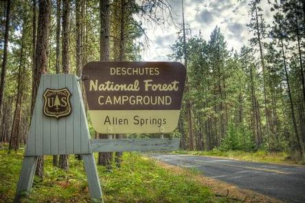
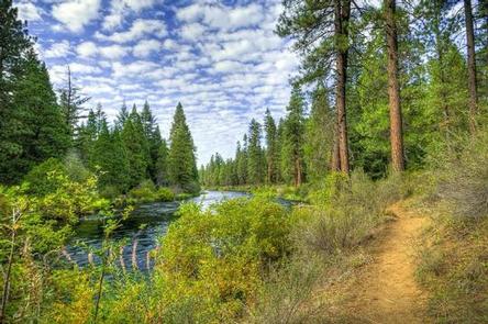
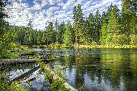
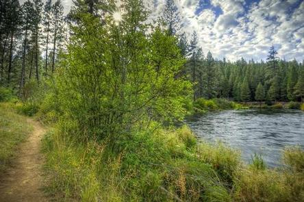
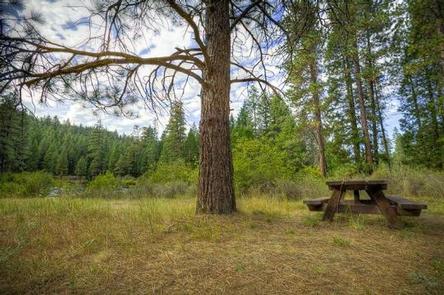
Like the other campgrounds on the Metolius, Allen Springs is located amongst towering Ponderosa Pines, on a turn of the Metolius River that broadens the river view. Most of the campsites are better suited to tents rather than RV’s.

Recreation

This campground offers many opportunities for hiking and biking with the many trails nearby. The ponderosa pine forest provides shade as well as the chance to go bird or nature watching.

Facilities

This facility has 16 sites that are nestled along the Metolius River. The circular shape of the campground means most of the campsites are better suited to tents rather than RVs. Allen Springs is a No Water campground so campers will need to bring their own supply. Each site is equipped with a picnic table and fire pit. We do have vault toilets onsite There is also a small picnic area onsite.

Natural Features

Nestled in the forest with near the Metolius River. Allen Springs Campground is a great shady family spot with short hikes all around.

Nearby Attractions

The close proximity to the town of Sisters offers many additional amenities and attractions, as well as the nearby Sisters Wilderness Trails.

Reservation

More from CampingHiking.net:

Sylvania (Clark Lake) Campground, Michigan Campground Images, Info & Reservations

Listen Directions From Watersmeet, MI, take US 2 west approximately 3.5 miles to County Road 535, turn left onto County Road 535 and travel approximately 3.5 miles to the Sylvania Wilderness Recreation Area entrance on left. Phone 906-396-5428 Activities BIKING, BOATING, CAMPING, FISHING, HIKING, HUNTING, WILDLIFE VIEWING, SWIMMING SITE Keywords

LOWER TWIN LAKES AT BRIDGEPORT, California Campground Images, Info & Reservations

Listen Directions From Bridgeport, California, take Highway 395 and turn south at Twin Lakes Road and travel 9.6 miles. Turn left onto South Twin Road and travel approximately 0.6 miles across the bridge to the campground. Phone 760-932-7092 Activities CAMPING, FISHING Keywords LOTL,HUMBOLDT-TOIYABE NF-FS Related Link(s) Rec Area Info &

FRENCH CREEK, Idaho Campground Images, Info & Reservations

Listen Directions From Boise, Idaho, travel north on Highway 55 for 85 miles to Cascade. Turn west on Old State Highway and go a half-mile to Lakeshore Drive. Turn south and travel 3 miles to West Mountain Road. Turn west and follow the road 5 miles to the campground. Phone

LINK CREEK, Oregon Campground Images, Info & Reservations

Listen Directions Travel approximately 13 miles northwest of Sisters on Highway 20/126. Turn left onto Forest Road 2070/Suttle Lake Campgrounds. Travel less than 1/2 mile to Blue Bay entrance on the right to Link Creek. Phone 541-323-1746 Activities BOATING, CAMPING, FISHING Keywords LINK,SUTTLE LAKE CAMPGROUND,DESCHUTES NF – FS Related Link(s)

STARRIGAVAN CREEK CABIN, Alaska Campground Images, Info & Reservations

Listen Directions Located 7 miles northeast of Sitka at the end of Halibut Point Road, about 3/4 mile from the local Alaska Marine Highway ferry terminal. There are no roads to Sitka. Access is via the Alaska Marine Highway or Alaska Airlines. Upon exiting the Ferry Terminal parking lot, turn