
Directions
From Placerville, CA: Travel US-50 east approximately 25 miles to Ice House Road. Turn north onto Ice House Road. Take the 1st right to stay on Ice House Road. Travel approximately 10 miles to the junction with Big Hill Lookout Road/Wrights Lake Tie Road. Turn right toward Ice House Reservoir on the Wrights Lake Tie Road. At approximately 1.2 miles, stay to the left. Travel another 1.7 miles, turn left. Continue approximately 6.2 miles to Wrights Lake Road (Wrights Road). Turn left and travel another 2 miles to the campground.
Phone
530-644-2324
Activities
BIKING, BOATING, CAMPING, FISHING, WILDLIFE VIEWING
Keywords
WRIGHTS LAKE EQUESTRIAN CAMPGROUND
Related Link(s)
California State Road Conditions
Overview
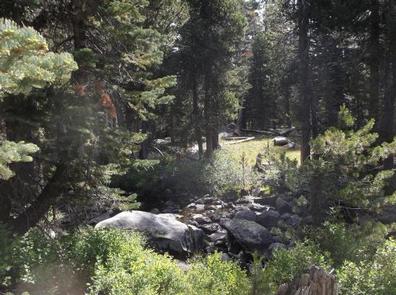
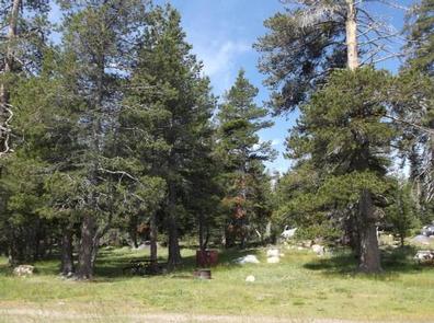
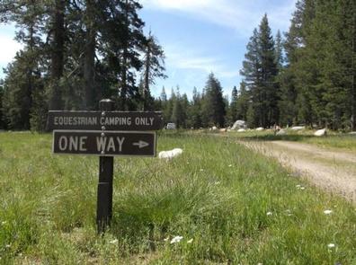
The Wrights Lake Equestrian Campground is available to visitors travelling with equestrian or packstock animals. The campground is situated near the Wrights Lake Campground in a grassy, open timber stand near the stream flowing from the spillway of Wrights Lake. The area is well-known for its vistas, hiking, wildflowers and birding.
Recreation
The campground provides access to the stream and lake, where visitors enjoy trout fishing, swimming and paddling. Motorboats are prohibited in the area. Stock users will enjoy access to multiple equestrian trails providing enjoyable rides throughout the back country and Desolation Wilderness, but may not ride through the Wrights Lake Campground and Day Use areas. An equestrian trail map is posted in the campground. Educational programs are offered at the Wrights Lake Campground amphitheater.
Facilities
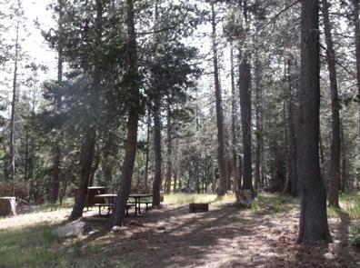
The campground offers 15 campsites for tents or RVs with equestrians and other packstock. Each site is equipped with a table, campfire ring and grill; there are no hookups. Firewood can be gathered in the area. The campground has accessible vault toilets.
Natural Features
At nearly 7,000 feet in elevation, the campground is surrounded by a mixed conifer forest with a grassy understory. Large lodgepole and fir trees help shade the campsites. Wildflowers bloom throughout the spring and summer seasons. The campground is near Wrights Lake, a shallow 40-acre body of water popular for its serene and quiet atmosphere.
Nearby Attractions
Barrett Lake 4WD trail is popular for both motorized and non-motorized recreation. Desolation Wilderness permits for day trips are available at the wilderness trailheads, and overnight hiking permits are available at the Pacific Ranger Station, or online .
Charges & Cancellations
https://www.recreation.gov/marketing.do?goto=/acm/resPolicies.htm