FOX CREEK HORSE CAMP, VA Campground Reservation, Info, Images, Map, Directions

FOX CREEK HORSE CAMP, Virginia Campground Images, Info & Reservations

Directions

From exit 45 on I-81, take State Route 16 South for approximately 17 miles to State Route 603 at Troutdale, Va. Turn right on State Route 603. Campground is approximately 4 miles down 603 on the right.

Phone

800-628-7202

Activities

CAMPING, FISHING, HORSEBACK RIDING, HUNTING, WILDLIFE VIEWING

Keywords

Related Link(s)

Rec Area Info & Images

Virginia State Road Conditions

Virginia State Tourism

Overview

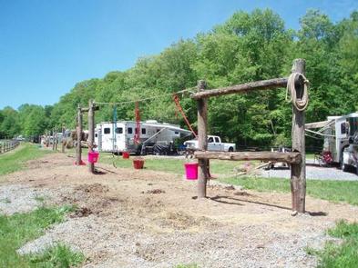
Fox Creek Horse Camp is a premiere destination for riding enthusiasts who are looking for the rare opportunity to ride from their campsite onto hundreds of miles of trails in the spectacular Mount Rogers National Recreation Area. Located at almost 4,000 feet, it serves as a welcome retreat for summer camping and horseback riding.

Recreation

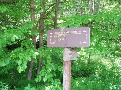
While hiking and horseback riding are the primary attractions near the campground, there are also ample native trout streams, the Mount Rogers Scenic Byway, local festivals and music, the Appalachian Trail and the Virginia Creeper National Recreation Trail.
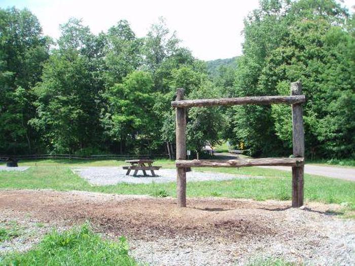
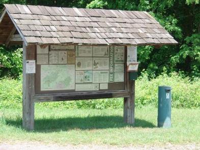
Facilities

This campground offers the basic amenities including pit toilets, garbage and manure collection, and visitor information. Most of the campsites are first-come, first-served except for two designated sites, which are available for reservations. Nearby Grindstone Campground offers campers at Fox Creek the option of showers, potable water, and a dump station for an extra fee.

Natural Features

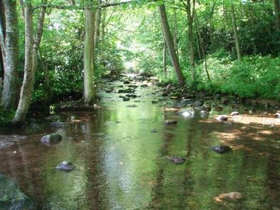
The campground is adjacent to Fox Creek, a small rocky trout stream with large boulders and rhododendron and northern hardwoods along the banks. The campsites are located in open fields on either side of the creek.

Nearby Attractions

The Mount Rogers High country offers opportunities for day trips and overnight pack trips. This open setting offers expansive views, summer rhododendron flowering, blueberry picking, and spectacular fall colors. The Mount Rogers National Recreation Headquarters is located about 20 minutes from the campground and offers maps, directions, and a variety of bookstore items.

Reservation

More from CampingHiking.net:

ALPINE RANGER STATION, Colorado Campground Images, Info & Reservations

Directions From Gunnison: Take US-50 west for approximately 35 miles. Turn left on Co. Rd 66 to FSR 867. Follow FSR 867 for approximately 20 miles to its junction with FSR 868. Turn right – Alpine Ranger Station will be 5 miles ahead on the right-hand side. Phone 970-641-0471 Activities

MCKENZIE BRIDGE, Oregon Campground Images, Info & Reservations

Directions From Eugene, OR, take I-105 east to McKenzie Highway 126 for 55 miles. Look for signs. The campground is located on the right side of the highway. Phone 801-226-3564 Activities FISHING, KAYAKING, RAFTING Keywords MCKE,WILLAMETTE NF -FS Related Link(s) Rec Area Info & Images Forest Service Concessionaire Oregon State

STORM MOUNTAIN, Utah Campground Images, Info & Reservations

Directions From I-215, take the 6200 South exit and travel a mile east to Wasatch Blvd. Take Wasatch Blvd a mile south to junction with Big Cottonwood Canyon/Highway 190. Make a left at the junction and travel up Big Cottonwood Canyon 2.8 miles to the picnic area. Phone SALT LAKE

BALD BUTTE LOOKOUT, Oregon Campground Images, Info & Reservations

Directions From the Paisley District Office, travel 0.5 miles north on Highway 31 and turn left on Mill Street. Stay on Mill Street to the Y junction (turns into gravel at this point) , then turn right on Forest Road 3315. Continue on Forest Road 3315 for 21 miles. Turn

HOWELL STATION, Iowa Campground Images, Info & Reservations

Directions 1081 198th Place Pella, Iowa 50219 From Pella, Iowa, take Highway T-15 southwest for 5 miles, then turn east on Idaho Drive to 198th Place. Travel south and follow signs to campground. Phone 641-828-7522 Activities BIKING, BOATING, CAMPING, FISHING, HIKING, VISITOR CENTER, WILDLIFE VIEWING, DAY USE AREA Keywords HOWE,LAKE