REYNOLDS CREEK GROUP CAMPGROUND, AZ Campground Reservation, Info, Images, Map, Directions

REYNOLDS CREEK GROUP CAMPGROUND, Arizona Campground Images, Info & Reservations

Directions

From Young, drive 20 miles south on State Hwy. 288 (unpaved). Site is on the right and is signed. From Hwy 188, drive 27 miles north on State Hwy. 288 (partially paved).

Phone

928-474-7900

Activities

CAMPING

Keywords

Related Link(s)

Rec Area Info & Images

Arizona State Tourism

Arizona State Road Conditions

Overview

The Reynolds Creek Group Campground is a rustic and secluded, creek side camp located on the Pleasant Valley Ranger District in the Tonto National Forest. The primitive group camping area is nestled between towering ponderosa pine at an elevation of 5,250 feet and provides a great base camp for a wide range of recreational activities including, hiking, fishing, hunting, and nature photography.

Recreation

The site is located between the Salome and Sierra Ancha Wilderness Areas and adjacent to the From the Desert to the Tall Pines National Scenic Byway. Two trailheads are located within a quarter mile of the campground and provide access to the Wilderness Areas as well as a lookout tower.

Facilities

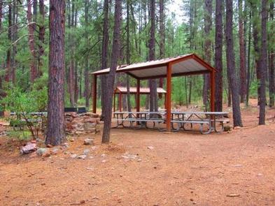
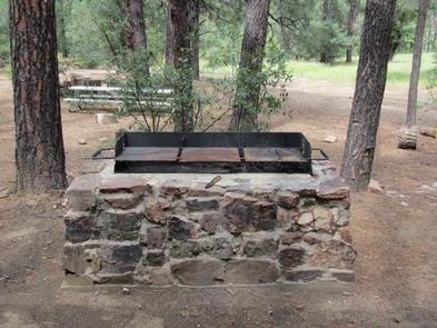
The site includes two large ramadas, eight picnic tables, group grill, one large metal campfire ring, and one vault toilet.

Natural Features

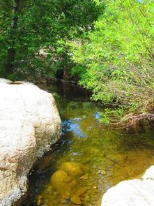
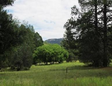
The group site is located adjacent to Reynolds Creek, which runs year round. Opportunities for wading, fishing, and hiking abound. Berry picking is a popular activity in the fall. A thick stand of ponderosa pine covers the group area, offering pleasant shade. A large meadow provides the perfect place for group activities and games.

Nearby Attractions

Workman Creek is located two miles to the south and has cascading waterfalls and plenty of opportunities for berry picking in the fall. Hikers and equestrians can explore the area’s majestic scenery on meandering trails.

Reservation

More from CampingHiking.net:

CHOCTAW LAKE, Mississippi Campground Images, Info & Reservations

Directions From Jackson, Mississippi, travel Highway 25 north toward Starkville. Turn onto Highway 15 north toward Ackerman, Mississippi, and travel 11 miles to Forest Road 967 to the campground. Phone 662-285-3264 Activities BIKING, BOATING, CAMPING, FISHING, HIKING, WILDLIFE VIEWING, SWIMMING SITE Keywords CHOL,NFs IN MISSISSIPPI – FS Related Link(s) Rec

Huckleberry Campground, Idaho Campground Images, Info & Reservations

Directions From St. Maries, ID go south on Highway 3 for a half mile then turn right (east) onto the St. Joe River Road. Once on the St. Joe River Road travel for approximately 29 miles. Phone 208-769-5000 Activities CAMPING, FISHING, RECREATIONAL VEHICLES, WILDLIFE VIEWING, WATER ACCESS Keywords None Related

HOWELL STATION, Iowa Campground Images, Info & Reservations

Directions 1081 198th Place Pella, Iowa 50219 From Pella, Iowa, take Highway T-15 southwest for 5 miles, then turn east on Idaho Drive to 198th Place. Travel south and follow signs to campground. Phone 641-828-7522 Activities BIKING, BOATING, CAMPING, FISHING, HIKING, VISITOR CENTER, WILDLIFE VIEWING, DAY USE AREA Keywords HOWE,LAKE

JUNIPER LAKE GROUP, California Campground Images, Info & Reservations

Directions From the Red Bluff (I.5), drive east on state HWY 36 approximately 70 miles to Chester. Turn left at fire station immediately after crossing Feather River Bridge (watch for National Park Service sign on right) continue approximately 13 miles follow signs to Juniper Lake Campground and Group Campsite Area.