Directions
From Portola, CA, travel east on Highway 70 for five miles to Beckwourth, CA. Travel north on County Road 111 (Beckwourth-Genesee Road) for six miles. Crocker Guard Station is on the left.
Phone
530-832-1076
Activities
CAMPING, FISHING, HIKING
Keywords
Related Link(s)
California State Road Conditions
Overview
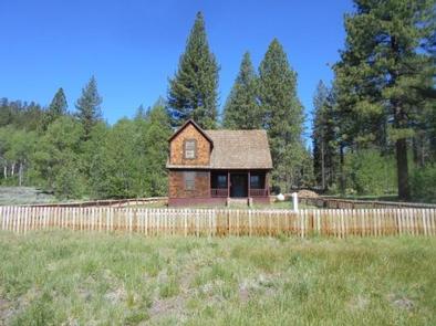
Crocker Guard Station was built in 1912 as a home for Forest Service personnel, and was later staffed as a fire station until the 1980s. The historic Crocker Guard Station is located ten miles northeast of Portola, California, at an elevation of 5,700 feet. Visitors will experience the beautiful solitude of the Eastern Sierra Nevada Mountains. Nearby recreational opportunities include fishing, boating, swimming and hiking.
Recreation
Crocker Campground is located adjacent to the Crocker Guard Station. This ten unit campground is free of charge and has tables, fire rings and vault toilets. The campground is the perfect place to expand your guest list or have a campfire. Lake Davis Recreation Area is within three miles, offering a variety of recreational opportunities where visitors can fish, boat, swim, bike and hike. Hunting is a popular activity in the fall.
Facilities
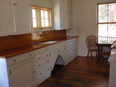
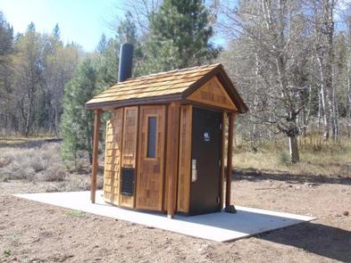
The house has four bedrooms with ten twin beds and mattresses including two sets of bunk beds, a kitchen, dining room, living room and an outside vault toilet building. Children will enjoy the large fenced in front yard. The rental has propane operated lights, cook stove and heater. There is no refrigerator. Cooking and eating utensils are provided. The house is equipped with smoke and carbon monoxide detectors and fire extinguishers. Visitors must bring drinking water. There is an outside hand pump with water for fire protection. Guests should bring bedding, towels, flashlights, trash bags and first aid kits. Visitors are responsible for cleaning the house, packing out trash and locking up before departure.
Natural Features
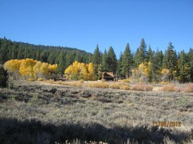
The Guard Station is situated in a small meadow near an aspen grove surrounded by a forest of pine trees.
Nearby Attractions
Stores, services and restaurants are available just ten miles away, in Portola, CA.
The largest railroad museum in the west is located in Portola. It has a gift shop, train rides and plenty of railroading information
Water activities like boating and fishing are as close as Lake Davis just five miles away on a dirt road.
The nigh time sky offers star gazing, golden moon rises and meteor showers away from bright lights. There is some light pollution from Reno.


