Directions
From I-75 take Exit 285 (Red Top Mountain Road). Northbound traffic turn left / Southbound traffic turn right onto Red Top Mountain Road. Turn right at the first traffic light onto the connector which will come to Hwy 41. Turn right onto Hwy 41. Travel 2 miles crossing over the Etowah River and turn right immediately after crossing over the bridge. Road will curve to right and come to stop sign. Turn left onto Old River Road and travel for 2.5 miles to park entrance.
Physical address: Cooper’s Furnace Day Use Area, 1052 Old River Road SE, Cartersville, GA 30121
Phone
678-721-6700
Activities
HISTORIC & CULTURAL SITE, FISHING, HIKING, PICNICKING
Keywords
Related Link(s)
Overview
Cooper’s Furnace Day Use Area is situated on the Etowah River, a tributary of the Coosa River. This Day Use Area is downstream of the dam which impounds Allatoona Lake. The river and peaceful surroundings offer a relaxing getaway from the nearby city of Atlanta, just 35 miles south. Visitors enjoy various water sports, hiking, hunting and viewing wildlife.
Recreation
Fishing, canoeing, and kayaking are popular activities along the Etowah River.
Facilities
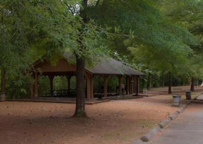
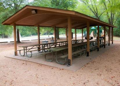
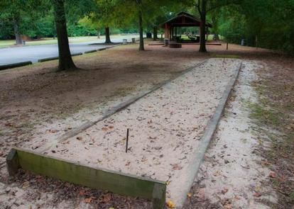
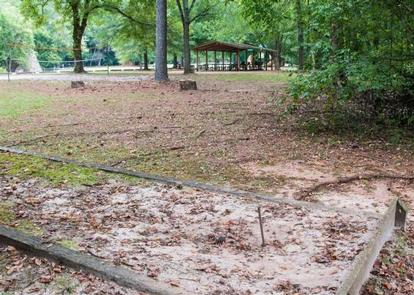
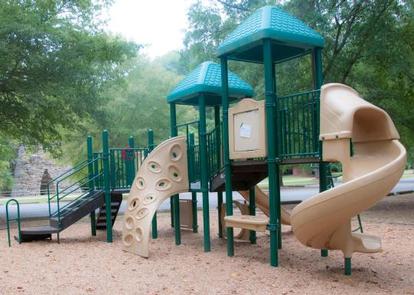
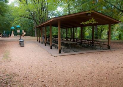
Cooper’s Furnace Day Use Area has two open shelters which both have a seating capacity of 60 people maximum. Shelter B is the first one on the right when entering the park. Shelter A is the second shelter on the right when entering the park. A restroom is within walking distance from both shelters. A horseshoe pit and volleyball court are adjacent to both shelters. A playground is located between the two shelters. Horseshoes and volleyball can be loaned out by the onsite Park Hosts. An iron furnace from the 1800s is also within the park. In addition, a system of hiking trails can be accessed from the Cooper’s Furnace Day Use Area.
Natural Features
The rolling hills around Allatoona Lake are thickly forested with lush oak, maple, blackgum, dogwood, magnolia, hickory and the occasional pine tree. Ferns and honeysuckle bushes make up the understory. The dense hardwood forests are home to raccoons, opossum, bobcats, red and gray fox, white tail deer, squirrels, and chipmunks. From time to time, visitors even spot black bears roaming the area.
Nearby Attractions
The City of Cartersville is nearby, offering the Tellus Science Museum, Etowah Indian Mounds, and Booth Western Art Museum. The City of Emerson is home to the Lakepoint Sports Complex. Kennesaw Mountain National Battlefield is located in Kennesaw; White Water Park is in Marietta, and the Georgia Aquarium is located in Atlanta.
Charges & Cancellations
Change and Cancellation Policies and Fees
Overnight and Day Use Facilities: To ensure fairness, reservation arrival or departure dates may not be changed beyond the booking window until 18 days after booking the reservation.
Camping / Day Use: A $10.00 service fee will apply if you change or cancel your reservation (including campsites, cabins, lookouts, group facilities, etc.). The $10.00 service fee will be deducted from the refund amount.
You can cancel or change reservations through Recreation.gov or by calling 1-877-444-6777.
Late Cancellations
Overnight and Day Use Facilities: Late cancellations are those cancelled between 12:01 a.m. (Eastern) on the day before arrival and check out time on the day after arrival.
Individual Campsites: If a customer cancels a reservation the day before or on the day of arrival they will be charged a $10.00 service fee and will also forfeit the first night’s use fee (not to exceed the total paid for the original reservation). Cancellations for a single night’s reservation will forfeit the entire use fee but no cancellation fee will apply.
Cancellations for a single night’s use will not be assessed a service fee.
Group Facility: If a customer cancels a group overnight facility reservation within 14 days of the scheduled arrival date they will be charged the $10.00 service fee and forfeit the first night’s use fee. Cancellations for a single night’s use will not be assessed a service fee.
Group Day Use Area: If a customer cancels a group day use facility reservation within 14 days of the scheduled arrival date, they will forfeit the total day use fee with no service fee charge.
No-Shows
Camping / Day Use: A camping no-show customer is one who does not arrive at a campground and does not cancel the reservation by check-out time on the day after the scheduled arrival date. Reserved campsites and group overnight facilities will be held until check-out time on the day following your scheduled arrival. Group day-use facilities will be held until check-in time on your scheduled arrival date.
If a customer does not arrive at the campground or group facility by check-out time the day after arrival or does not cancel the reservation by the times listed under “Late Cancellations” above, the customer may be assessed a $20.00 service fee and forfeit use fees.
Refunds
Customers must request refunds no later than 14 days after the scheduled departure date. Recreation.gov will not grant refund requests after 14 days of departure.
Reservation Fee: For some facilities, tours or permits an additional reservation fee is charged. For some overnight and day-use facilities, an additional non-refundable reservation fee may apply. The non-refundable reservation fee for tours and tickets is $1.00. The non-refundable reservation fee for permits varies by location.
¢ Refunds for Bankcard Purchases: Refunds for bank card payments will be issued as a credit to the original bank card.
¢ Refunds for Check or Cash Purchases: Refunds for Recreation.gov payments made by check or money order, and cash payments at selected campgrounds will be issued a check refund. A refund will be processed within 30 days of receipt and approval. Please Note: Refund requests made during or after departure can only be processed when approved by the facility management staff based upon local policy.
¢ Refunds for Emergency Closures: In the event of an emergency closure, the Recreation.gov team will attempt to notify users and offer alternate dates (as appropriate). If this is not possible, reservations will be cancelled and all fees paid will be refunded. Reservation fees for free tickets are non-refundable in the event of an emergency closure.

